
Weather maps suggest a six-day blizzard could bring snow across the entire length of the UK in February, with the Scottish Highlands potentially seeing up to 100cm (40 inches) as the Met Office warns of wintry hazards
Meteorological charts indicate a blizzard spanning six straight days could imminently blanket the entire UK with snow – with certain areas potentially receiving an enormous 100cm (40 inches).
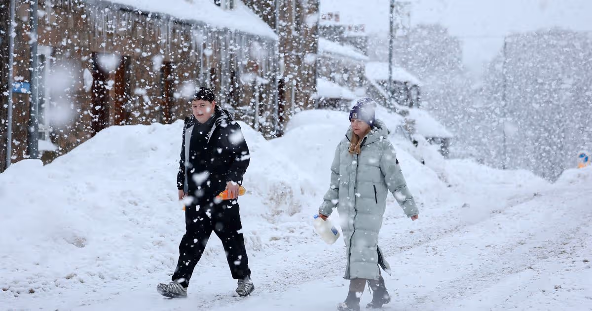
The UK should anticipate snowfall as Storm Chandra delivers wintry downpours, heavy rain and powerful gusts nationwide, whilst portions of the UK prepare for deluges.
The Met Office has been compelled to issue multiple weather alerts, with Scotland, the Midlands and northern England facing snow and rainfall.
A major incident was also declared on Tuesday evening, as sections of the UK were cautioned about overnight flooding dangers.
Across England, 95 flood warnings – indicating expected flooding – and 257 flood alerts – signalling possible flooding – remained active, reports the Mirror.
Three flood warnings and 17 flood alerts were operational throughout Wales, whilst eight flood warnings and eight flood alerts covered Scotland.
Yellow weather alerts have been issued for ice on Wednesday morning spanning much of England, Wales, Northern Ireland, and southern and central Scotland.
A yellow weather alert for rain is also active for South West England on Thursday, with the Met Office stating that additional rainfall could trigger further flooding and transport chaos.
Storm Chandra represents the most recent storm to be designated by the western Europe storm naming group list shared between the UK, Ireland and the Netherlands. The GFS weather model indicates significantly more snowfall could arrive during February.
The charts initially show snow descending across Wales, the Midlands, the north-east and sections of Scotland on February 6.
Birmingham, Newcastle, Edinburgh and Glasgow all appear likely to witness the white stuff at first.
A considerably larger portion of England could experience snow on February 7, with charts indicating London, East Anglia and the north-west will see flakes settling.
Additional flurries are anticipated in Wales and the Midlands, whilst persistent snow in Scotland will trigger substantial accumulations beginning to develop in the Highlands.
Areas further south could subsequently be affected.
Charts for February 9 display snow lying on the ground as far south as Exeter.
Continuing flurries across Wales and central England will contribute to previously fallen snow, resulting in more considerable accumulations, the data indicates. Northern Ireland could also be struck.
By February 11, the charts display nearly every corner of the UK blanketed in at least some snow.
The sole regions shown without any snow on the ground are certain parts of Yorkshire, Lincolnshire and southern Scotland.
Snow is visible on the ground throughout the entire length of the UK – approximately 600 miles.
Snow depth charts disclose the Scottish Highlands could witness as much as 100cm (40 inches).
Sections of South Wales could see 32cm (13 inches), with 21cm (eight inches) in Oxfordshire, 10cm (four inches) in East Anglia, and 8cm (three inches) near London. The Met Office also indicates snow might arrive in February, with “wintry hazards” expected.
Their outlook for February 10 to 24 explains: “With the jet stream likely further south than normal, the wettest conditions are more likely in central and southern areas.
“North and northwestern parts of the UK are most likely to be drier than normal. Whilst mild incursions of wet and windy weather are favoured at times in the south and west, colder conditions in the north and northeast will bring an increased risk of wintry hazards, especially where any precipitation from the southwest interacts with the cold air.”
BBC Weather predicts additional snowfall could materialise as well.
The BBC outlook for February 9 to 22 explains: “There should be somewhat drier and brighter conditions as a result, but wintry showers would be possible, while more widespread bands of rain and hill snow could still try to creep in from the south and west.
“A change should come at some point, with a chance of milder air encroaching farther north and east as time goes by, bringing wetter weather with it. So, bands of rain should return, possibly preceded by hill snow. Milder weather would take longest to reach Scotland. Questions remain regarding just when this transition might unfold.”


