A team of North East business leaders also discussed what needs to be done to inspire further growth.
On the panel were Stephen McDonald, Energy and Sustainability Manager at Durham County Council; Stewart Stewart, Chief Executive of Nova Pangaea Technologies; Grant Glendinning, Chief Executive and Group Principal at Education Training Collective; Faye Gordon, Executive Director of Finance and Investment at believe housing and Miles Askew of Cummins.
Mr Houchen said that nowhere in the UK can match the Tees Valley for investment in renewable energy.
He told the audience: “Where we stand today, we have, objectively, the biggest renewables, green energy investments in the country, certainly over the last ten years.
“We have SeAH Wind here and Net Zero Teesside now under construction, just those two projects alone represent north of £5bn-worth of capital investment, probably closer to £7bn by the time it’s all finished.
“It is significant, and you can’t point to anywhere else in the country that has that type of investment.
“There’s lots of people that wish it, lots of people that hope that it comes, but it comes with issues around Development Consent Orders, planning, regulation – and energy connections are increasingly a big thing, particularly as there’s a shift at industrial sites towards data centres, which obviously we’re looking at here as well.
“But I do think we are at the centre of it and have some incredible businesses. And it’s not just this site, you’ve got Wilton just across the road, which is an equally incredible site.
“We have Nova Pangaea here, you’ve got Arcadia eFuels, you’ve got Proteum, a couple of SMR companies, and community energy on the north bank of the rive – really big, exciting frontier green energy projects for the UK all within this region. “
He said it was difficult to predict the “direction of travel” for Net Zero but is confident there will be no immediate change thanks to “fanatic” energy secretary Ed Miliband.
Mr Houchen said: “I think the one thing I can have confidence in is, with this government, it’s not going to change. To give an insight into a little bit of politics, Ed Miliband’s seniority and security in his position in the Labour Party is supreme and he is an absolute fanatic.
“Yes, he’s at the Department of Energy and Net Zero at the moment but if there are changes of leadership, he might end up being the Chancellor.
“So I think within this government, it’s not going to change, which means there’s at least three and a half years of consistency in this policy. The bit that is unknown for everybody is what happens after that.
“But that is causing some questions and reflections from some investors who may feel that if they’re putting their money in now, these are 20, 30, 40 year investments and three and a half years isn’t a long time so they are also looking to the next political cycle.
“So you’re also seeing a bit of churn and a little bit of delay and some questions being asked about the future of the national framework.”
The area’s industrial heritage has helped create a unique climate for a burgeoning green energy sector on the Tees, he said.
“When we started out on regenerating Teesworks in particular, we knew that the unique thing about this was, if we could get it right, knock down the steelworks, it was the scale of the site as in the land available,” Mr Houchen said.
“And then more recently, it was also understanding what’s going to make us unique. It’s the industrial heritage and it’s having large scale, energy intensive businesses.
“You don’t pick winners by saying ‘we want this specific business to come’, you’re creating a platform that says, “if you are a large scale, capital-intensive, energy-intensive business, then this is pretty much the only place in the country that you’re going to be able to come to with any speed.”
He said energy prices have become a key consideration for investors.
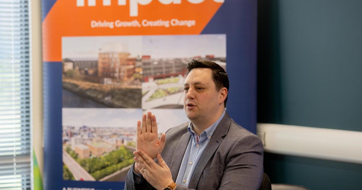
![]() Impact event at Teesworks Skills Academy Picture: SARAH CALDECOTT
Impact event at Teesworks Skills Academy Picture: SARAH CALDECOTT
Mr Houchen said: “I would say from a large-scale energy intensive manufacturing point of view, if you’re going to come to the UK, you’re going to come to Teesside.
“The big question that sits beyond that, which is increasingly causing us a bit of a headache and is causing businesses to reflect, is energy pricing.
“ When you have the world’s highest industrial energy pricing at north of £25 per kilowatt hour and you look at American investors, of which we have many, who can do about five cents a kilowatt hour in Texas.
“In Finland it’s a different market and there are other drivers, but you can see sometimes one pence a kilowatt hour.
“So, that’s the biggest challenge we have for the energy intensive industries. Will there be a downturn? I don’t know, but we’ll keep fighting, we’ll keep trying to get investment and there’s lots of interest and there’s lots of investors who are continuing to look to Teesside.
“I would say even if there was a downturn, the fundamentals of the region, what we have to offer, are too solid. And so if we’re feeling it, the country is definitely feeling it.
“And as things get better, we’re going to come out of that first compared to anyone else, we are more insulated in that way .”
A student in the audience expressed frustration from young people who find it difficult to get work or even placements in the emerging businesses in Tees Valley.
Mr Houchen pointed out that Tees Valley has been chosen as one of eight UK regions to pilot the UK Youth Guarantee Trailblazer, a government-backed programme offering up to £5 million to help young people aged 18 to 21 who are not in work, education, or training.
The scheme will provide a mix of paid work placements and unpaid taster sessions to help participants gain experience and explore different career options.
Panel member Grant Glendinning said he was encouraged by the scope of new career opportunities for young people.
He said: “I’m optimistic about the Tees Valley and Teesside. I remain optimistic. We have a strategic plan in our group that talks about a resurgent Teesside as a vision.
“And I think, although how we get there might change through the years, we can’t lose sight of the fact that there are some fantastic large projects on their way.
“In the Education Training Collective, we’re all about trying to ensure that local people, local young people, and adults benefit from some of these investment opportunities and the benefits that they’ll bring. “
He was asked by BUSINESSiQ editor Mike Hughes, who hosted the event, whether the opportunities were filtering through to local students in practice.
![]() Impact event at Teesworks Skills Academy Picture: SARAH CALDECOTT
Impact event at Teesworks Skills Academy Picture: SARAH CALDECOTT
He replied: “At its heart, there is a core digital and engineering, huge skills gap in the country. And those are fantastic things to train for. We’ve run two very successful cohorts of scholarship programmes with bp at Redcar and Cleveland College.
“These are providing great opportunities for young people. Of the young people who are finished on our BP cohorts, one of them is now down in Barrow, to begin work at BAE Systems, after a spell at EDF, so that shows there are great opportunities around.
“Focus on those core transferable technical skills, and I think there’s some really bright opportunities for young people from this region.”
Stewart Stewart spoke about the opportunities arising at Nova Pangaea Technologies , which converts woody and non-food derived agricultural residues into high value ethanol and biochar.
The ethanol can be used to enable the production of Sustainable Aviation Fuel (SAF) while the biochar, a natural carbon removal product, can deliver an immediate decarbonisation and enable a negative CO2 emissions profile.
Mr Stewart said: “The good thing about all these businesses that are looking to focus on the Tees area for development of new forward looking industrial plants, is they use a lot of the same physical hands-on trades that have been used traditionally within other areas of industry.
“So, as a student, you may be thinking about carbon capture, sustainable aviation fuel or hydrogen. But you may be wondering how do I know which one to focus on?
“Myself, I wouldn’t focus on a particular industry, we’ll want to see your passion for why you want to work in those particular areas when you focus on a job.
“But realistically, what they’ll be hired for at an early stage is if they have worked on a project where they were designing something new?”
Stephen McDonald revealed exciting prospects for deep geothermal energy to be produced in County Durham.
He said: “It’s probably something that’s got me the most excited in my 20 years in local government.
“There are various methods of geothermal, you can go shallow, you can go to minewater. But I’m talking 6 to 7 kilometres down into the earth.
“Now, why I’m talking about that is because County Durham, going up into Gateshead, has the best resource for geothermal in the country other than Cornwall.
“That’s because of the geology, We’ve got granite underneath our feet, in various places. We always knew we had it but we didn’t think it actually extended right across to the north of the city.
“It’s a really stable form of electricity generation with byproductive heat, and that’s something which is going to be a real necessity for the future.”
Faye Gordon of social landlord believe housing, which has 18,000 homes across the region, said energy efficiency is a key aim.
She said: “We’re very much focussed on how energy efficient we can make it. We can work very closely with customers, going into those homes to make sure that they are fully informed about how to use the technology in their home to get the best out of it.
“I think that there is a big challenge for the sector in terms of some of that stock that has been there for 50, 60, 70 or over 100 years. How do you get that to operate on a more energy efficient footing?
“And that is very challenging. So I think as a sector, we’ve all got targets to hit in terms of energy efficiency rating of our homes.
“I think for us there is a challenge around whether we have the right skills coming through and can we work with our supply chain to give them certainty over pipeline work coming through so that they can also invest in their workforce and trade?”
Miles Askew, of Cummins said: “We manufacture engines, primarily diesel. So the industry that we work in is shifting and is evolving. And we’ve got a carbon based fuel at the moment.
“But there are leaps within the industry that could be made to make it more green. We’ve mentioned Sustainable Aviation Fuel and there is an on road equivalent, paraffinic fuel, which you can use in our products today, and that will give you a lower carbon footprint in a diesel, and you wouldn’t have to change the product.
“We’ve been spending time over the last five years or so looking at, what does the regulation mean? What do we invest in next? We’ve got pockets of investment in our core products, which are diesel, trying to improve the fuel efficiency of those.
“We’ve developed a zero carbon brand called Accelera, by Cummins, which is not hosted here, but there are elements of that washing up here.
“We are complementing a solar farm that we’re going to pipe into our sector in Darlington. So we’ve got product-related carbon, and we’ve got process-related carbon.
“In Darlington as a site, we try very hard, because there’s carbon in our products, to decarbonise our process.
“We’ve got some of those that wash down to Darlington specifically, and by 2030, we will try to reduce things like electricity usage. We’re trying to generate our own electricity through a solar farm. “