

Entertainment
Kelley Wolf Reunites With Scott Wolf, Kids After Restraining Order Dismissed
Kelley Wolf has reunited with estranged husband Scott Wolf and their three kids at Universal Studios after a restraining order was dropped against her.
In a joint Instagram post shared on Friday, February 20, Scott, 57, shared a family photo, with himself, Kelley and their three children — Jackson, 16, Miller, 12, and Lucy, 11 — smiling as they posed in front of the Universal Studios sphere in California.
“2/20/2026. Healing. 💙💙💙💙💙 Thank you @unistudios for an epic day at the park! So much fun! 🙏🏻💛” the post’s caption read.
The family day out comes after a judge dismissed Scott’s case against Kelley, 49, last month that accused her of allegedly violating a restraining order.

Over the years, many celebrity couples have had on and off relationships that ultimately ended in divorce — but wasn’t always made legal the first time around. Sylvester Stallone and Jennifer Flavin were married for 25 years until she filed for divorce in August 2022. “I love my family. We are amicably and privately addressing […]
The motion was granted by a Utah judge on January 27 after the Summit County District Attorney’s Office filed to dismiss the case without prejudice, according to court documents obtained by Us Weekly on January 29. The decision was made “as part of a global resolution” alongside a request to dismiss a separate case against Kelley over allegedly harassing Scott.
Scott and Kelley, who tied the knot in 2004, have been embroiled in legal drama since announcing their separation in June 2025.
“After 21 years of marriage, I have made the most difficult decision of my life, and filed for divorce from my wife Kelley,” Scott said in a statement to People at the time. “Our children have always been, and continue to be, the loves of our lives and our every priority, so I kindly ask for privacy at this time as we help guide them through this new chapter.”

For her part, Kelley shared the divorce news by posting her own statement via Instagram at the same time.
“It is with a heavy heart that Scott and I are moving forward with the dissolution of our marriage. This has been a long, quiet journey for me — rooted in hope, patience, and care for our children. While I will not speak publicly about the details, I feel peace knowing that I’ve done everything I can to walk this path with integrity and compassion,” Kelley wrote.
She added, “We both look forward to an extraordinary life centered around the most extraordinary children. My priority has always been their wellbeing — and my own healing. That will never change. I am stepping into a chapter of peace, freedom, and protection — with grace. Thank you to the many friends, family, and professionals who have held space for me with love.”
Later that month, Us confirmed that Kelley had been detained by authorities and subsequently hospitalized. Following her release, Scott was granted a temporary restraining order against his estranged wife. The Doc star was also awarded full physical custody of their kids, and sole use and possession of their family home in Utah.
In August, Kelley was arrested for electronic communication harassment and electronic disclosure of personal identifying information. In a hearing the following month, Kelley told a judge that she planned to get mental health treatment.
Last month, Scott reflected on a difficult 12 months as he marked the new year with a poignant Instagram post.
“2025 Recap. Grateful for the hardest year of my life,” Scott captioned an Instagram carousel of photos of his three children with Kelley. “The curriculum was brutal for those I love most. There was suffering, learning, growing, loving, laughing, crying. Mostly learning and growing. In other words, life. I think we passed.”
Scott further reflected, “I love my people more than ever. I love people more than ever. I love my work more than ever. So the hardest year brought the most love. Life indeed. Wishing you all a 2026 full of love.”

Continue Reading
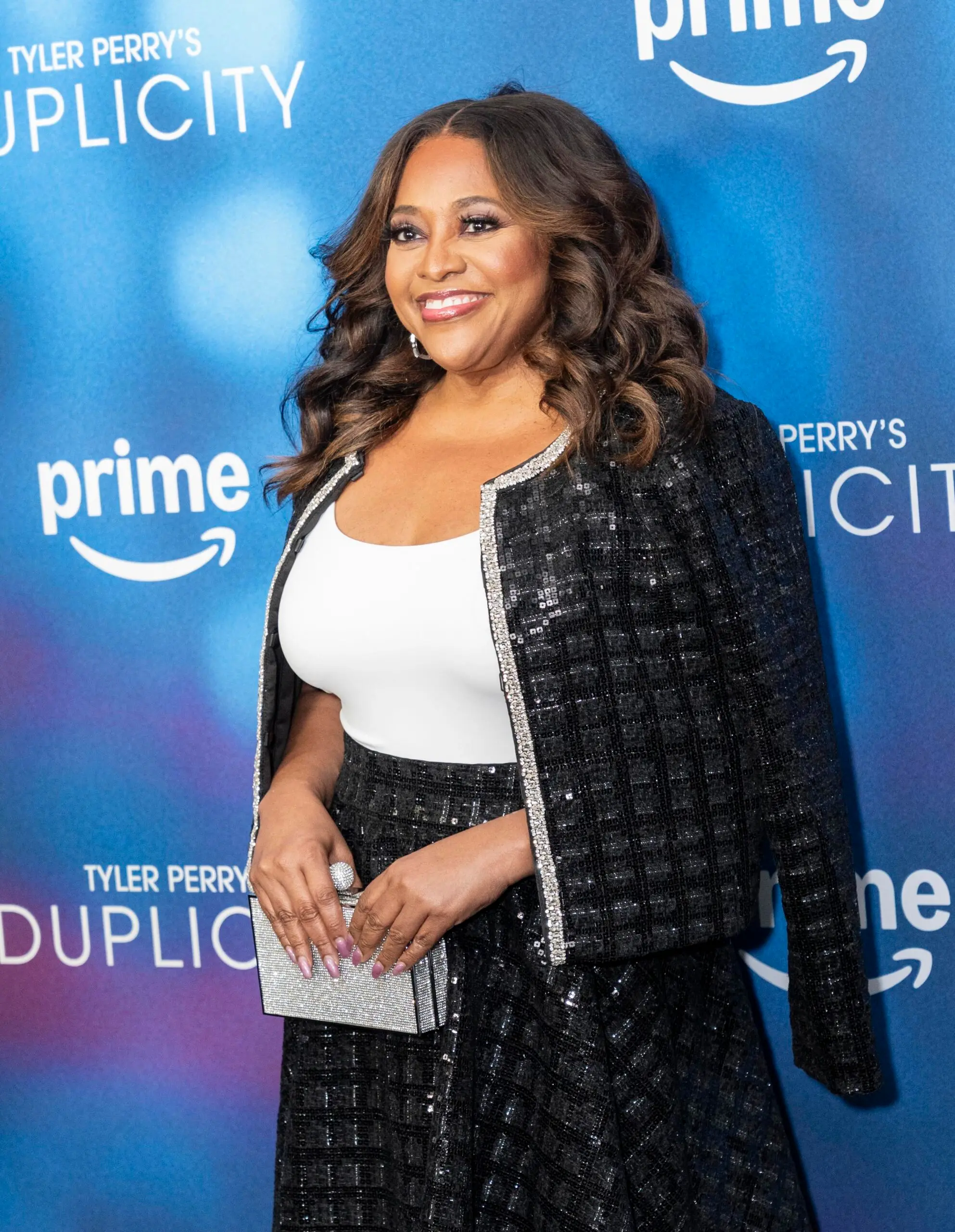
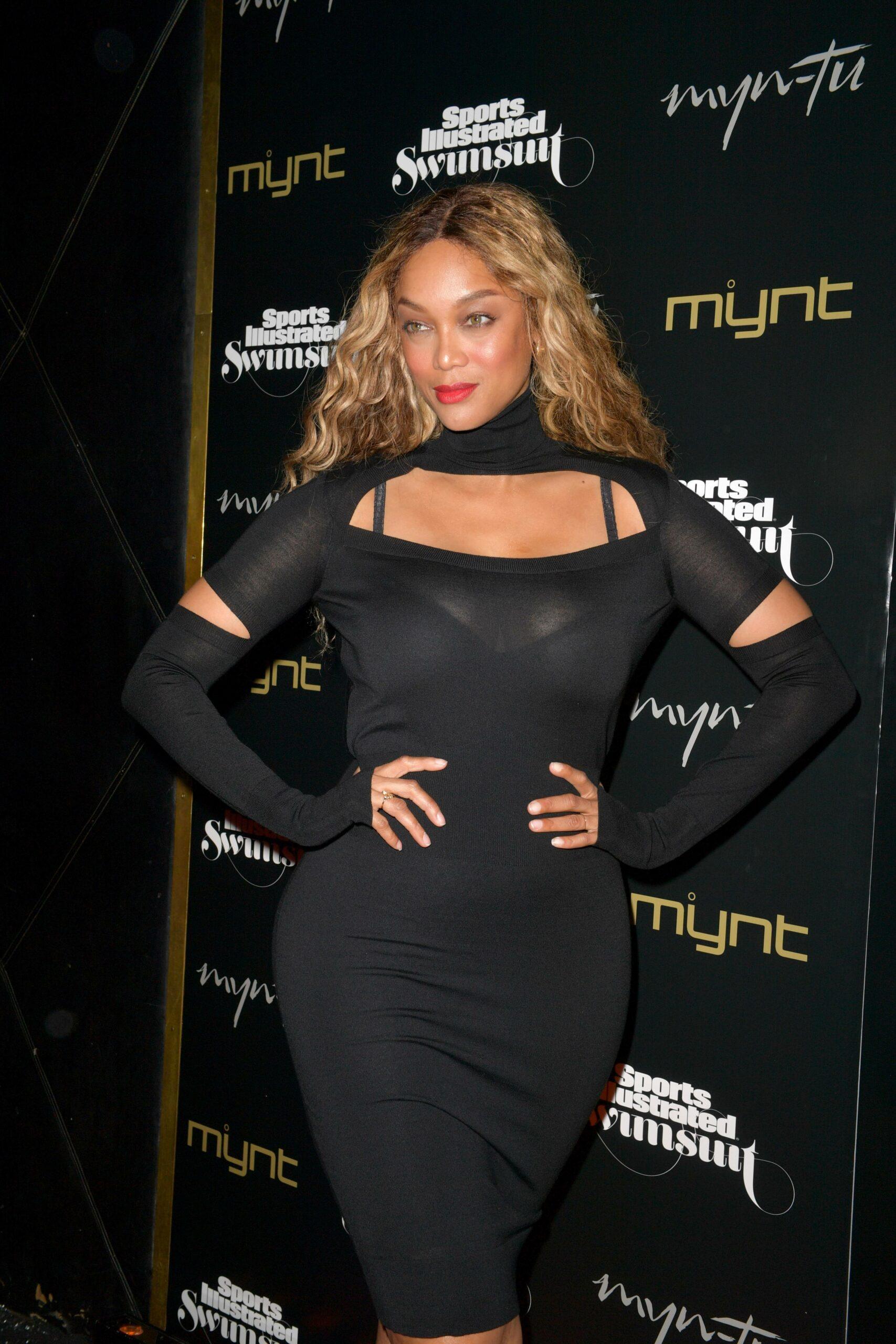
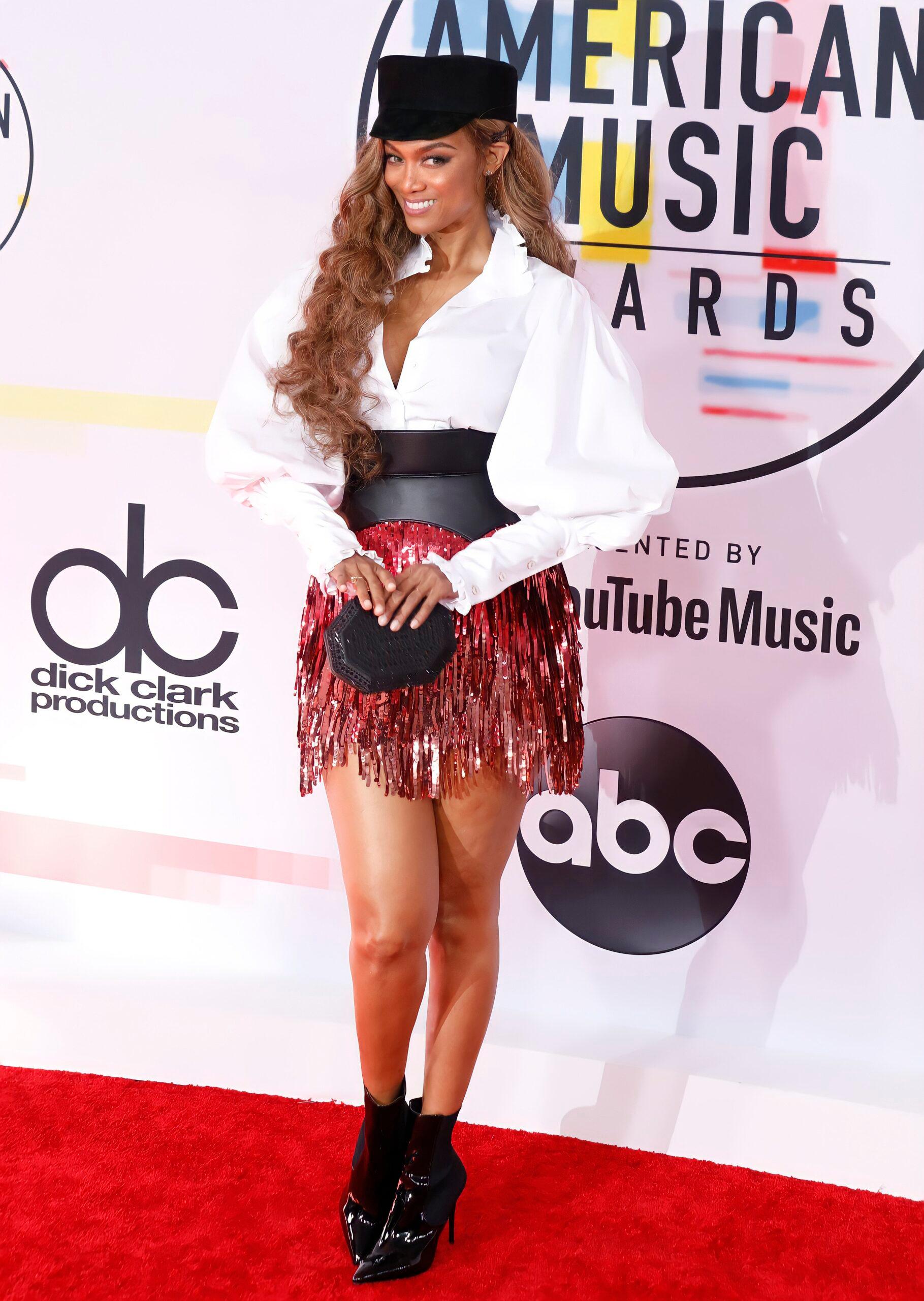
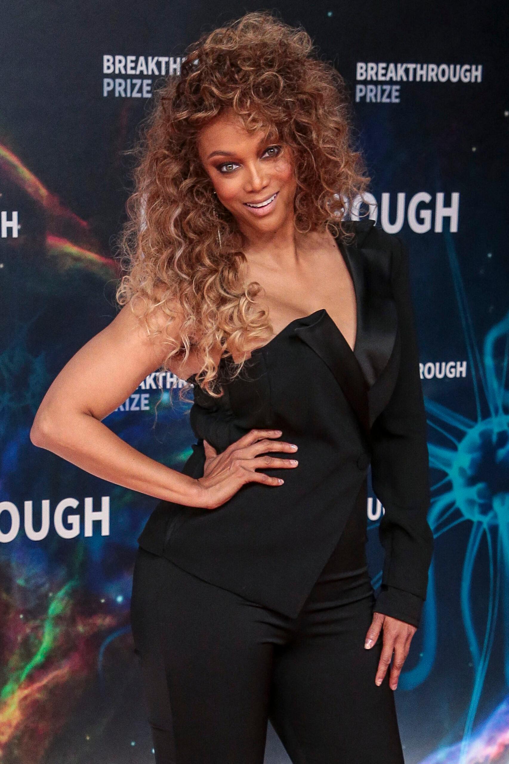
Sherri Shepherd is coming to Tyra Banks’ defense following the release of the explosive documentary about the behind-the-scenes drama of the popular modeling competition reality show.
Amid online reaction that has ranged from heavily criticizing the supermodel to downright slamming her for past actions on the series, which premiered back in 2003, the talk show host was visibly emotional as she defended her.
Article continues below advertisement
Sherri Shepherd Tearfully Defends Tyra Banks As ‘ANTM’ Documentary Backlash Continues

During a segment on her daytime talk show on Thursday, February 19, Shepherd addressed the fallout from the much talked about Netflix documentary, “Reality Check: Inside America’s Next Top Model,” and offered a compassionate take on Banks amid the supermodel facing backlash.
“The show did awful things to the contestants, and I think everybody expected Tyra to take more accountability,” she stated. “I understand why people are mad.”
Shepherd then noted how different reality television was at the time “ANTM” was at the height of its popularity.
“But I also say, you have to understand the time this all happened was in 2003,” she said. “Reality TV was the wild, wild west back then. Every show was trying to outdo each other to stay on the air.”
Article continues below advertisement
“We’re woke now, we know so much more now than we did back then,” Shepherd continued her defense of Banks. “I hate that she’s getting so much flak. She does need to take accountability, I know that, but I also know the battles some people will never understand that are fought.”
Article continues below advertisement
Shepherd Also Pointed Out The ‘Battles’ That Banks Likely Had To Face Behind-The-Scenes To Create The Show And Keep Afloat
The former “The View” co-host noted the difficulties that Banks faced as “a young Black woman trying to make it in the reality TV game,” which did not have many women Black women in positions of power at the time.
“We’re trying to compare a time today that we know a lot to a time when there was nothing like this show on the air,” Shepherd said. “We’re not taking into account the battles that this Black woman had to fight just to stay on the air for other people to come on the air.”
Then, as she fought back tears, Shepherd added that she understands that things could have been done differently in hindsight, but Banks was ultimately coming from a genuine place even though her methods may not have always been executed properly.
Article continues below advertisement
“To keep a show on the air there are things that we have to do that people will tell us, if you want to stay on the air, this is what you’ve got to do, and we’ve got to weigh the options, and sometimes we make bad decisions and we look up and go, in hindsight, maybe I should not have done it, but I just wanted to open up the door and give a platform to people who look like me,” Shepherd said.
Article continues below advertisement
‘ANTM’ Winner Eva Marcille Also Expressed Her Support Of Tyra Banks Following The Documentary Release
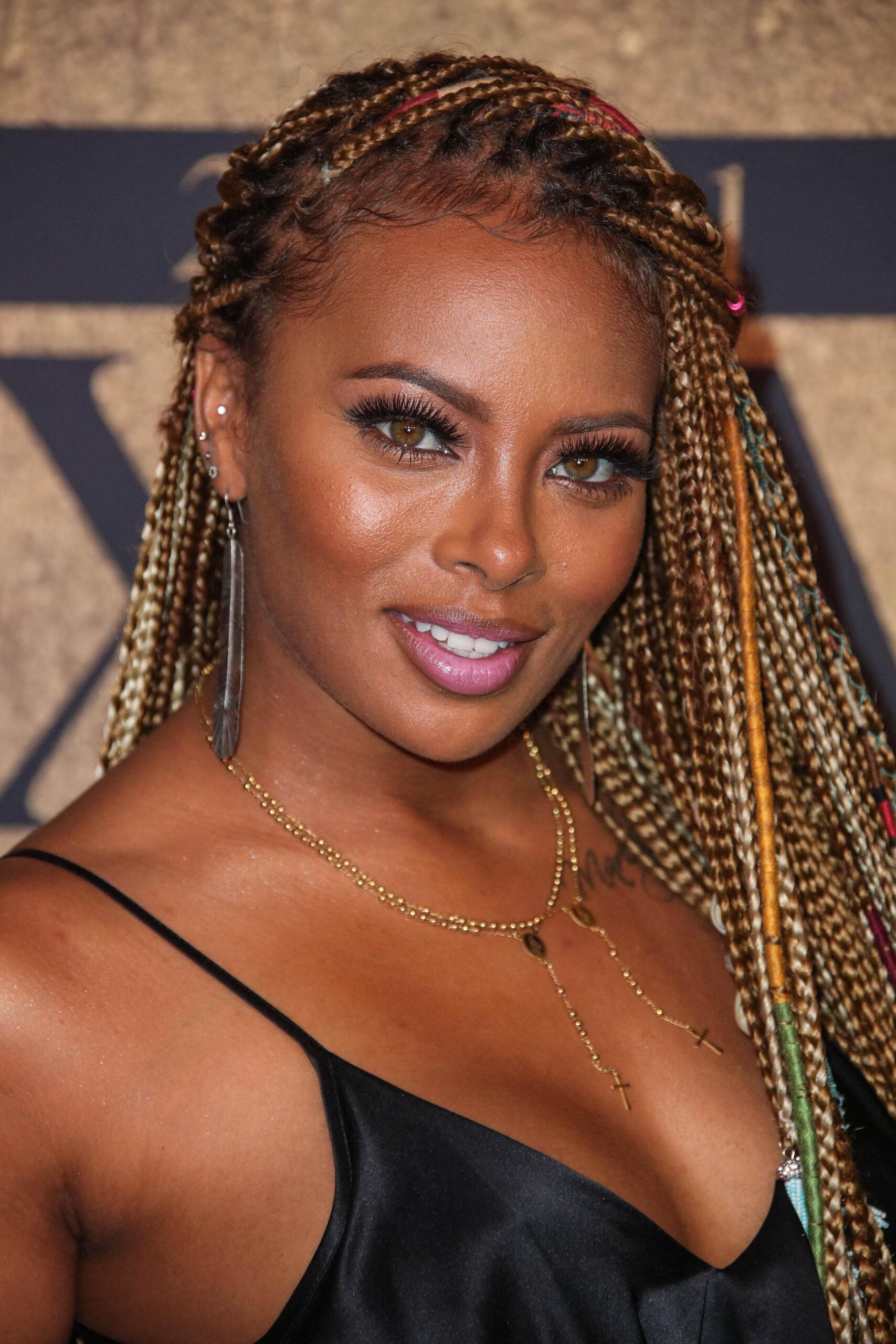
During an appearance on “CBS Mornings” on Thursday, February 19, PEOPLE reported that Marcille was naturally asked about the Netflix documentary about the show, which has been a heavy topic of conversation since its release earlier this week, and she shared her perspective.
“I have been asked about Tyra for 21 years,” the former “Real Housewives of Atlanta” star said. “No matter what project I’m doing, what I’m involved in, somehow ‘Top Model’ finds its way in my interview. I’ve done 154 projects since ‘Top Model.’ It’s been 21 years.”
Marcille, who is easily the most successful person to come from “ANTM,” then shared that she will always thank Banks, something she has consistently done for decades, for changing her life for the better.
“Thanks to ‘Top Model,’ though,” she said. “What I will say is I will never fail to thank Tyra. What Tyra set out to do in this business, I will always say — and especially for ‘Top Model,’ initially — she set out to change the world; to change what the modeling industry looked like, sound like, felt like and expected. And she did that for me.”
Marcille also pointed out that it was “very surprising” that she was not asked to participate in the documentary.
Article continues below advertisement
Former ‘ANTM’ Contestant Lashes Out At Tyra Banks Online
Tiffany Richardson, best known for her viral moment on the show that prompted Banks to yell the iconic line, “I was rooting for you, we were all rooting for you,” took to social media after the documentary was released and slammed the supermodel in an expletive-filled rant.
“Hold up @tyrabanks let’s keep it cute.. you are 1 lying a-s tied a-s b-tch.. you know how you treated me the whole time off and on camera, YOU WAS A BULLY!!! You treated me like shit and said the nastiest things about me and my son,” Richardson rant began. “That is not how the argument went but YALL EDITED TO MAKE IT LOOK LIKE YOU CARED… also F-CK @theshaderoom F-CK YO WERID A-S FANS AND F-CK YOU @tyrabanks I BET YOU WONT SIT DOWN WITH ME FACE TO FACE AND TALK ABOUT IT!!!”
“Also F-CK MY FAMILY TOO [eye roll emojis] yall don’t ever defend me, I got more money and helping more people than all or many of the top models but that’s the update yall give [eye roll emoji] damn shame.. it’s giving yall still hating on lil black a-s me… @tyrabanks hoe just let it go, ITS BEEN OVER 20 years f-cccckk,” she wrote.
Article continues below advertisement
Banks Says That She’s Working On An ‘ANTM’ Return
“After the show I had so many big ideas for my life,” she said. “I’m obsessed with pivoting and I live in Australia now. I feel like my work is not done. You have no idea what we have planned for cycle 25.”

Sky Bri
My Bday Hot Shots …
Sky-High Quality!!!
Published

Sky Bri‘s hottest shots are sure to blow the internet sky-high … click through her beautiful birthday gallery to see for yourself!
The OnlyFans star turned 27 on Saturday … and she’s spent another year dominating the internet with a series of sexy, skimpy outfits.
Just check her out in this tiny blue and white underwear set that provides barely any coverage …. and will certainly get fans’ imaginations whirling.

Sky’s also ready for the bedroom or boardroom with this low-cut number … complete with a tiny tie printed on the front!
Happy Birthday, Bri … we can’t wait for another year of sultry snaps like these!

Grey’s Anatomy star Kate Walsh is paying tribute to her former onscreen love interest, Eric Dane, in the wake of his death.
Posting via her Instagram on Friday, February 20, Walsh honored her costar after he died on Thursday at age 53 following a battle with ALS.
“I’m at a loss for words to try to express the sadness around Eric’s passing,” Walsh, 58, wrote alongside a carousel of photos that featured Dane, herself and fellow Grey’s cast members.
The actress began her tribute by sharing her condolences to Dane’s daughters Billie, 15, and Georgia, 14 and the mother of his children, Rebecca Gayheart.
“First and foremost I am thinking of his girls and Rebecca and holding them in my prayers and my heart,” Walsh wrote.
Walsh played Dr. Addison Montgomery in the medical drama. Her character’s romance with Dane’s character Dr. Mark “McSteamy” Sloan was a major plot point in early seasons of the show.
In her tribute post, Walsh reflected on her memories shooting alongside Dane as she complimented his real-life personality.
“I literally remember my very first scene with Eric…an elevator scene at Seattle Greys 😊 So, so long ago. I believe it was his first scene on the show too and he was nervous. He was so handsome and I thought ‘but can this guy act?’ 😂 and of course he could, and did, and the rest is history,” Walsh wrote.

Eric Dane and Kate Walsh. (Photo by Vivian Zink/Disney General Entertainment Content via Getty Images)
She continued, “One of the things I loved about Eric was his sensitivity and vulnerability, (and intelligence, of course) but he had the gravitas & old soul that made his work magnetic and made him a great friend off set. In those early days of Grey’s, as with most network tv shows, we spent more time with each other than with anyone else and so we became a family of sorts and Eric was such a source of support and love.”
Walsh ended the post by urging her followers to help organizations trying to find a cure for the debilitating disease.
“ALS is an awful disease & too many people have lost loved ones to it. I know it was Eric’s mission to help find a cure. I would encourage you to look into @targetals in his memory. 🕊️,” she wrote.
Dane’s family confirmed via a statement on Thursday that the Euphoria star died following a battle with ALS.
“He spent his final days surrounded by dear friends, his devoted wife and his two beautiful daughters, Billie and Georgia, who were the center of his world,” the statement read. “Throughout his journey with ALS, Eric became a passionate advocate for awareness and research, determined to make a difference for others facing the same fight. He will be deeply missed and lovingly remembered always.”
The statement concluded: “Eric adored his fans and is forever grateful for the outpouring of love and support he’s received. The family has asked for privacy as they navigate this impossible time.”
Dane appeared on Grey’s Anatomy from 2006 to 2012 before returning for a surprise appearance in 2021.
He publicly announced he had been diagnosed with ALS via People in April 2025.
:max_bytes(150000):strip_icc():format(jpeg)/eric-dane-rebecca-gayheart-billie-georgia-022026-7778f7cb17b140ce927b8136a808d25a.jpg)
In his final interview, the actor directly addressed his two daughters.
Entertainment
Baz Luhrmann's Elvis concert film, “Love Story”, and “Soul Power” top this week's Must List
:max_bytes(150000):strip_icc():format(jpeg)/MUST-LIST-FEB20-6c02469bb25c4e239c64851b18bf63a1.jpg)
“The Other Place” with Emma D’Arcy and “Superfan” round out our picks for the weekend of Feb. 20.

Astrologer Richard James
Jessica Alba and Danny Ramirez Are Compatible …
But Are They In It For the Right Reasons???
Published
Jessica Alba and Danny Ramirez‘s relationship heated up quickly … but, ya gotta wonder if they’re soulmates — and, an expert astrologer is here to find out.
Vaunted evolutionary astrologer Richard James checked Jessica and Danny’s star charts — including his Venus and her Mars — and he kicks off by saying this relationship’s intense … sparked by a “love at first sight” beginning.
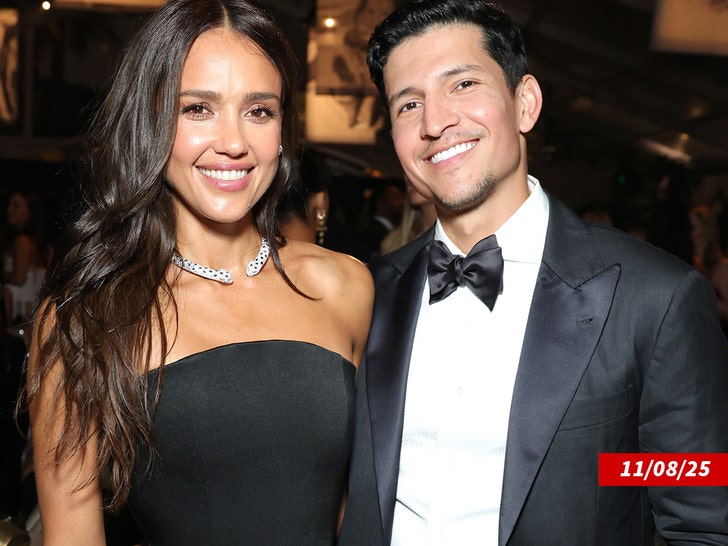
Ramirez is going to help Alba grow and change … if she’s receptive to that. James also notes Alba’s chart indicates she’s fiercely independent, while Ramirez needs a bit more cuddling and coddling.
Ultimately, this couple has a seal of approval from the stars themselves … but, Richard adds ya gotta wonder about the human element as well here — including whether this is the right time to dive into a long-term relationship given Alba’s divorce, which was finalized earlier this month.
Are wedding bells in the future? Stay tuned.
Richard James has a weekly astrology show called “StarCast Weekly” where he goes through all the signs and tells people what they can expect for the week ahead on the streamer Gaia.

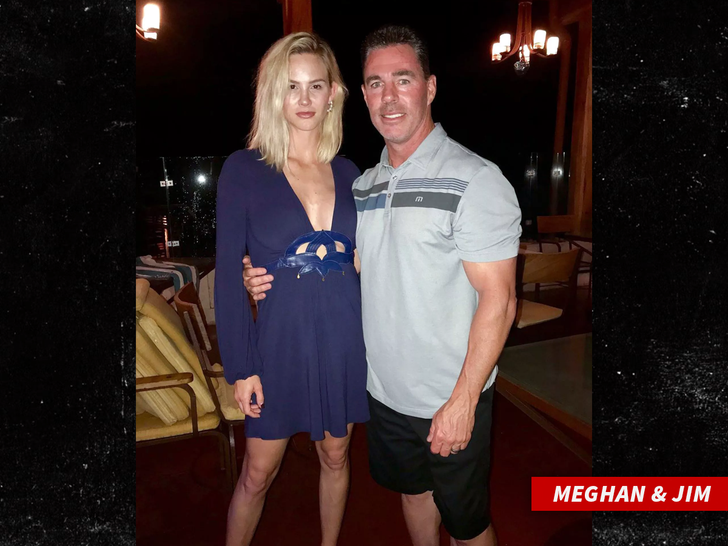
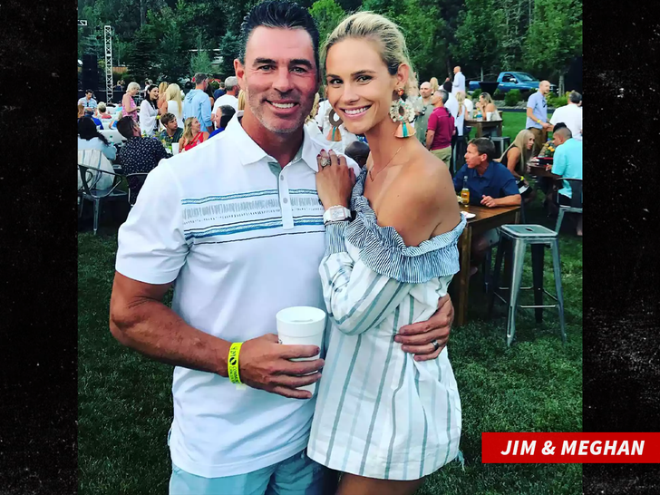
‘RHOC’ Meghan King
My Ex-Husband Got Sex Workers to Harass Me!!!
Jim Edmonds Denies Claim
Published
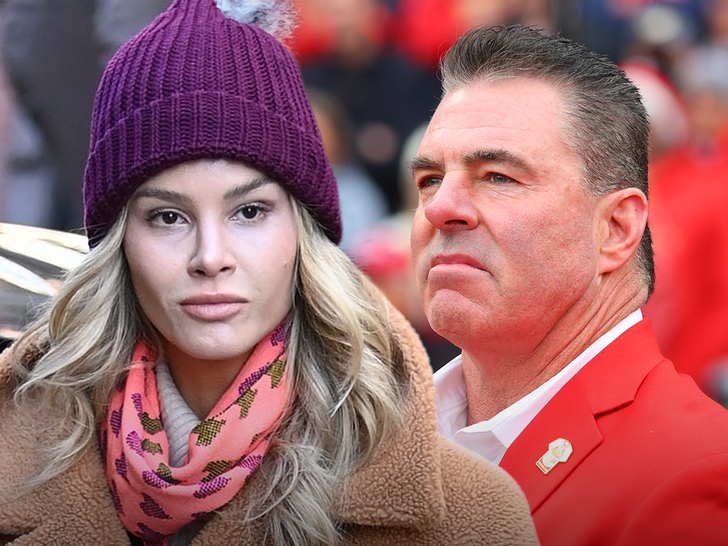
‘Real Housewives of Orange County’ alum Meghan King accused her ex-husband Jim Edmonds of leaking her cell phone to sex workers to harass her years ago … something she mentioned to cops while reporting recent harassing phone threats from an unknown person — but a rep for Jim adamantly denies the claim.
According to a Kirkwood Police Department report, Meghan drove to the station in Missouri in September 2025 to report alleged threatening phone calls she’d been getting.
Meghan told an officer she’d been receiving consistent calls from an unknown person threatening to hurt her and her kids. Meghan claimed she was getting the calls for the past 2 months … but said it had gotten increasingly worse over the prior 2 days. She told the officer the person had been making “crazed overt threats” and making less and less sense.
Meghan claimed she engaged with the caller for a bit, but then stopped … she said she blocked the number, but says they kept using new numbers to message her.
The officer listened to 2 voicemails left by the unknown individual and said the person sounded female … the caller made repeated threats of grabbing, hurting, and killing Meghan and her children. The suspect also told Meghan she would “go to jail.”
The report reads … “The suspect speaks calmly at times and quickly at others, using frequently-repeated phrases or details in a rambling and erratic manner.”
The officer noted in the report Meghan is a former star of “The Real Housewives of Orange County,” and that sometimes random people call her.
Meghan told police she was dealing with her ex-husband, Jim Edmonds, “losing his mind” over their ongoing custody dispute. As TMZ previously reported, Meghan lost custody of the three kids she shares with Jim after a school official called Child Protective Services.
The report says the officer asked Meghan if she believed Jim had a connection to the threatening calls … she said she didn’t know … but mentioned the ongoing custody battle.
Meghan also told the cop Jim had harassed her through other people before, and referenced an alleged incident a few years ago when she claimed Jim distributed her number in numerous places — including giving it to sex workers with instructions to harass her.
According to the report, Megan said “after an overwhelming wave of phone calls and texts, she received a text from a number not known to her, which included a photo of the text sent by [Jim] containing instructions to harass her.”
The police department launched an investigation into the random texts and calls, adding that “Due to the nature of the threats, a department-wide email was sent requesting a close patrol of [Meghan’s] residence.”
Jim’s rep, Steve Honig, tells TMZ, “This is the first anyone is hearing of this, and it’s absurd. Jim is spending his time in Tennessee raising his kids and doesn’t have time for such nonsense.”
Entertainment
Conan O'Brien breaks silence on Rob and Michele Reiner's killings after argument with son at comedian's holiday party
:max_bytes(150000):strip_icc():format(jpeg)/conan-obrien-rob-reiner-022026-4c9304281ae94218befef9817cb894c9.jpg)
The acclaimed filmmaker and his wife were found stabbed to death in their Brentwood, Calif., home on Dec. 14.
Entertainment
Anthony Ramos unpacks being 'butt-ass naked' in front of Ashton Kutcher on “The Beauty”: 'It was a crazy scene'
:max_bytes(150000):strip_icc():format(jpeg)/The-Beauty-Ashton-Kutcher-Anthony-Ramos-4-022026-bbdbf7a2f3bc45e0bf5903d116614734.jpg)
Ramos named the scene as one of the most memorable during his time on the Ryan Murphy drama.

For a series that built its fandom online, the next growth move is simple: remove friction. Since this anime has always thrived on discovery — clips, edits, character moments, the whole paywall-free binge framing feels strangely out of place. That’s why this kind of platform placement matters: it turns a title people know about into a title people can start immediately, and all of it.
The official channel for the franchise on X shared a looping GIF that cycles through the four core heroines, each framed with their signature color and emblem energy, like a quick reminder of the show’s identity: style-forward action, tight team dynamics, and character-first momentum. It’s also a smart fit for Pluto’s audience, where what’s-on-now discovery still drives viewing. A curated push + familiar iconography is how you spark rewatchers and convert first-timers who’ve seen the names (Ruby, Weiss, Blake, Yang) but never hit play.
While only RWBY Volume 1 is now streaming on Pluto TV, the remaining volumes are rolling out across the week. And to accelerate the catch-up wave, Pluto is also running an all-day RWBY marathon on the app across 2/21 and 2/22, a programmed “start here and stay here” window designed to turn curiosity into a full-season binge.
‘RWBY’ Has Had a Tough Journey, But It’s Still Going Strong
RWBY launched in 2012 under Monty Oum and grew from short, web-first episodes into a long-running franchise built around Volumes (seasons). After Oum’s death on February 1, 2015, the team continued production, and the main series has since reached 9 volumes / 117 episodes (as of March 2024). Along the way, it expanded into side projects like RWBY Chibi, the Japanese anime adaptation RWBY: Ice Queendom, and the Justice League x RWBY crossover films.
The franchise hit another turning point when Rooster Teeth shut down, and VIZ Media acquired RWBY in 2024; VIZ says there’s no confirmed new season release date yet, but showrunner Kerry Shawcross will be involved in what comes next.
The most immediate what’s-next, however, is availability: RWBY is rolling out on Pluto TV, with an all-day marathon scheduled for 2/21–2/22. Stay tuned to Collider for more updates.

- Release Date
-
2022 – 2022-00-00
- Network
-
Tokyo MX
- Directors
-
Yukihiro Miyamoto, Shuuji Miyazaki, Shohei Fujita
-

Hiro Shimono
Jaune Arc (voice)
-
Saori Hayami
Ruby Rose (voice)
-
Yoko Hikasa
Weiss Schnee (voice)
-
Megumi Han
Penny Polendina (voice)
NewsBeat1 minute ago
I was on BBC One’s Death in Paradise – Don Warrington and Ralf Little showed true selves

Business4 minutes ago
(VIDEO) Hilary Duff Talks About Estrangement from Sister Haylie, Calling It ‘Most Lonely Part’ of Her Life

Tech8 minutes ago
How infostealers turn stolen credentials into real identities


-

 Video5 days ago
Bitcoin: We’re Entering The Most Dangerous Phase
-

 Tech6 days ago
Luxman Enters Its Second Century with the D-100 SACD Player and L-100 Integrated Amplifier
-
 Crypto World4 days ago
Can XRP Price Successfully Register a 33% Breakout Past $2?
-

 Sports4 days ago
GB's semi-final hopes hang by thread after loss to Switzerland
-

 Fashion18 hours ago
Weekend Open Thread: Boden – Corporette.com
-

 Video1 day ago
XRP News: XRP Just Entered a New Phase (Almost Nobody Noticed)
-
 Tech4 days ago
The Music Industry Enters Its Less-Is-More Era
-

 Business4 days ago
Infosys Limited (INFY) Discusses Tech Transitions and the Unique Aspects of the AI Era Transcript
-
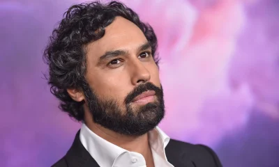
 Entertainment3 days ago
Kunal Nayyar’s Secret Acts Of Kindness Sparks Online Discussion
-

 Video4 days ago
Financial Statement Analysis | Complete Chapter Revision in 10 Minutes | Class 12 Board exam 2026
-

 Tech3 days ago
Retro Rover: LT6502 Laptop Packs 8-Bit Power On The Go
-
 Sports2 days ago
Clearing the boundary, crossing into history: J&K end 67-year wait, enter maiden Ranji Trophy final | Cricket News
-

 Entertainment3 days ago
Dolores Catania Blasts Rob Rausch For Turning On ‘Housewives’ On ‘Traitors’
-

 Business3 days ago
Tesla avoids California suspension after ending ‘autopilot’ marketing
-
 NewsBeat6 days ago
The strange Cambridgeshire cemetery that forbade church rectors from entering
-

 Crypto World3 days ago
WLFI Crypto Surges Toward $0.12 as Whale Buys $2.75M Before Trump-Linked Forum
-
 Politics4 days ago
Eurovision Announces UK Act For 2026 Song Contest
-
 NewsBeat6 days ago
Man dies after entering floodwater during police pursuit
-

 Crypto World2 days ago
83% of Altcoins Enter Bear Trend as Liquidity Crunch Tightens Grip on Crypto Market
-

 NewsBeat7 days ago
UK construction company enters administration, records show