
Snow and ice are expected across the region
Forecasters have issued an update as snow and ice are set to hit Greater Manchester this weekend. A yellow weather warning for snow and ice had previously been issued by the Met Office.
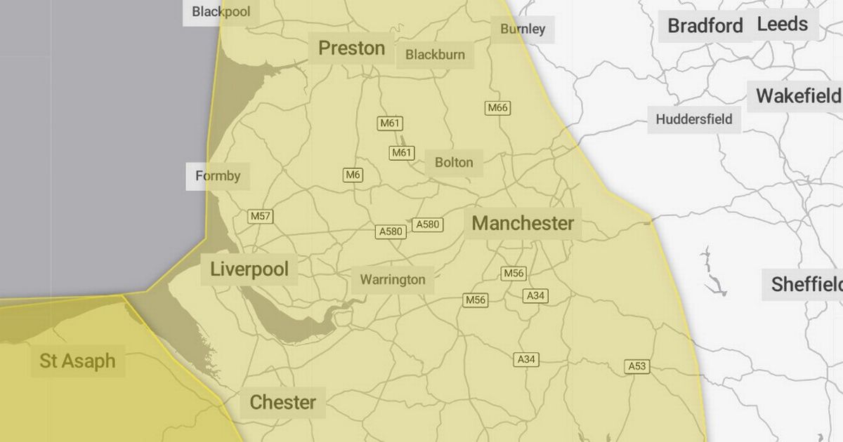
It initially covered southern and eastern parts of the region, but in a new update the Met Office has extended the warning. All parts of Greater Manchester are now covered by the weather warning, alongside Cheshire, Merseyside and most of Lancashire.
Parts of the Midlands, the South West and all of Wales are also hit by the warning, which comes into force at 3pm on Sunday (January 4) and lasts until midday on Monday. The Met Office says snow and ice could cause travel disruption, with drivers and pedestrians urged to take care on icy surfaces.
A spokesperson for the Met Office said: “Snow showers are expected to push further inland across Wales, parts of northwest England, the West Midlands and southwest England during Sunday evening. Along windward coasts, some rain and sleet is likely, but inland showers will fall as snow.
“Whilst not all locations in the warning area will see snow, 1-3 cm could develop in many places by Monday morning, with the potential for 5-8 cm to build up in a few locations, particularly across inland and higher parts of Wales. Icy stretches are likely to form widely.”
All Greater Manchester boroughs are currently forecast for at least some snow showers on Sunday afternoon and early evening. The region will also see bitter temperatures, with overnight lows of around -7C in most areas on Sunday night, before temperatures struggle to top 0C on Monday.


