
As well as heavy rain the forecasting agency is warning of wind gusts of up to 70mph as an area of low pressure barrels towards us
The Met Office has upgraded its weather warning for Wales in the coming days. A yellow wind warning has now been issued for the areas of Carmarthenshire, Ceredigion, Conwy, Denbighshire, Gwynedd, Isle of Anglesey, Pembrokeshire, Powys and Swansea.
It will be in place from Monday at 10pm until 4pm on Tuesday. It follows a yellow warning for rain which has already been issued.
The Met Office warns for Wales: “South to southwesterly winds will strengthen on Monday night and remain strong and gusty into Tuesday morning, before gradually easing through Tuesday afternoon.
“Peak gusts of 40-50 mph are expected fairly widely, but gusts of 60-70 mph will be possible along some exposed coasts and over/to the north of high ground.
“There is a small chance of gusts in excess of 70 mph over northwest Wales.”
It warns you should expect the following:
- Some delays to road, rail, air and ferry transport are likely
- Probably some bus and train services affected, with some journeys taking longer
- Delays for high-sided vehicles on exposed routes and bridges likely
- Some short term loss of power and other services is possible
- It’s likely that some coastal routes, sea fronts and coastal communities will be affected by spray and/or large waves
And offering safety advice, the Met Office adds: “Give yourself the best chance of avoiding delays by checking road conditions if driving, or bus and train timetables, amending your travel plans if necessary.
“People cope better with power cuts when they have prepared for them in advance.
“It’s easy to do; consider gathering torches and batteries, a mobile phone power pack and other essential items.“If you are on the coast, stay safe during stormy weather by being aware of large waves. Even from the shore large breaking waves can sweep you off your feet and out to sea.
“Take care if walking near cliffs; know your route and keep dogs on a lead. In an emergency, call 999 and ask for the Coastguard.
“Be prepared for weather warnings to change quickly. When a weather warning is issued, the Met Office recommends staying up to date with the weather forecast in your area.”
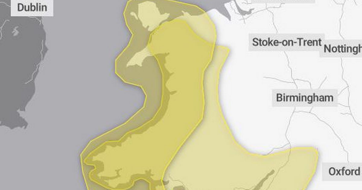
The warning for rain now covers 20 areas of Wales, an increase of four, and includes: Blaenau Gwent; Bridgend; Caerphilly; Cardiff; Carmarthenshire; Ceredigion; Conwy; Denbighshire; Gwynedd; Merthyr Tydfil; Monmouthshire; Neath Port Talbot; Newport; Pembrokeshire; Powys; Rhondda Cynon Taf; Swansea; Torfaen; Vale of Glamorgan; Wrexham.
It is in place from 6pm on Monday until 6pm on Tuesday and says: “Outbreaks of rain will become persistent and heavy on Monday night into Tuesday morning, and whilst the rain may be more intermittent during Tuesday daytime some occasional heavy bursts will still be possible.
“There will naturally be some variation in rainfall totals across the area, but accumulations of 20-40 mm are likely in quite a few places, with 60-80 mm over Dartmoor and high ground in Wales. There is a small chance of 80-100 mm falling over the most exposed, prone hills. Given the saturated nature of the ground, this is likely to lead to some flooding in places and transport disruption. Rain will also be accompanied by strengthening southerly winds, which may exacerbate impacts.”


