
The Met Office says it’s still too early to provide weather details for Christmas
Whether you’re planning to head to the Belfast Christmas Market this coming week or out and about for some festive shopping, the Met Office has issued an update on weather conditions over the next few days.
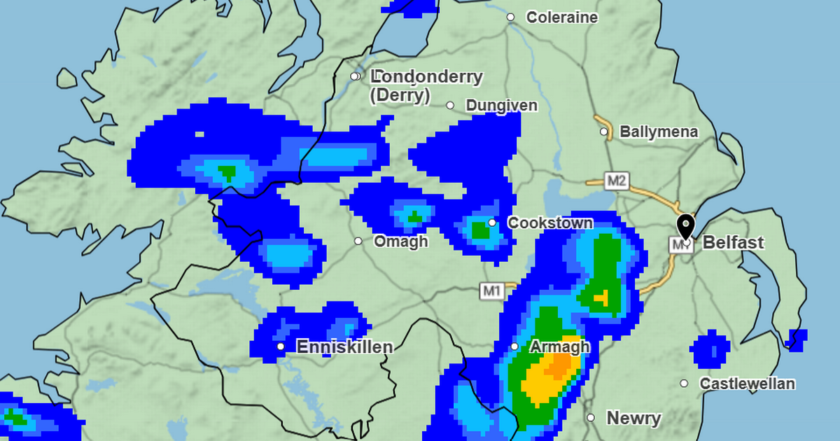
After a soggy Sunday across most of Northern Ireland with a yellow rain warning in place, further unsettled conditions are expected this coming week.
Met Office Deputy Chief Meteorologist Dan Holley said: “Whilst there is some uncertainty as to the exact track and intensity of the area of low pressure as it passes close to western Scotland later on Tuesday, many parts of the UK are likely to see spells of rain which, given saturated ground, could lead to flooding and delays to road and rail travel.
“In addition, strong winds are expected, particularly in northern and western areas. We are closely monitoring developments and may issue updates to the warnings as the situation evolves.”
The Met Office forecast for the rest of December remains unsettled with further periods of low pressure expected to bring more wet and windy weather. And meteorologists also say it’s too early to provide an accurate forecast for the Christmas period.
For now, here’s what to expect for the coming days in Northern Ireland, according to the Met Office.
Monday:
It will be a mostly dry day with some good bright or sunny spells. A few isolated morning showers possible but dry for the majority. Breezy in the morning. Maximum temperature 10 °C.
Outlook for Tuesday to Thursday:
Cloudy with heavy rain early on Tuesday. Drier Wednesday with showers and a few sunny spells. Cloudy with rain on Thursday. Strong winds and a risk of coastal gales throughout.
UK long range weather forecast: Thursday 11 December – Saturday 20 December
A continuation of a similar pattern to that seen through early December is anticipated, especially at first, as frontal systems from the Atlantic spread into and across the UK, interspersed with some temporary drier interludes. These will bring occasional spells of rain, which may be heavy at times bringing the risk of some impacts given how wet it has been lately.
In addition, there may also be potential for some periods of strong winds at times too. Whilst it will often be mild, later in the period there may be a transition for temperatures to return closer to average, with a slightly higher chance of some wintry hazards across northern parts of the UK, especially on high ground.
For all the latest news, visit the Belfast Live homepage here and sign up to our daily newsletter here.


