
News Beat
Pacific Northwest braces for more flooding from a powerful storm
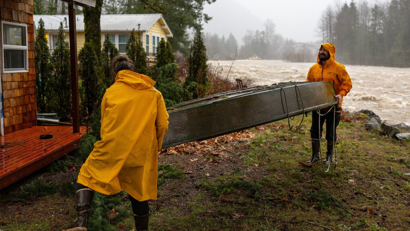
PORTLAND, Ore. (AP) — Pacific Northwest residents braced for another round of heavy rain, flooding and evacuations on Wednesday after a powerful storm clobbered the region a day earlier, swelling rivers, closing roads and prompting high water rescues.
Rivers across western Washington were rising again after a brief morning lull, the National Weather Service said, warning travelers to use caution. Major or record flooding was expected along the Skagit and Snohomish rivers north of Seattle, and overtopping of levees was possible, the National Water Center said.
Evacuations were ordered Wednesday in part of the town of Orting in the foothills of Mt. Rainier south of Seattle. Officials said there was a significant threat to life or property amid extremely high river levels and concerns about levees upstream on the Puyallup River. Teams planned to go door to door to alert residents, and an evacuation center was set to open.
Forecasters warn that the worst river flooding is still to come.
By early Wednesday, parts of the Cascade Range in Washington were reporting “impressive” hourly rain rates near or above a half-inch (1.2 centimeters) per hour, the weather service posted on X. The Paradise area on the slopes of Mount Rainier picked up 3.25 inches (8.2 centimeters) of rain in 10 hours.
On Tuesday, a storm caused power outages, flooding and school closures in parts of Oregon and Washington. Drivers navigated debris slides and water that closed roads and submerged vehicles.
Stay up to date with the news and the best of AP by following our WhatsApp channel.
Fire officials northeast of Seattle said rescue crews used inflatable kayaks to pull people from stranded cars, and carried another person about a mile (1.6 kilometers) to safety after rising water trapped them in the woods.
Washington Gov. Bob Ferguson said Tuesday night that the state’s Emergency Operations Center had moved to its highest activation level because of the rain and wind.
Major rivers are forecast to crest later this week
The Skagit River near the northern Washington town of Concrete was forecast to rise more than 15 feet (4.6 meters) above major flooding levels by Thursday, which would break a record, according to the National Water Prediction Service.
Harrison Rademacher, a meteorologist with the weather service in Seattle, described the atmospheric river soaking the region as “a jet stream of moisture” stretching across the Pacific Ocean “with the nozzle pushing right along the coast of Oregon and Washington.”
The weather service expects several days of heavy rainfall along the coast and more than a foot (30 centimeters) of new snow in the northern Rockies in northwestern Wyoming. Flood watches were in effect, with scattered flash flooding possible along the coast and into the Cascade Range through midweek.
Along Interstate 5 between Seattle and Portland, firefighters conducted five rescues for people who tried to drive on flooded roads, including a semitruck driver, said Malachi Simper, spokesperson for Lewis County Fire Protection District 5. Authorities also rescued a family of six from their home in Chehalis, he said, adding that the road to the house was under about 4 feet (1.2 meters) of water at the time. No one was injured.
Authorities go door to door warning about flooding
Deputies in Washington knocked on doors in certain neighborhoods to warn residents of imminent flooding, and evacuated a mobile home park along the Snohomish River. The city of Snohomish issued an emergency proclamation, while workers in Auburn, south of Seattle, installed temporary flood control barriers along the White River.
Farther south near the Oregon border, the city of Longview on the Columbia River said it was opening a severe weather shelter Tuesday night.
Another storm system is expected to bring more rain starting Sunday, Rademacher said. “The pattern looks pretty unsettled going up to the holidays.”
In southeast Alaska, an arctic blast could bring wind chills as low as minus 50 degrees (minus 45.6 Celsius) in Skagway and minus 15 degrees (minus 26 Celsius) in the capital Juneau, according to the weather service.
Severe weather also targets the Upper Midwest
A fast-moving storm brought freezing rain, high winds and heavy snow to the Upper Midwest on Tuesday, forcing some schools to close or move to virtual lessons.
Parts of central and northern Minnesota and northwest Wisconsin saw heavy snow, while the Twin Cities metro and southwest Minnesota got a mix of wintry weather. St. Cloud, Minnesota, got nearly 6 inches (15 centimeters) of snow by Wednesday morning, the weather service said.
The storm was heading into the Great Lakes region on Wednesday. Parts of upstate New York near Lake Ontario, including the western Adirondacks, were under a winter storm warning with heavy snow expected.
___


