
News Beat
Storm Goretti to bring heavy snow to UK with fresh Met Office weather warnings issued
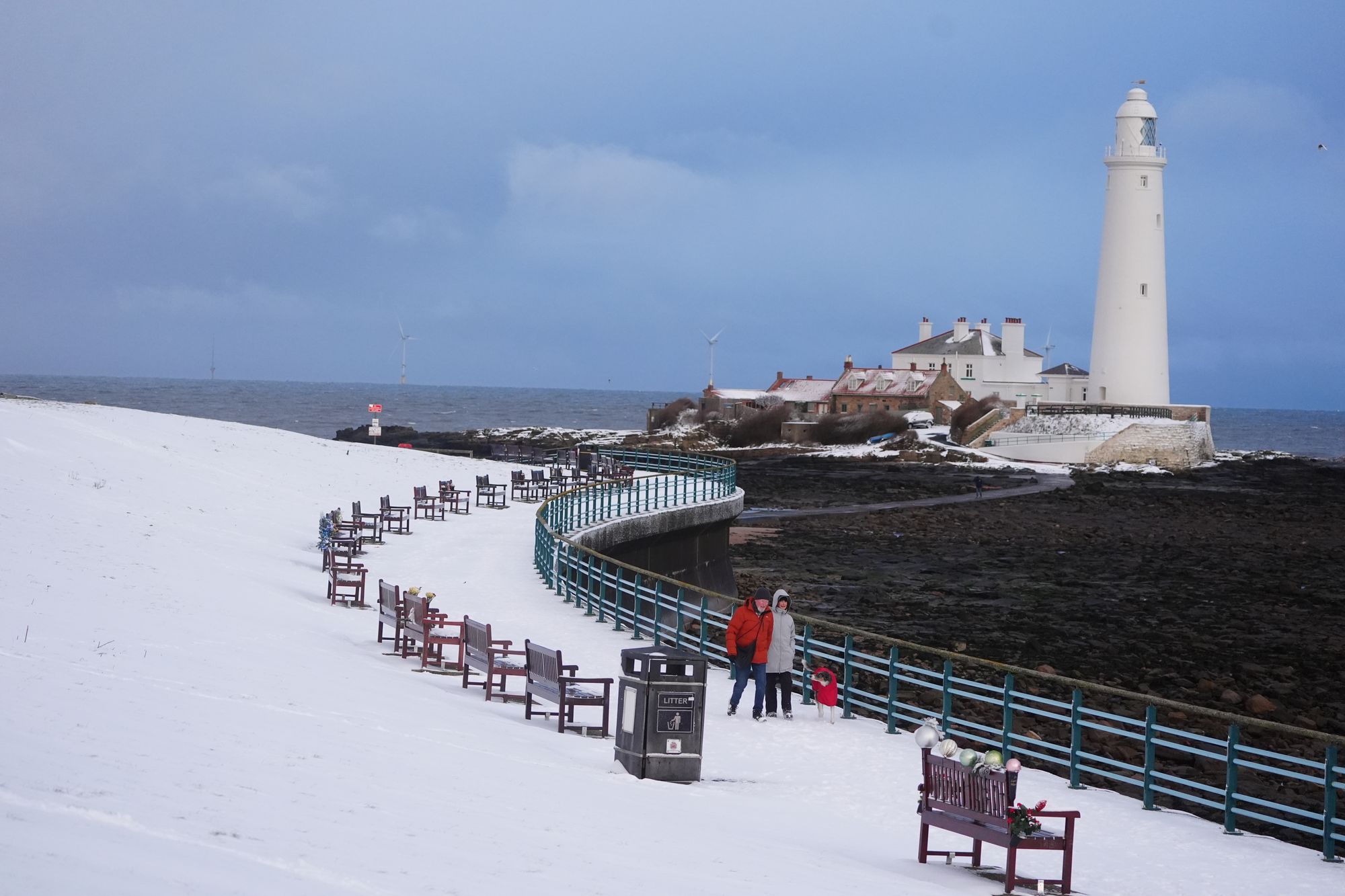
The Met Office has issued fresh weather warnings as Storm Goretti is set to bring heavy snow to the UK later in the week.
Storm Goretti, named by French meteorological service Meteo-France, is the first storm of the year and is likely to cause difficult travel conditions in Britain, though France will be the most severely impacted.
An amber warning has been issued for heavy snow across north-east and northern Scotland from 11am until 7pm.

The UK’s forecaster has issued a new yellow weather warning for snow across Wales, the southeast and west of England, and the Midlands on Thursday from 6pm until midday on Friday.
Dozens of flights between the Dutch hub and UK airports on KLM were once again cancelled on Tuesday – including services to and from Aberdeen, Birmingham, Edinburgh, Heathrow, Humberside, Inverness, Leeds Bradford, London City, Manchester, Newcastle, Norwich and Teesside.
Aberdeenshire council have declared a “major incident” as ongoing snow continues to cause travel disruptions and school closures.
Adam Stachura, the policy director at Age Scotland, urged people to stay at home where possible, according to The Telegraph.
He said: “With such cold temperatures and icy conditions ahead, try and make sure you have enough food and any important medications at home to reduce the need for unnecessary and potentially risky trips.”
The forecaster warned that roads and railways will likely be affected by longer journey times and some people might be injured if they fall on icy surfaces.
Wednesday’s weather warnings
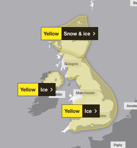
The Met Office has also issued a yellow ice weather warning for Northern Ireland until 11am on Wednesday, as despite temperatures rising and skies clearing, a scattering of wintry showers will once again bring an ice risk overnight. Showers may give a fresh dusting of snow in a few places.
A wider yellow warning for ice is in place across the rest of the UK from midnight until 10am, with icy patches on untreated wet surfaces expected. This could lead to minor disruption, especially on Wednesday morning, including some injuries from slips and falls on icy surfaces.
Thursday’s weather warnings
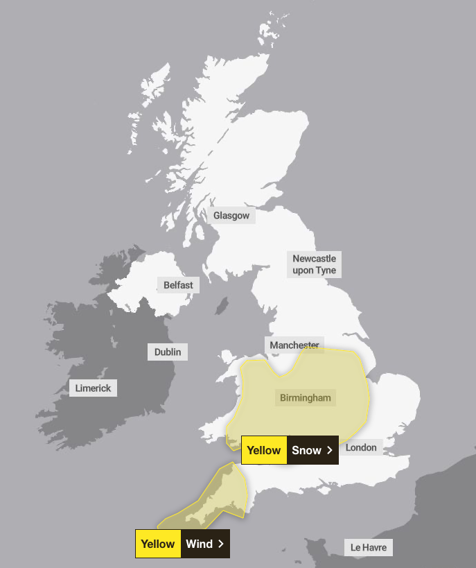
The Met Office has issued a yellow snow weather warning across Wales, the southeast and west of England, and the Midlands on Thursday from 6pm. Storm Goretti will likely bring heavy snow over higher ground in south Wales. In some areas, 5 to 10cm of snow may settle with the potential for up to 20cm in some locations, especially over higher ground. Strong winds may lead to some drifting of snow.
A yellow wind warning is in place across the south west of England as a deep area of low pressure will move across the south of the UK during Thursday and into Friday, bringing a mixture of rain, snow and strong winds. The warning is in place from 3pm until midnight.
Friday’s weather warnings

The yellow snow weather warning is set to remain until midday on Friday, as the Met Office warned rain and snow look as if they will clear eastwards following the storm.
Cold health alert extended until Friday
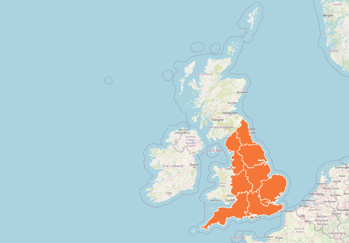
The UK Health Security Agency (UKHSA) has issued amber cold health alerts for all of England until Friday at 10am, warning there could be significant impacts across health and social care services, including a rise in deaths, particularly among those aged 65 and over or with health conditions.
Dr Agostinho Sousa, head of extreme events and health protection at UKHSA, said: “As the colder weather sets in, it is vital to check in on friends, family and neighbours that are most vulnerable.
“The forecast temperatures can have a serious impact on the health of some people, leading to increased risk of heart attacks, strokes and chest infections, particularly for individuals over the age of 65 and those with pre-existing health conditions.”
Matthew Lehnert, chief meteorologist at the Met Office, said: “As we begin the first full working week of the year, we face a range of winter weather hazards with snow showers and ice.
“In the north of Scotland, snow showers are expected to become more frequent on Sunday night, with some locations within the amber warning areas seeing a further 20 to 30cm accumulate by Monday morning.
“Elsewhere in the UK, snow showers, ice and frost are expected at times, but milder air will make attempts to spread eastward from Tuesday. This will mean rain becomes more likely in the south, but there is also the possibility of more organised snow along the boundary of the mild and cold air masses. Strong winds could also be a feature later in the week.
Travel disruption
Hundreds of schools across the UK are still closed, with some rural parts becoming completely cut off and transport severely affected by the weather.
In Glasgow, services on the city’s subway network were suspended on Tuesday after ice on the third rail caused a power failure. Operator SPT said: “Currently both inner and outer circles are suspended and no stations are open.”
Schools in the Highlands are due to reopen on Wednesday, though more snow is expected in the afternoon.
The snowy conditions disrupted road, air and rail travel across the country – with some train lines shut after heavy snow drifted onto the tracks.
ScotRail said services on the route between Aberdeen and Dundee would run in the morning, despite National Rail train services in northern Scotland being disrupted until the end of the day on Tuesday.
Scottish transport secretary Fiona Hyslop previously said: “We’ve already seen challenging conditions and freezing temperatures, with more snow and ice on the way for the same areas.
“Of course, for many, Monday marks a return to work from the festive break. If you have to travel, then please ensure your vehicle is winter-ready and have a winter kit in your car.
“Follow Police Scotland travel advice. If you can delay your journey until the amber warning has expired, please do so.
“I’d also like to thank all the frontline staff such as gritter drivers, chainsaw gangs, police officers and many others who have been out working in dreadful conditions these past few days and over the next 48 hours.”


