
News Beat
Storm Goretti tracker map shows where ‘eight inches’ of snow could hit UK | News UK
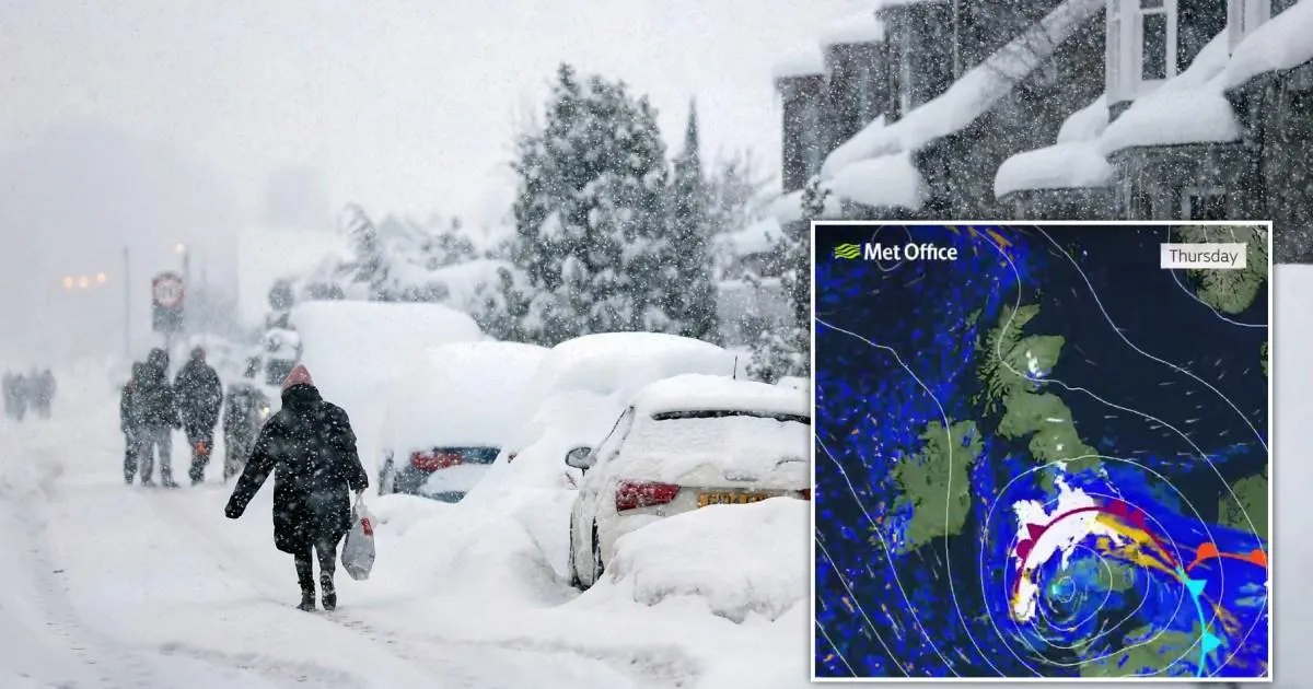

Storm Goretti could dump several inches of snow on the UK from tomorrow as the cold weather shows no signs of stopping.
People woke up to icy pavements and closed schools today, with temperatures well into the negative amid a bitter, days-long Arctic blast.
But forecasters warn conditions will only worsen later this week, with heavy snow in the north and equally heavy rain and winds down south.
The heaviest snow will be in the Home Counties, which could see up to eight inches of the white stuff tomorrow and Friday according to some forecasters.
To find out if your area has a chance of a very belated White Christmas, you can use our tracker map below:
Sign up for all of the latest stories
Start your day informed with Metro’s News Updates newsletter or get Breaking News alerts the moment it happens.
Are there yellow weather warnings today?
Also blanketing Britain today are yellow weather warnings for snow and ice.
Three alerts are active today, including one for snow and ice in northern Scotland active for all of today.
The largest for ice stretches across almost all of Scotland and England, with only the western end of Cornwall and the Welsh coast unaffected.
There is a risk in the region of power outages, which could knock out phone reception for some, as well as injuries from slipping on the ice.
Travel delays are likely this morning, the Met Office says, including train and air cancellations.
There is a third ice warning in Northern Ireland as forecasters stress that scattered wintry showers will cover the nation in ice.


The NHS advises that if you do need to head outside today, ‘waddle like a penguin’ to stay safe on the icy pavements.
By sticking your arms out and taking short, shuffling steps, you keep your centre of gravity close to your feet, so are less likely to wobble.
But get used to waddling, Jim Dale, a forecaster who founded British Weather Services, told Metro.
Storm Goretti – named by the French national weather service – is inbound from the Atlantic tomorrow into Friday.

He said: ‘The storm will dump the snow especially across Wales and the Midlands. Not eight inches, but more like five inches or 12cm.
‘Scotland of course have much, much more even now.’
Dale said that as blob of Polar air is behind the cold snap and has been hovering above the UK for about a week now.
He added: ‘It’s slightly less cold today as we await the storm.’
Get in touch with our news team by emailing us at webnews@metro.co.uk.
For more stories like this, check our news page.
MORE: How long is the UK’s freezing cold snap going to last?
MORE: This is what it looks like in the coldest place in the UK after temperatures reached -12
MORE: Arctic temperatures could last all week after London issued snow warning


