NewsBeat
Anticipated Thunderstorms as Heatwave Subsides
© PA
– Advertisement –
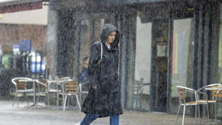
After a week of record-breaking high temperatures in the UK, thunderstorms have surged through various regions, bringing an abrupt conclusion to the recent heatwave experienced by many.
On Sunday, a fresh record was established as the UK experienced its seventh consecutive day of temperatures surpassing 30 degrees Celsius. This remarkable streak, the longest ever recorded for the month of September, came to an end.
However, on Monday morning, early thunderstorms hit southern Scotland, prompting a yellow warning in effect until 6 a.m.
Following this, thunderstorms also occurred in Northern Ireland, northern regions of England, Wales, and northeastern Scotland.
The upcoming week promises cooler temperatures, though some parts of the southeast are expected to enjoy another day of warmth, with London anticipating highs of 27 degrees Celsius today.
Northern parts of England and southern Scotland are projected to experience temperatures in the low 20s, while slightly warmer conditions are anticipated in the Midlands.
Sky News weather producer Chris England says temperatures will “be around the seasonal average” this week.
“Cloud, rain and cooler air spreading from the northwest will bring an end to the hot spell, although the southeast will be quite warm and humid into Tuesday,” he said.
“Thereafter, temperatures will be around the seasonal average, but it’ll be unsettled, with further rain and strong winds moving into the northwest on Wednesday night, then sinking south.
“Central Britain looks like being mostly wet into the weekend, with some heavy rain likely, while gales are possible around north-western coasts. The southeast looks mostly dry after tomorrow.”
Met Office meteorologist Tom Morgan said “a few thunderstorms” can be expected on Monday.
“For the vast majority they will be a bit more scattered in nature than (on Sunday),” he added.
Saturday marked the pinnacle of the heatwave, as temperatures inched just above 33 degrees Celsius at London’s Kew Gardens. Last week, the presence of Saharan dust led to striking sunsets and sunrises in the clear skies.
However, this phenomenon has now yielded to a south-eastward advancing band of rain, ushering in cooler temperatures, especially in the northwest, starting from Monday.
Mr. Morgan described this heatwave as “unprecedented.”
“We have never seen anything as long lived in terms of a heatwave in September before,” he said.
As we move into Tuesday, the majority of the UK should anticipate temperatures that align with the typical September averages. Highs of 18 degrees Celsius are forecasted for northwest England, with the Midlands experiencing slightly higher temperatures.
In contrast, portions of the southeast are expected to maintain temperatures of approximately 23 degrees Celsius, possibly extending into Wednesday.
According to the Met Office, Wednesday should bring a cooler and sunnier outlook for the entire region, but it may become cloudier with westward-advancing rain later in the day, persisting until Friday.
Additional periods of rain are in the forecast for both Thursday and Friday.
(function(d, s, id){ var js, fjs = d.getElementsByTagName(s)[0]; if (d.getElementById(id)) {return;} js = d.createElement(s); js.id = id; js.src = "https://connect.facebook.net/en_US/sdk.js"; fjs.parentNode.insertBefore(js, fjs); });
setTimeout(function(){
if(jQuery('#ctkstyle1').length) { jQuery('#ctkstyle1').remove(); }
}, 500);
console.log("loaded...");
ctkloaded = 1; } }
jQuery(document).ready(function(){
if(typeof(lazySizesConfig) != 'undefined') lazySizesConfig.expand=50;
if(typeof(ctkps) == 'number') { if(ctkps == 0) { jQuery.getScript("//pagead2.googlesyndication.com/pagead/js/adsbygoogle.js"); } }
jQuery(document).mousemove(function(e) { setTimeout(ctkvidinit, 300); });
jQuery(document).on("touchstart",function(){ setTimeout(ctkvidinit, 300); });
});
NewsBeat
Russia suffering ‘environmental catastrophe’ after oil spill in Kerch Strait

BBC Verify
 Reuters
Satellite images reviewed by BBC Verify have shown a major oil slick spreading across the Kerch Strait that separates Russia from annexed Crimea, a month after two oil tankers were badly damaged in the Black Sea.
Oil has leaked into the strait from two ships which ran into trouble during bad weather on 15 December. Volgoneft-239 ran aground following the storm, while Volgoneft-212 sank.
Up to 5,000 tonnes of oil has now leaked, and media reports and official statements analysed by BBC Verify suggest the spill has spread across the Black Sea and the Sea of Azov.
A senior Russian scientist called the spill the country’s worst “environmental catastrophe” of the 21st Century.
“This is the first time fuel oil has been spilled in such quantities,” Viktor Danilov-Danilyan – the head of science at the Russian Academy of Sciences (RAS) – said in a 17 January interview with a Russian newspaper.
Russian scientists said in December that this spill could be more than twice the size of a similar disaster in the strait in 2007, which saw up to 1,600 tonnes of heavy oil leak into the sea. Ukraine’s ministry of ecology has estimated that the clear up from the latest spill could cost the Russian state up to $14bn (£11.4bn).
Paul Johnston, a scientist at Greenpeace Research Laboratories, said “there’s always an element of uncertainty around oil spills”, but a lack of timely information has heightened this uncertainty further.
“I’m not entirely optimistic we’ll ever know the full extent of the problem,” he added.
Satellite images reviewed by BBC Verify on 10 January – the most recent available high-resolution photos – showed a massive oil slick running through the strait, measuring at least 25km (15 miles) long. A second, smaller slick measuring around 5.7km (3.5 miles) long is also visible.
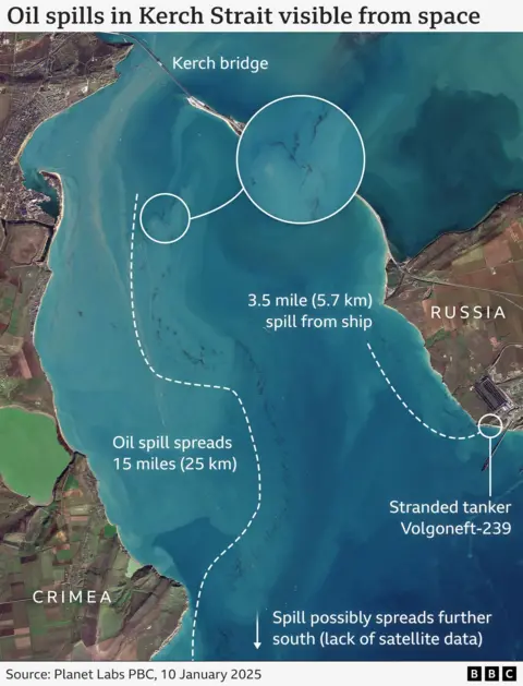
Mr Danilov-Danilyan said that oil could “by late January reach Odesa” in southern Ukraine and “one cannot rule out” it travelling as far as the coasts of Romania, Bulgaria and Turkey.
In a statement to BBC Verify, a spokesperson for Greenpeace said the group estimated that oil from the spill now covered an area totalling up to 400 sq km.
The spill appears to have moved quickly after the initial incident. On 24 December, satellite images reviewed by BBC Verify showed oil accumulating on a beach in Anapa – some 40 miles from the strait.
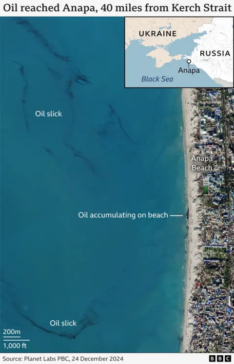
BBC Verify has analysed reports in Russian media, statements from officials and Greenpeace releases from this month that talk about oil being found or cleared up on various beaches.
The reports suggest that the oil has now spread as far north as the occupied city of Berdyansk in Ukraine and as far south-west as Lake Donuzlav on the Crimean Peninsula, which Russian illegally annexed in 2014.
The leak involves heavy M100-grade fuel oil that solidifies at a temperature of 25 degrees Celsius.
A Greenpeace spokesperson told the BBC that M100 doesn’t stay on the water’s surface for long. Once underwater, it is “technically impossible to neutralise”, and can take decades to be biodegraded by marine micro-organisms.
Footage recorded by the Russian NGO The Earth Touches Everyone and included below appeared to show large amounts of heavy oil accumulating on the seabed.
 The Earth Touches Everyone
Some experts have warned that the leak has heavily impacted marine life in the region. Footage authenticated by BBC Verify has shown birds covered in oil.
It is not known exactly how many animals have been harmed by the spill.
Overall, Russian officials say about 6,000 birds have been delivered to “rehabilitation centres” on the Russian mainland, but it is unclear how many of them will survive. A local bird sanctuary in Stavropol territory said of 1,051 birds affected by the oil spill that have been delivered to them only about 17% have survived.
 Reuters
Greenpeace told BBC Verify that the final number of dead birds could be far higher, citing the 12,000-13,000 killed by the 2007 spill in the strait.
A dolphin rehabilitation centre in Russia’s Krasnodar Territory told Interfax news agency that around 70 dead dolphins have been discovered on the shores following the latest oil spill.
“This is a horrific blow to the ecosystem,” Mr Danilov-Danilyan told Russia media. He predicted the death of “tens of thousands of birds, many dolphins, [and] big losses in the coastal flora and fauna”.
“Practically nothing, other than microorganisms that feed on fuel oil and break it up, can live in that sort of environment, even in salt water. The removal of 200,000–500,000 tonnes, at least, of contaminated soil too will not go without consequences, and will certainly lead to a reshaping of the coast,” he said.
Dmitry Lisitsyn, Executive Fellow at Yale University’s School of the Environment, told BBC Verify that under Russian safety regulations these types of tankers are barred from leaving rivers in winter.
“Those ships are not intended for high waves, they are very long with a shallow draught,” he said.
Questions have also been raised about the seaworthiness of the vessels, which are both over 50 years old, according to Marine Traffic.
Footage released by Russian authorities showed the bow of one tanker completely broken off during the incident, with streaks of oil visible in the water. The captains of both vessels have been arrested and criminal investigations have been opened into the incident.
Ukrainian activists have accused the ships of being part of Russia’s so-called shadow oil fleet. Moscow has been accused of using the so-called ghost fleet of tankers, which are often poorly maintained and lack proper insurance, to move oil and circumvent sanctions, though analysts the BBC has spoken to could not confirm the claims.
Experts say the long-term fallout from the spill may not be limited to just Russia.
“In general, Russia has suffered more than any other country so far from the Kerch Strait accident,” Dmitry Markin of Greenpeace said.
“However, the majority of the leaked fuel oil is still in the sea. Therefore, the long-term consequences for the occupied territories of Ukraine may be no less severe.”
Graphics by Erwan Rivault.

NewsBeat
Starmer unlikely to be ruffled by Trump – but he must keep his party in line | Politics News

From shattering the record for most executive orders signed on a first day in office, a bishop imploring him to have mercy on immigrants and LGBTQ+ people, Melania’s hat and Mark Zuckerberg’s wandering eye – the first few days of Trump 2.0 has been not just the talk of the town in Washington DC, but in Westminster too.
President Trump himself said as he took the mantle of 47th president of the United States that he wants to make his second term “the most consequential in US history”.
What is becoming even more clear as campaigning gives way to governing is that Trump 2.0 could prove vastly consequential for us too.
👉 Click here to listen to Electoral Dysfunction on your podcast app 👈
Talk to those around Whitehall and in the government, and there is a quiet acknowledgement of the ill-wind that is blowing from America towards liberals like Sir Keir Starmer as President Trump pulls out of climate accords, ramps up the war on purging government workers in diversity, equity and inclusion roles, and begins to roll out an aggressive immigration crackdown from mass deportations to a broad ban on asylum.
But what you will see in the coming weeks, is a pointed effort on the part of the government to neither comment nor engage on US domestic issues. This is likely to infuriate liberals and progressives both in the Labour Party and voter base, but when it comes to Trump 2.0 pragmatism reigns.
This is partly, say those in government, because of the difference in the win this time around.
Trump not only won the Electoral College, he won the popular vote – the first time a Republican candidate has won both in 20 years – and control of the House of Representatives and Senate. That gives a legitimacy and power that he didn’t have last time around and that momentum looks set to stay, at least until the mid-terms in two years’ time.
It is also because the Labour government, and wider Europe, needs Trump onside.
On the big issues facing the government, the US looms large, be it on economic growth – tariffs and trade deals – or security – Ukraine and the Middle East.
Whether you love or loathe Donald Trump, the decisions he takes on how to handle Israel, Gaza and Iran or bring about peace in Ukraine matters to us, and that means pragmatism must reign and punches pulled when it comes to the deep ideological divisions that are so obvious between Donald Trump’s politics and that of Keir Starmer.
We are entering more turbulent times and one very senior political figure admits it is going to be “rocky”.
They say this is because we find ourselves in a period where the organising principle for western foreign policy – the rules-based international order – is in quick retreat, as the US and Europe struggle to contain territorial and political ambitions of authoritarian countries like Russia and China.
Tricky terrain to navigate, the four priorities Starmer will want to try to land with President Trump when he gets an audience in the coming weeks are – Ukraine, the Middle East, tariffs and trade.
On the first, the contours of a plan are being discussed but the challenge is to get Putin to the negotiating table.
Russia, aware that President Trump is unwilling to keep pouring military aid into Ukraine, will want to carry on for as long as possible.
The task for allies is to persuade President Trump to go in hard on Putin so he is forced to the table in a position of discomfort.
We saw some of this from President Trump this week as he warned Putin of punishing sanctions on Russia should Moscow refuse to negotiate.
But there will be demands for Ukraine too, not least an expectation from President Trump that in return for US military support, President Zelenskyy must send younger Ukrainian men to the battlefield and lower the conscription age from 25 to perhaps as young as 18.
This will be incredibly difficult for President Zelenskyy and the Ukrainian people who have already sacrificed so much in a war they did not ask for and didn’t want.
As part of any ceasefire deal, expect the UK to be involved in a European peacekeeping force.
Expect too for Trump to ramp up pressure on NATO countries to boost defence spending from 2% of GDP to 3% or more (Trump called for the defence spend baseline of NATO members to be 5% in recent weeks).
Needless to say, the US’s handling of the Ukraine war and our role in that will be critical to not just our foreign policy, but national conversation in the coming months.
When it comes to the Middle East, the situation is trickier still.
I’m told there is some concern with the Foreign Office that Israel could make the case to Trump that the depletion of Iran’s proxies – Hezbollah and Hamas – make this a moment to target Iran.
There is nervousness that Trump, who has long made his acute dislike of Iran clear (last time around he abandoned the Obama nuclear deal with Tehran), buys into that and escalates a wider conflict in the region.
Even the risk of the US green-lighting a direct attack from Israel on Iran will only serve to accelerate Tehran’s nuclear programme.
Where Starmer is hoping to make some progress is on trade.
President Trump, a big Brexit and Boris Johnson backer, talked up a US-UK trade deal in his first term, only for President Biden to put it on the backburner.
Now, the UK government is hoping there will be some sectoral deals in which our two countries can improve trading relations in return for the UK offering President Trump perhaps assurances around his security concerns regarding China (you might remember back in 2020, pressure from the US prompted the the government to U-turn on allowing Huawei to have a role in its new generation of 5G networks).
How this plays out, even as the Labour government looks to build trading ties with Beijing, will be something to watch.
One obvious question will be – can the UK benefit from renewed UK-China trade ties without annoying Trump?
The final big issue for the UK is tariffs, but for now it doesn’t look like Trump is taking aim at the UK.
Instead, he has this week announced he’s considering imposing a 10% tariff on Chinese-made imports as soon as 1 February.
Starmer needs it to stay that way, given his plan for “national renewal” hinges on economic growth – which is looking precarious even without the prospect of tariffs on exports to the US.
Analysts had warned that a blanket 10% tariff could cost British industry $3bn (£2.5bn) a year, with cars, aerospace, pharmaceuticals and machinery among the sectors to be hardest hit.
One area where the government is more quietly confident is on the matter of its pick for ambassador, Lord Mandelson.
While rumours have been flying around that the architect of New Labour and former EU trade commissioner might get vetoed by President Trump, sources in government expect him to be appointed, and believe his nous as a political operator, coupled with his expertise in trade negotiations, make him a good choice.
But the bigger question is whether he can become a Trump whisperer in replacing current ambassador, Karen Pierce, who is well-regarded and liked by the Trump team.
How to handle Trump will undoubtedly be a test for Starmer, not just in his direct dealing but in the ripple effects of the Trump White House on British politics and his own supporters.
What goes in his favour is that he deals in facts not emotions, so is unlikely to be ruffled with whatever Trump and his allies throw at him.
His bigger challenge will perhaps be keeping the rest of his party in line when he wants pragmatism rather than principle to rule the special relationship.
NewsBeat
Mostly civilians died in IDF attack on Lebanon village, BBC finds

Senior international investigations correspondent, BBC World Service
 BBC
BBCJulia Ramadan was terrified – the war between Israel and Hezbollah was escalating and she’d had a nightmare that her family home was being bombed. When she sent her brother a panicked voice note from her apartment in Beirut, he encouraged her to join him in Ain El Delb, a sleepy village in southern Lebanon.
“It’s safe here,” he reassured her. “Come stay with us until things calm down.”
Earlier that month, Israel intensified air campaigns against Hezbollah in Lebanon, in response to escalating rocket attacks by the Iran-backed armed group which had killed civilians, and displaced tens of thousands more from homes in northern Israel.
Ashraf was confident their family’s apartment block would be a haven, so Julia joined him. But the next day, on 29 September, it was subject to this conflict’s deadliest single Israeli attack. Struck by Israeli missiles, the entire six-storey building collapsed, killing 73 people.
The Israel Defense Forces (IDF) says the building was targeted because it was a Hezbollah “terrorist command centre” and it “eliminated” a Hezbollah commander. It added that “the overwhelming majority” of those killed in the strike were “confirmed to be terror operatives”.
But a BBC Eye investigation verified the identity of 68 of the 73 people killed in the attack and uncovered evidence suggesting just six were linked to Hezbollah’s military wing. None of those we identified appeared to hold a senior rank. The BBC’s World Service also found that the other 62 were civilians – 23 of them children.
Among the dead were babies only a few months old, like Nouh Kobeissi in apartment -2B. In apartment -1C, school teacher Abeer Hallak was killed alongside her husband and three sons. Three floors above, Amal Hakawati died along with three generations of her family – her husband, children and two granddaughters.

Ashraf and Julia had always been close, sharing everything with each other. “She was like a black box, holding all my secrets,” he says.
On the afternoon of 29 September, the siblings had just returned home from handing out food to families who had fled the fighting. Hundreds of thousands of people in Lebanon had been displaced by the war.
Ashraf was in the shower, and Julia was sitting in the living room with their father, helping him upload a video to social media. Their mother, Janan, was in the kitchen, clearing up.
Then, without warning, they heard a deafening bang. The entire building shook, and a massive cloud of dust and smoke poured into their apartment.
“I shouted, ‘Julia! Julia!,’” says Ashraf.
“She replied, ‘I’m here.’
“I looked at my dad, who was struggling to get up from the sofa because of an existing injury to his leg, and saw my mother running toward the front door.”
Julia’s nightmare was playing out in real life.
“Julia was hyperventilating, crying so hard on the sofa. I was trying to calm her down and told her we needed to get out. Then, there was another attack.”
Video footage of the strike, shared online and verified by the BBC, reveals four Israeli missiles flying through the air towards the building. Seconds later, the block collapses.
Ashraf, along with many others, was trapped under the rubble. He began calling out, but the only voice he could hear was that of his father, who told him he could still hear Julia and that she was alive. Neither of them could hear Ashraf’s mother.
Ashraf sent a voice note to friends in the neighbourhood to alert them. The next few hours were agonising. He could hear rescuers sifting through the debris – and residents wailing as they discovered loved ones dead. “I just kept thinking, please, God, not Julia. I can’t live this life without Julia.”
Ashraf was finally pulled from the rubble hours later, with only minor injuries.
He discovered his mother had been rescued but died in hospital. Julia had suffocated under the rubble. His father later told him Julia’s last words were calls for her brother.

In November, a ceasefire deal was agreed between Israel and Hezbollah with the aim of ending the conflict. The deal gives a 60-day deadline for Israeli forces to withdraw from southern Lebanon and for Hezbollah to withdraw its forces and weapons north of the Litani River. As this 26 January deadline approaches, we sought to find out more about the deadliest single Israeli attack on Lebanon in years.
In the apartment below Julia and Ashraf’s, Hawraa and Ali Fares had been hosting family members displaced by the war. Among them was Hawraa’s sister Batoul, who, like Julia, had arrived the previous day – with her husband and two young children. They had fled intense bombardment near the Lebanon-Israel border, in areas where Hezbollah has a strong presence.
“We hesitated about where to go,” says Batoul. “And then I told my husband, ‘Let’s go to Ain El Delb. My sister said their building was safe and that they couldn’t hear any bombing nearby.’”
Batoul’s husband Mohammed Fares was killed in the Ain El Delb attack. A pillar fell on Batoul and her children. She says no-one responded to her calls for help. She finally managed to lift it alone, but her four-year-old daughter Hawraa had been fatally crushed. Miraculously, her baby Malak survived.
 Fares family
Three floors below Batoul lived Denise and Moheyaldeen Al-Baba. That Sunday, Denise had invited her brother Hisham over for lunch.
The impact of the strike was brutal, says Hisham.
“The second missile slammed me to the floor… the entire wall fell on top of me.”
He spent seven hours under the rubble.
“I heard a voice far away. People talking. Screams and… ‘Cover her. Remove her. Lift the stone. He’s still alive. It’s a child. Lift this child.’ I mean… Oh my God. I thought to myself, I’m the last one deep underground. No-one will know about me. I will die here.”
When Hisham was finally rescued, he found his niece’s fiance waiting to hear if she was alive. He lied to him and told him she was fine. They found her body three days later.
Hisham lost four members of his family – his sister, brother-in-law and their two children. He told us he had lost his faith and no longer believes in God.
To find out more about who died, we have analysed Lebanese Health Ministry data, videos, social media posts, as well as speaking to survivors of the attack.
We particularly wanted to interrogate the IDF’s response to media – immediately following the attack – that the apartment block had been a Hezbollah command centre. We asked the IDF multiple times what constituted a command centre, but it did not give clarification.
So we began sifting through social media tributes, gravesites, public health records and videos of funerals to determine whether those killed in the attack had any military affiliation with Hezbollah.
We could only find evidence that six of the 68 dead we identified were connected to Hezbollah’s military wing.
Hezbollah memorial photos for the six men use the label “Mujahid”, meaning “fighter”. Senior figures, by contrast, are referred to as “Qaid”, meaning “commander” – and we found no such labels used by the group to describe those killed.
We asked the IDF whether the six Hezbollah fighters we identified were the intended targets of the strike. It did not respond to this question.

One of the Hezbollah fighters we identified was Batoul’s husband, Mohammed Fares. Batoul told us that her husband, like many other men in southern Lebanon, was a reservist for the group, though she added that he had never been paid by Hezbollah, held a formal rank, or participated in combat.
Israel sees Hezbollah as one of its main threats and the group is designated a terrorist organisation by Israel, many Western governments and Gulf Arab states.
But alongside its large, well-armed military wing, Hezbollah is also an influential political party, holding seats in Lebanese parliament. In many parts of the country it is woven into the social fabric, providing a network of social services.
In response to our investigation, the IDF stated: “The IDF’s strikes on military targets are subject to relevant provisions of international law, including taking feasible precautions, and are carried out after an assessment that the expected collateral damage and civilian casualties are not excessive in relation to the military advantage expected from the strike.”
It had earlier also told the BBC it had executed “evacuation procedures” for the strike on Ain El Delb, but everyone we spoke to said they had received no warning.
UN experts have raised concerns about the proportionality and necessity of Israeli air strikes on residential buildings in densely populated areas in Lebanon.
This pattern of targeting entire buildings – resulting in significant civilian casualties – has been a recurring feature of Israel’s latest conflict with Hezbollah, which began when the group escalated rocket attacks in response to Israel’s war in Gaza.
Between October 2023 and November 2024, Lebanese authorities say more than 3,960 people were killed in Lebanon by Israeli forces, many of them civilians. Over the same time period, Israeli authorities say at least 47 civilians were killed by Hezbollah rockets fired from southern Lebanon. At least 80 Israeli soldiers were also killed fighting in southern Lebanon or as a result of rocket attacks on northern Israel.
The missile strike in Ain El Delb is the deadliest Israeli attack on a building in Lebanon for at least 18 years.
 Scarlett Barter / BBC
The village remains haunted by its impact. When we visited, more than a month after the strike, a father continued to visit the site every day, hoping for news of his 11-year-old son, whose body had yet to be found.
Ashraf Ramadan, too, returns to sift through the rubble, searching for what remains of the memories his family built over the two decades they lived there.
He shows me the door of his wardrobe, still adorned with pictures of footballers and pop stars he once admired. Then, he pulls a teddy bear from the debris and tells me it was always on his bed.
“Nothing I find here will make up for the people we lost,” he says.
Additional reporting by Scarlett Barter and Jake Tacchi
Politics
Chopper's Political Podcast: UK terrorism agency needs reform says Tom Tugendhat after Rudakubana failings


Sit back, pour yourself a drink and join GB News Political Editor Christopher Hope at his regular table in a Westminster pub where he will discuss the latest insider political intrigue and gossip with everyone from popstars to politicians.
New episodes released every Friday.
NewsBeat
Britain’s biggest mortgage lender expects three interest rate cuts this year | Money News
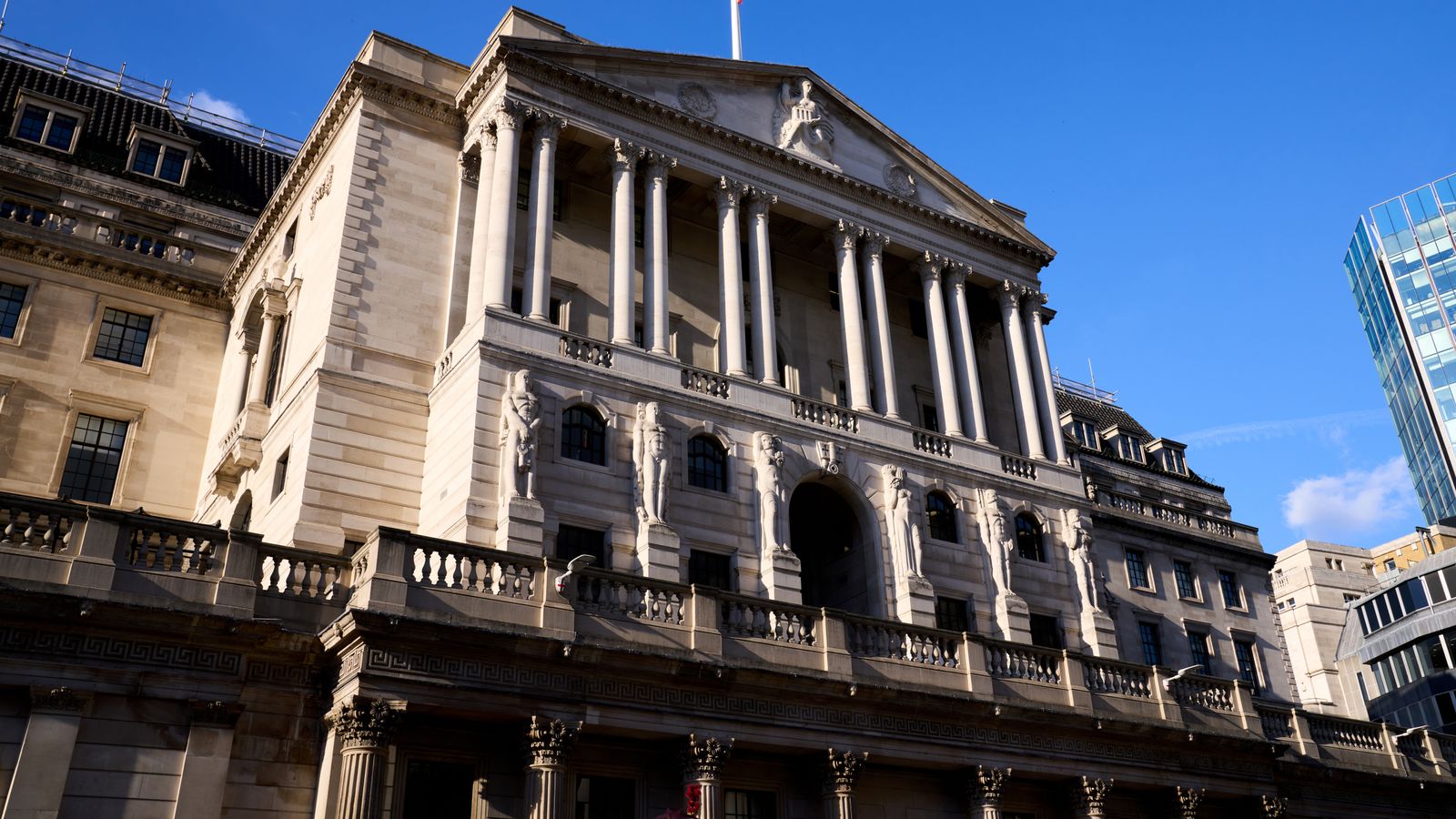
The boss of Britain’s biggest mortgage lender has told Sky News he expects three interest rate cuts this year, bringing some relief to borrowers and mortgage holders.
Lloyds Banking Group chief executive Charlie Nunn said he anticipates rates will continue to fall gradually thanks to the resilience of household and business finances – but cautioned that the UK could expect low growth because of a relative lack of investment.
Speaking at the World Economic Forum in Davos, he said: “We think there’ll be three rate cuts this year.
“Of course, most people choose to fix their mortgage for two to five years and the pricing on that has been relatively stable and we think that stability is likely to remain for the remainder of this year.
“Those that are on the fixed rates are in a good place, and for those that are on a variable rate, their mortgage is likely to continue to come down slowly with the base rate.
“For those that are remortgaging, they are likely to get a significant uptick depending on when they set their mortgage.”
As Britain’s longest-serving bank chief in charge of the largest retail lender with more than 27 million customers, Mr Nunn is well-placed to assess consumer sentiment and economic prospects at the start of the year.
He added: “The UK economy is what I would characterise as very resilient but relatively slow growth. And that’s first of all because household finances continue to strengthen – there are some customers struggling to make ends meet and we’re always focused on them – but actually, deposits and savings in households have increased 6% year-on-year, and cash flows for many businesses again have also strengthened in the last year.
“What we haven’t yet got is investment in growth, and we still have quite a tight labour market with quite high wage inflation.”
Read more from Sky News:
Southport killer jailed
Red weather warning over Storm Eowyn
Sainsbury’s to cut 3,000 jobs
Mr Nunn praised Chancellor Rachel Reeves and Business Secretary Jonathan Reynolds for delivering a positive message about the UK’s prospects in Davos, where optimism about America has contrasted with gloom-consuming European prospects.
“The UK message here has been very positive,” he said. “We’ve got a sort of barbell going on, with colleagues in America being very positive post the inauguration of [Donald] Trump… while Europe is feeling quite negative in Davos, and the UK is building its own path really as a place that people want to invest.”
“The UK is well-placed, we think, relative to the rest of the world, but sentiment has been down in the last few months and people have been nervous about some of the changes that the chancellor made on taxes in the coming months.”
The Lloyds boss was sanguine about the impact of Mr Trump’s second term, saying what counts is what he does, rather than just what he says.
“He’s one of the most predictable politicians we track, what he did on Monday this week is exactly what he said he’d do,” he said. “So there’s no uncertainty, I think, about his priorities and what he sees as important for the US economy and the ‘US first’ mindset.
“The uncertainty has always been around the execution, if he does execute, to what extent and when. Our base case for this year is that Trump will be good for the US growth, it will probably slow down the global economy if he starts to apply tariffs.”
NewsBeat
How Chelsea’s Cole Palmer has inspired the kids of St Kitts

Chelsea and England forward Cole Palmer proudly wears the flag of St Kitts and Nevis on his boots to honour his family roots.
And it is having an impact on the Caribbean island of St Kitts, as BBC Sport found out when visiting to speak to local children – and to Prime Minister Terrance Drew.
READ MORE: Cole Palmer – made in the Caribbean
Politics
Former security minister urges Government to ‘improve’ Home Office scheme ‘not scrap it’
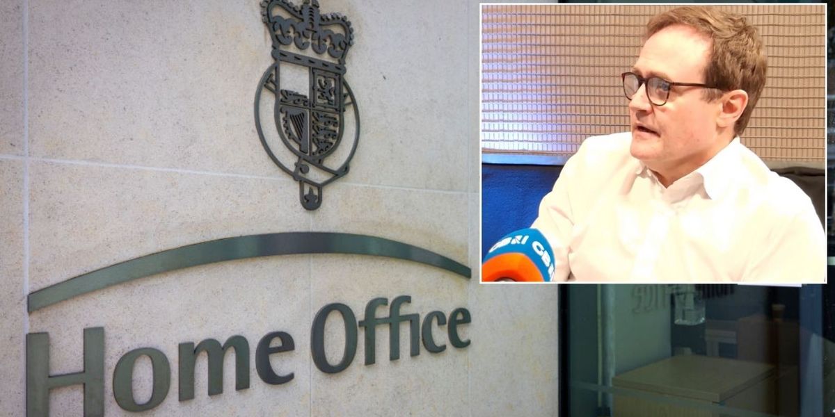
Home Office’s Prevent programme should be “improved” not scrapped, says former Security minister Tom Tugendhat as Axel Rudakubana was jailed for 52 years for attacking and killing children in Southport last year.
The Government has launched a review of the Prevent programme after it emerged Rudakubana was referred to Prevent three times between 2019 and 2021, yet went on to commit his bloody murders in July last year.
Tugendhat – who was Security minister between 2022 and 2024 – was asked on Chopper’s Political Podcast whether he felt that Prevent should be axed.
He replied: “No, I wouldn’t. I would improve it.”
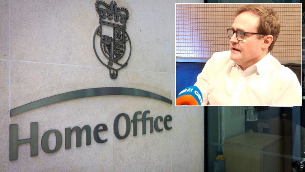
Home Office’s Prevent programme should be “improved” not scrapped, says former Security minister Tom Tugendhat as Axel Rudakubana was jailed for 52 years for attacking and killing children in Southport last year
Getty/ GB News
Tugendhat urged ministers to implement the recommendations in a review of Prevent by Sir William Shawcross.
He told today’s Chopper’s Political Podcast: “I would look at the Shawcross report – there’s a huge amount in there that we were able to get done. And there’s bits that we weren’t able to get done because they take time to introduce.
“And part of it is about making sure you’re ‘triaging’ properly. So you’re getting stuff in line in the appropriate way and you’re responding appropriately.”
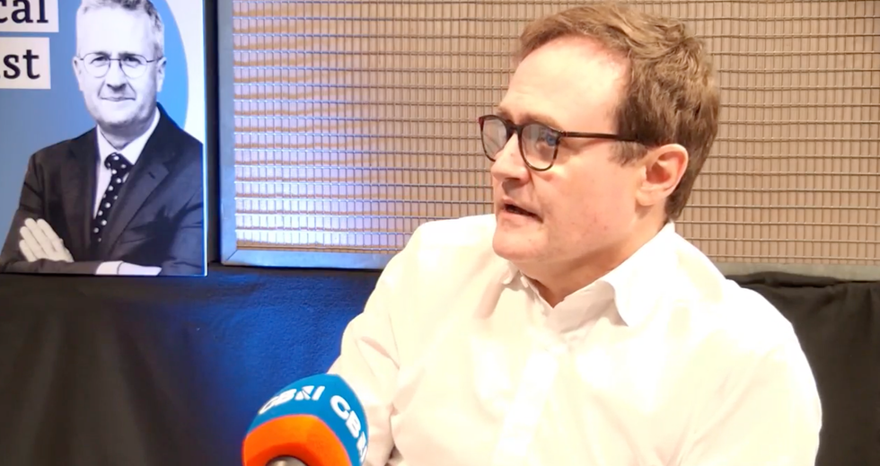
Tugendhat – who was Security minister between 2022 and 2024 – was asked on Chopper’s Political Podcast whether he felt that Prevent should be axed
GB News
He added: “We need to get better at identifying triggers, as it were, on people.
“And when people have radicalised themselves or been radicalised to find out where we’re going.
“That’s why the Prevent aspect is so important.”
Listen or watch Chopper’s Political Podcast on Apple Podcasts, Spotify or GB News’ YouTube channel.
NewsBeat
UK faces four years of economic pain because of Labour’s budget, BrewDog co-founder says | Money News

Britain faces four years of economic pain because the government has made life difficult for businesses following the budget, the co-founder of BrewDog has told Sky News.
James Watt has also suggested the UK is work-shy and only hard graft will lead to prosperity, which is lacking in the country.
It comes on the day Work and Pensions Secretary Liz Kendall announces a new review named “Keep Britain Working” in an effort to support people with long-term illnesses or disabilities back into work, while trying to lower the ballooning welfare bill.
The review will be led by former John Lewis chairman Sir Charlie Mayfield at a time when around 3.7 million people of working age receive health-related benefits, which is 1.2 million more than in February 2020.
Britain is now spending more on incapacity and disability benefits (almost £65bn) than defence – and that figure is set to rise.
Mr Watt, who stepped down as BrewDog chief executive last May, made headlines earlier this month after posting a video with fiancee Georgia Toffolo in which they said they do not believe in a “work-life balance”.
He is launching an entrepreneurial competition show named House Of Unicorns in a bid to find a start-up company with a £2m prize.
He said: “I think the Labour government certainly haven’t helped businesses and haven’t helped founders.
“I think the budget is really, really bad for the UK and caused a lot of damage. And I think the UK attitude towards success and attitude towards entrepreneurs doesn’t help us.
“When you contrast that with the American attitude towards success that is one of the reasons you see so many more founders and entrepreneurs in America versus the UK at the moment.”
Read more from Sky News:
Southport child killer jailed for minimum of 52 years
Amanda Knox fails to overturn slander conviction in Italy
ICC prosecutor calls for arrest of Taliban duo over ‘persecution’
‘UK economy is heading towards recession’
Mr Watt was scathing about the country’s economic prospects, saying: “The UK economy is heading towards a recession, we have debt levels which are way too high, we are trying to tax our way to economic prosperity, which I don’t think will work at all.
“And all the chancellor has done is make it very, very difficult for businesses to employ people, which I think in turn is going to lead to four years of economic pain.”
Asked whether he thought British workers were work shy, Mr Watt told Sky News: “I think you just have to look at the data, we are 18% less productive than America, we are 13% less productive than the French. And we often joke about the French being lazy.”
Work and pensions secretary defends budget
But the work and pensions secretary defended the budget, insisting it was not a tax on jobs.
On a visit to Coca-Cola’s headquarters, Ms Kendall told Sky News: “We have seen a tick up in youth unemployment and I’m really concerned about that.
“We’ve got now one million young people not in education, employment or training. That is terrible for their future life chances, because we know if you’re out of work and you don’t have skills when you’re young, it can have lifelong consequences.
“That’s why we will have a youth guarantee. So every young person is earning or learning. No ifs, no buts.”
‘We won’t means test’ pension triple lock – Liz Kendall
Ms Kendall also doubled down on her commitment to the state pension triple lock despite the necessity to cut the welfare bill.
“We won’t means test it,” she said. “We committed to the triple lock because we believe current pensioners and future pensioners deserve to be able to plan with security.”
Mr Watt however is the latest in a line of business leaders who have warned the budget will lead to companies laying people off this year.
It comes as new figures released this week showed an increase in unemployment and a fall in vacancies at a time in which the population continues to grow.
NewsBeat
'People want answers quickly': Harriet Harman calls for time limits for public inquiries
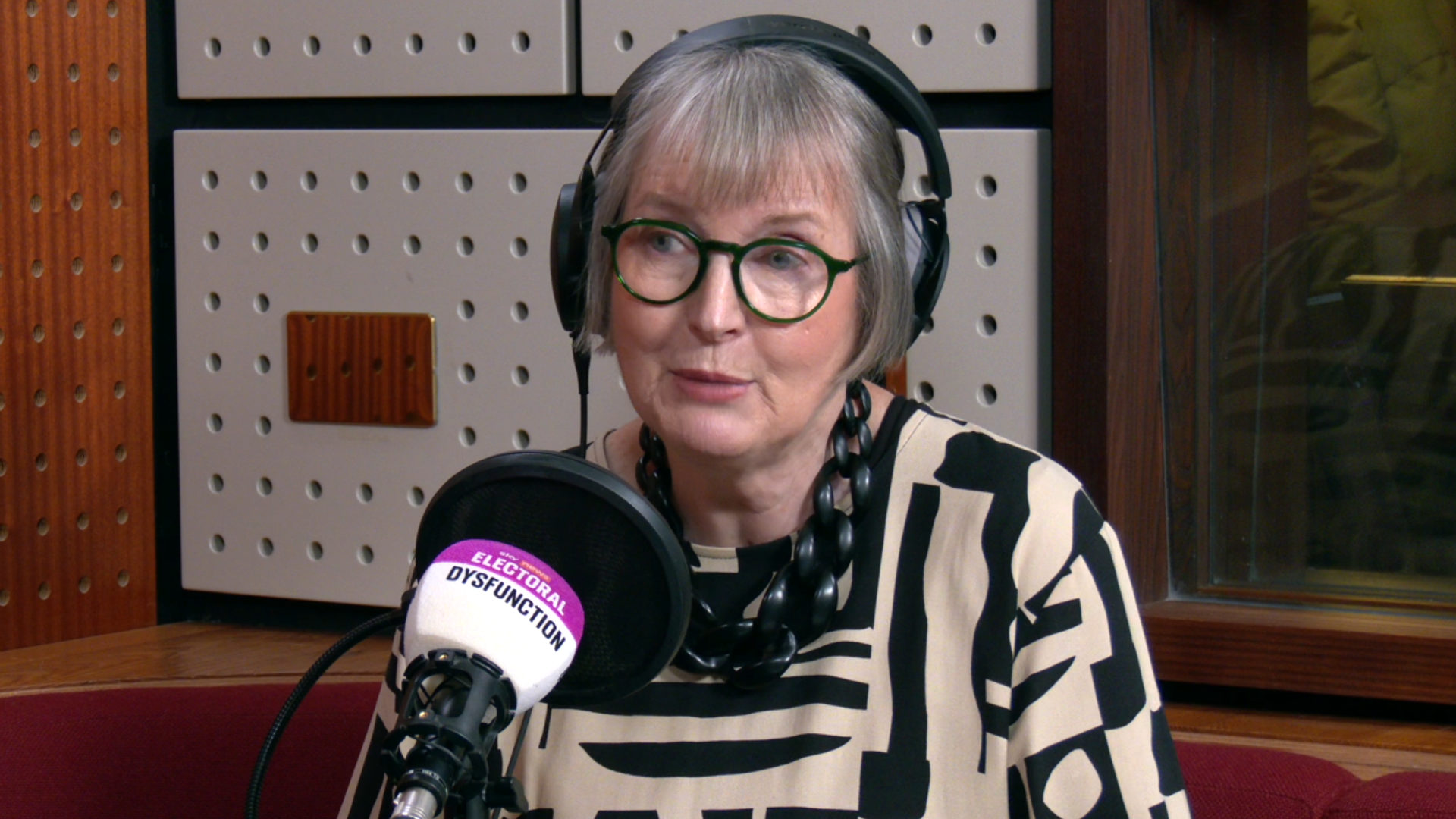

The government should set time limits for public inquiries and “not let them go on for years and years”, Harriet Harman has said.
NewsBeat
Axel Rudakubana latest: Southport killer ‘s52-year jail term to be reviewed as families share pain and anger

Southport killer Axel Rudakubana’s 52-year jail term is set to be reviewed after concerns were raised it was unduly lenient.
The 18-year-old was jailed for life after murdering three young girls and stabbing several others in an act of “extreme violence” at a Taylor Swift themed dance class.
He was sentenced in his absence after failing to return to the dock, and will now spend decades behind bars for what the judge termed “the most extreme, shocking and exceptionally serious crime”.
Rudakubana avoided a whole-life tariff – which would have ensured he could never leave prison – because he was nine days shy of being 18 when he committed the atrocity. The 52-year sentence is a record length for a person of his age.
Southport’s Labour MP Patrick Hurley has now asked the Attorney General to review the sentence as “unduly lenient”.
Attorney General Lord Hermer and Solicitor General Lucy Rigby now have 28 days to decide whether to refer the sentence to the Court of Appeal.
The families of Rudakubana’s victims shared their pain and anger inside Liverpool Crown Court. Mother of murdered seven-year-old Elsie Dot Stancombe, Jenny, described the attack as “the act of a coward” and said Rudakubana was “cruel and pure evil”.
Violent images of dead bodies, beheadings and rape found on his devices
Officers found violent content on Axel Rudakubana’s devices including images of dead bodies, victims of torture, beheadings, cartoons depicting killing, violence and rape or which insulted or mocked different religions, including Islam, Judaism and Christianity, Liverpool Crown Court heard.
Prosecutor Deanna Heer KC said there were numerous images relating to different wars and international conflicts, including in Gaza, Ukraine, Sudan, Korea, Iraq and the Balkans.
The court heard a number of documents were found which also related to war, weapons and genocide.
These included documents called “A concise history of Nazi Germany,” “Death and survival during the 1994 genocide in Rwanda,” and “Examination of punishments dealt to slave rebels in two 18th Century British Plantation Societies”.
Alexander Butler24 January 2025 04:00
Rudakubana had document on ‘how to carry out a knife attack’
Police found a document called “Military studies in the Jihad against Tyrants: The Al-Qaeda Training Manual” on a tablet belonging to the defendant, the court heard.
Ms Heer said of particular relevance were; a passage referring to assassination and mass murder; a section called “Assassinations Using Cold Steel: A: Assassinating with a Knife” which gave advice on where the “enemy” should be struck in order to kill; and “Assassinations with Poison,” which gave information on the production of ricin and explained that it is considered one of the most deadly poisons.
The prosecutor said: “The manual had been downloaded on three occasions in 2021, meaning that it was already in the defendant’s possession when he purchased the castor beans from which he produced the ricin in early 2022. If that is right, then he clearly knew just how deadly a substance it was before he produced it.
“Furthermore, by the time he went to The Hart Space in 2024, the defendant was in possession of instructions in the manual on how to carry out a knife attack with lethal force.”
Alexander Butler24 January 2025 03:00
Man who confronted Axel Rudakubana moments before Southport attack had no idea of ‘unspeakable’ horror ahead
Alexander Butler24 January 2025 02:00
Rudakubana researched car bombs, detonators and nitric acid amid fixation with violence
Alexander Butler24 January 2025 01:00
Southport killer Axel Rudakubana gloated he was ‘glad they’re dead’ after murdering three children
Alexander Butler24 January 2025 00:01
Tears, shock and relief: Inside the courtroom where Southport killer Axel Rudakubana was jailed for 52 years
Alexander Butler23 January 2025 23:41
How a violence-obsessed teen unleashed horror at Southport children’s dance class
Alexander Butler23 January 2025 23:00
Watch: Axel Rudakubana sentenced to 52 years for Southport murders
Alexander Butler23 January 2025 21:38
Home secretary says ‘cowardly, evil’ crimes horrified UK
Home secretary Yvette Cooper said Axel Rudakubana’s “truly horrendous, cowardly and evil crimes” had horrified the UK as she repeated pledges to ensure lessons were learnt from the horror.
“The whole country has been horrified beyond words by these truly horrendous, cowardly and evil crimes,” she said.
“We will always remember Bebe, Elsie and Alice, and the happiness they brought to their families in their short lives.
“And we will remember too the strength and bravery shown by the survivors of this horrific attack, and the astounding courage of those who rushed towards danger and undoubtedly saved many more lives.
“The police and emergency services who responded that day deserve our eternal gratitude, and we thank too the investigators and prosecutors who have worked so hard for justice, and Mr Justice Goose for presiding over these hugely difficult proceedings.
“We have vowed to get the answers the country deserves about how this horror was allowed to happen and to ensure that lessons are learnt.
“I will set out further details of the independent public inquiry soon, but for today all our thoughts are with the families enduring this unimaginable pain, and the example of strength and courage they have provided to us all.”
Jane Dalton23 January 2025 20:21
Grieving father says killer should have been tried as adult
A parent of one of the children who survived the attack said Rudakubana’s crimes were so horrific he should “rot in jail” and the “law needs changing”.
“Life should mean life,” the father told The Sun. “He’s an adult and should be tried like one.”
Rudakubana will have to serve the minimum term of his sentence, which will be subject to a review by the Parole Board before he could ever be considered for release.
Taking into account the 175 days he has already served on remand, the court heard this meant he will be required to serve 51 years and 190 days before this can happen.
Jane Dalton23 January 2025 20:04


You must be logged in to post a comment Login