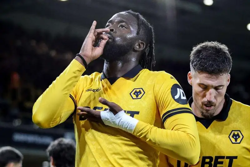
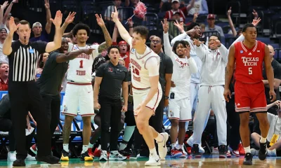
Nigeria striker Tolu Arokodare scored again against London opposition, but his goal was not enough as Wolverhampton Wanderers lost 3-1 to Chelsea in the Premier League at Molineux.
Arokodare scored his second league goal of the season, with both strikes coming against clubs from London. He had earlier scored against Arsenal and also netted against Chelsea in the EFL Cup.
Chelsea dominated the game from the start and scored three goals in the first half. Cole Palmer hit a quick hat-trick inside 25 minutes as Wolves struggled to cope with Chelsea’s speed and movement. The hosts went into the break 3-0 down.
Advertisement
Wolves improved after half-time and almost pulled one back when Mateus Mane hit the woodwork. Soon after, Arokodare reacted fastest to a flick-on from a corner to score from close range and give Wolves hope.
The Nigerian forward later had another chance when he was sent through on goal, but Chelsea goalkeeper Robert Sanchez made a good save. Wolves kept pushing for another goal, but Chelsea stayed calm and saw out the game.
The win was Chelsea’s fourth league victory in a row as they continue their push for a top-four finish. Wolves remain bottom of the table, with Arokodare’s sixth goal in 29 games this season offering a small positive for the struggling side.
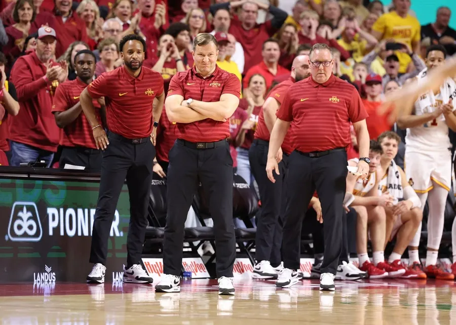
Mar 4, 2025; Ames, Iowa, USA; Iowa State Cyclones head coach T.J. Otzelberger, JR Blount and Kyle Green watch the Cyclones play the Brigham Young Cougars during the second half at James H. Hilton Coliseum. Mandatory Credit: Reese Strickland-Imagn Images
Iowa State assistant Kyle Green accepted a five-year contract on Wednesday to become the new head coach at Northern Iowa.
The move represents a return to the university for Green, who spent 16 seasons as an assistant with the Panthers spread over three stints (2001-03, 2006-11 and 2012-21) before joining the Cyclones as an assistant prior to the 2021-22 campaign.
“I am incredibly honored and grateful for the opportunity to become the next head coach at UNI, a university and community that has meant so much to me and my family,” Green said.
“… This is more than just a school or job to me and my family. It is a home. A place that has given so much more to our family than we could ever give back. A school with unparalleled history in men’s basketball. A tradition built by Hall of Fame coaches in Eldon Miller, Greg McDermott and Ben Jacobson. Coaches who I am fortunate to say are also mentors of mine. I don’t take the honor of carrying the torch forward lightly and cannot wait to get started. Go Panthers!”
Advertisement
The addition of Green comes on the heels of Jacobson accepting an offer for the same post at Utah State. Jacobson spent the past 20 seasons on the sideline at Northern Iowa before stepping down after the team’s 79-53 loss to St. John’s in the first round of the NCAA Tournament.
The Panthers finished with a 23-13 record (11-9 in the Missouri Valley Conference).
The TATA IPL 2026 has kicked off in record-breaking fashion, with the opening weekend drawing a massive combined reach of over 515 million viewers across linear television and digital platforms. Driven by two high-scoring encounters featuring successful 200-plus run chases, the tournament has already set new benchmarks in audience engagement and consumption.
Record-breaking engagement across platforms
Advertisement
The opening matches generated a staggering 32.6 billion minutes of watch-time, marking a 26% increase compared to the previous season’s first two games. The surge in viewership highlights the growing appetite for live cricket in India, especially when paired with thrilling on-field action.
Connected TV (CTV) emerged as a major growth driver, with reach increasing by 30% and concurrency jumping by an impressive 61%. Meanwhile, linear television also saw strong gains, with the first two matches registering a 24% rise in TV ratings compared to previous seasons.
Advertisement
Enhanced viewing experience drives growth
A key factor behind the surge has been the introduction of innovative and differentiated viewing experiences. One of the standout features this season is the CTV Hindi feed, which includes insights from former cricketing greats such as Ravichandran Ashwin, Suresh Raina, Harbhajan Singh, Virender Sehwag, and Irfan Pathan. This watch-along format has added a fresh and immersive dimension, blending expert analysis with fan engagement.
Advertisement
Leadership speaks on IPL’s growing impact
Ishan Chatterjee, CEO, Sports, JioStar, emphasized the scale of the tournament, stating, “TATA IPL 2026 has opened at record scale, with deeper engagement than ever before across all platforms. This reinforces both the unmatched scale of live cricket in India and JioStar’s position as the definitive home of cricket.”
Advertisement
He further added, “We are seeing strong growth in reach and engagement, along with clear value and outcomes for all our partners. Live cricket continues to be the most effective environment to drive real brand outcomes at scale.”
IPL Chairman Arun Singh Dhumal echoed similar sentiments, saying, “The start to the season has been extremely encouraging. The combination of high-quality cricket and enhanced viewing experiences is clearly resonating with fans across the country.”
Advertisement
BCCI Honorary Secretary Devajit Saikia also highlighted the league’s evolution: “The opening weekend numbers are a strong reflection of the deep and enduring connection that fans have with the IPL.”
A promising season ahead
Advertisement
With strong sponsor backing and record-breaking numbers already in place, IPL 2026 has set the tone for what could be its biggest season yet. The early success underlines the league’s unmatched popularity and its ability to continually innovate, ensuring fans remain at the heart of the experience.
The FA have released agent fee details from February 2025 to February 2026.
19:32, 01 Apr 2026Updated 19:37, 01 Apr 2026
Advertisement
Manchester United spent £31,777,462 on agent fees between February 2025 and February 2026. Manchester City, meanwhile, spent 37,358,301.
In figures released by the Football Association, the total fees paid out to agents by Premier League clubs over a year are shown, along with the transactions involved. City’s total means that they spent the third-highest amount in the league, only behind Chelsea (£65.1m) and Aston Villa (£38.4m).
United, meanwhile were the team to spend the fifth-highest amount. Liverpool (£33.9m) and Arsenal (£32,1m) spent more over the 12-month period. In total, Premier League clubs paid £460,300,308 to agents over the year-long period.
**Get MEN Premium now for just £1 **HERE** – or get involved in our United WhatsApp group by clicking **HERE**. You can also join our United Facebook page by clicking **HERE** and don’t miss out on our brilliant selection of newsletters **HERE.
Advertisement
For United, the transactions document showed that payments were made for the incoming transfers of Matheus Cunha, Diego Leon, Bryan Mbeumo, Senne Lammens and Benjamin Sesko.
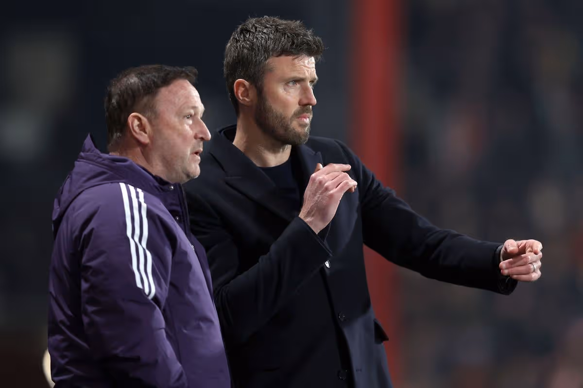
The appointment of Michael Carrick as interim manager also appears on the document. As well as Carrick there are transactions for his assistants Jonathan Woodgate and Steve Holland.
Former midfielder Christian Eriksen also appears on the document, marked as a ‘contract amendment.’ The Dane left United in the summer at the end of his contract.
United also made payments for deals that saw Marcus Rashford, Andre Onana and Rasmus Hojlund leave the club on loan.
Advertisement
It comes after United’s financial results released in February showed a £32.6 million operating profit for the first six months of the fiscal year. A turnaround compared to the £3.9 million loss 12 months earlier.
For City, the signings of Rayan Ait-Nouri, Marcus Bettinelli, Rayan Cherki, Sverre Nypan, Gianluigi Donarumma, James Trafford, Antoine Semenyo and Marc Guehi are included on the transaction document. As are the transfers away from the club for Manuel Akanji and Ilkay Gundogan.
England and Nike have launched the new home, away and goalkeeper kits to be worn at this summer’s FIFA World Cup. You can get free delivery on all orders with the code: ENGFREEDEL
Veteran Pakistan player Fakhar Zaman was on Tuesday suspended for two matches of the Pakistan Super League (PSL) for breaching the code of conduct pertaining to altering the condition of the ball. The Pakistan Cricket Board (PCB) announced that the match referee found Fakhar guilty of a Level 3 offence, breaching Article 2.14 of the applicable Code of Conduct for Players and Player Support Personnel during the PSL match between Lahore Qalandars and Karachi Kings here on Sunday.
According to a report in Geo News, quoting sources, “Fakhar Zaman has challenged his two-match suspension over ball-tampering charges during his side’s Pakistan Super League (PSL) match against Karachi Kings.”
The suspected ball-tampering incident occurred just before the start of the final over, when the on-field umpires penalised Lahore Qalandars five runs and changed the ball before the last over of Karachi Kings’ batting innings.
On-field umpires Shahid Saikat and Faisal Khan Aafreedi, TV umpire Asif Yaqoob, and fourth umpire Tariq Rasheed levelled the charge.
Advertisement
Fakhar denied the offence and contested the charge at a full disciplinary hearing in accordance with the Code of Conduct.
Match referee Roshan Mahanama conducted the disciplinary hearing and made the determination after reviewing all evidence and providing an opportunity for a personal hearing to Fakhar.
Lahore Qalandars captain Shaheen Shah Afridi, team director Sameen Rana, and team manager Farooq Anwar were also present during the hearing.
Lahore Qalandars are next scheduled to face Multan Sultans on April 3 at the Gaddafi Stadium and Islamabad United on April 9 at the National Bank Stadium in Karachi.
Advertisement
Meanwhile, the Lahore Qalandars management has fined captain Shaheen Shah Afridi one million rupees for breaching the PSL’s security protocol at the team hotel in Lahore.
On Monday, the PCB’s disciplinary committee fined fast bowler Naseem Shah 20 million rupees for a controversial tweet that breached the conditions of his central contract with the board
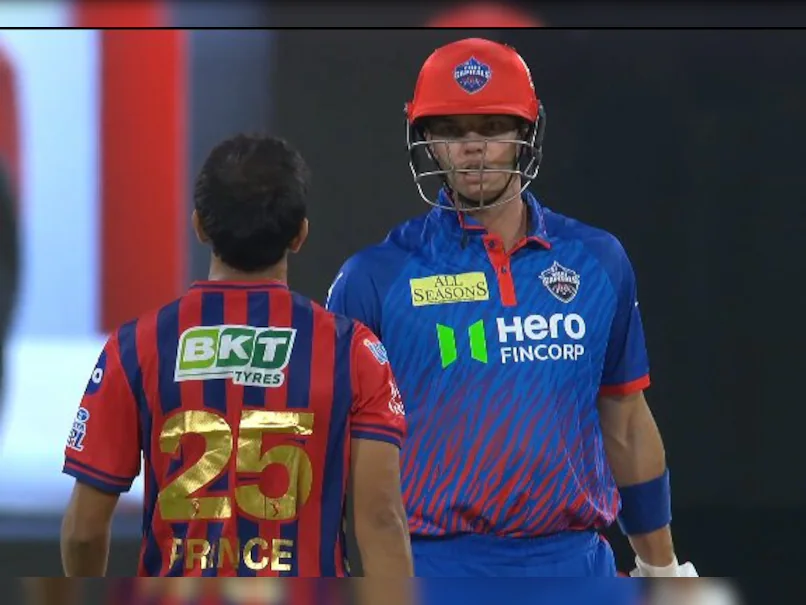
NEW DELHI: Rishabh Pant’s bold move to open the innings didn’t go as planned as Lucknow Super Giants slumped to a defeat against Delhi Capitals in their IPL 2026 opener, raising questions about his role at the top.Pant’s outing ended in a bizarre run-out in the third over. A straight drive from Mitchell Marsh was deflected onto the stumps by Mukesh Kumar, catching Pant well short at the non-striker’s end. The LSG skipper, who scored 7 off 9 balls, walked off visibly frustrated after the unlucky dismissal.
Watch
Angkrish Raghuvanshi focused only on team’s wins
Reflecting on the moment, Pant said, “I think the best way to recover from it is to ignore. I think that’s the best way looking forward because you know something like that, you can’t control, but thinking about it definitely puts you on the back-foot.” He also admitted that the team struggled to build partnerships: “See, it’s always the case, but you know the way we batted, we couldn’t get a partnership going for long.”Pant’s promotion to the top, breaking the established pair of Aiden Markram and Marsh, raised eyebrows. Addressing whether he will continue as opener, he said, “I think it’s a 50-50 call, but we’ll see. But definitely see me in the top order.”LSG’s batting faltered throughout, managing just 141 in 18.4 overs despite starts from Markram and a fighting 35 from Marsh. Lungi Ngidi and T Natarajan starred with three wickets each, while Kuldeep Yadav chipped in with crucial breakthroughs.
Rizvi, Stubbs seal win for DC
Chasing 142, Delhi were in early trouble before Sameer Rizvi (70*) and Tristan Stubbs (39*) stitched a match-winning 119-run stand. Rizvi’s fearless hitting turned the game on its head as DC chased down the target in 17.1 overs.With the opening experiment failing and LSG’s batting misfiring, Pant now faces a crucial call on his position going forward.
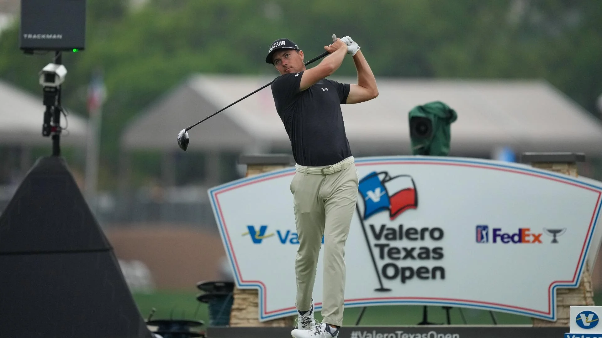
A two-event stop in Texas concludes this week with the 2026 Valero Texas Open beginning on Thursday at 8:30 a.m. ET at TPC San Antonio – The Oaks Course. Scottie Scheffler and Rory McIlroy are both out this week ahead of major play, but there’s still a strong Valero Texas Open field headlined by top-10 OWGR players such as Tommy Fleetwood and Russell Henley. The latest 2026 Valero Texas Open odds via FanDuel list Fleetwood and Ludvig Aberg as the +1500 co-favorites. Russell Henley (+1600), Jordan Spieth (+1800) and Robert MacIntyre (+1800) are among the other favorites. Collin Morikawa and Gary Woodland have both withdrawn from the field.
SportsLine’s proprietary model, built by DFS pro Mike McClure, simulated every PGA Tour event 10,000 times and reveals golf betting picks that have a history of being extremely profitable.
This same model has also nailed a whopping 16 majors entering the weekend, including the 2025 Masters — its fourth Masters in a row — as well as last year’s PGA Championship and Open Championship. Anyone who has followed its sports betting picks could have seen massive returns on betting sites.
Advertisement
New users can claim a special offer by signing up for DraftKings Sportsbook. Visit our DraftKings promo code review right now to see their latest offers and get started.
Now that the 2026 Valero Texas Open field is locked in, the model simulated the tournament 10,000 times, and the results were surprising. Head to SportsLine now to see the projected leaderboard, which you can use for PGA picks, one and done contests or Texas Open DFS lineups.
2026 Valero Texas Open predictions
One major surprise the model is calling for at the Texas Open 2026: It projects that Henley barely cracks the top 5 despite being one of the favorites. Henley has yet to finish inside the top 5 in any event this year, so the model isn’t ready to project him near the top of the leaderboard. He finished fourth in this event in 2024, but didn’t play it in 2025 and he finished T52 and missed the cut in his other two Texas Open appearances. See who else to fade here.
Another surprise: The model projects Sepp Straka as a top-10 contender despite him not being in the top group of favorites at +2700. The 32-year-old Austrian has finished inside the top 20 in four of his last five events, including a strong T8 finish at The Players Championship last time out. He struggled during his first two appearances at this tournament, but turned a corner last year, finishing T22 after a strong weekend, so the model likes his value this week. See who else to pick here.
Advertisement
New to sports betting? Visit our FanDuel promo code review right now to see their latest offers and get started.
Tommy Fleetwood +1500 Ludvig Åberg +1500 Russell Henley +1600 Jordan Spieth +1800 Robert MacIntyre +1800 Si Woo Kim +2200 Sepp Straka +2200 Hideki Matsuyama +2200 Maverick McNealy +2700 Michael Thorbjornsen +3000 Rickie Fowler +3000 J.J. Spaun +3300 Denny McCarthy +3300 Alex Noren +3300 Keith Mitchell +3500 Ryo Hisatsune +3500 Johnny Keefer +4000 Nick Taylor +5500 Sudarshan Yellamaraju +4500 Thorbjørn Olesen +4500 Richard Hoey +4500 Marco Penge +5000 Alex Smalley +6000 Tony Finau +6000 Will Zalatoris +6000 Brian Harman +6000 Jordan Smith +6500 Stephan Jaeger +6500 Christiaan Bezuidenhout +7000 Austin Smotherman +7000 Davis Thompson +7000 Matt Wallace +7000 Max McGreevy +7000 J.T. Poston +7000 Mac Meissner +7000
The Lucknow Super Giants vs Delhi Capitals IPL 2026 match at the Ekana Cricket Stadium saw heated words being exchanged between Delhi Capitals’ Tristan Stubbs and Lucknow Super Giants pacer Prince Yadav. The incident happened in the fifth over. After the fifth ball of the over, Prince Yadav went all the way to Tristan Stubbs and stared at the South African batter. Stubbs did not hold back and returned the gesture.
Earlier, Lucknow Super Giants put up an embarrassing batting display with some questionable tactical calls, getting shot out for 141 in 18.4 overs in their IPL match against Delhi Capitals on Wednesday. Delhi Capitals skipper Axar Patel opted to bowl first, and even though the Ekana Stadium wicket wasn’t a belter, there could be no tangible excuse for the LSG unit for its pathetic batting display.
A fit-again T. Natarajan (3/29 in 4 overs), Kuldeep Yadav (2/31 in 4 overs) and the brilliant Lungi Ngidi (3/27 in 3.4 overs), who bowled perhaps a contender for the ‘ball of the tournament’, made life miserable for the home team, which looked as bad on the field as it had seemed on paper, as per pre-tournament predictions.
Captain Rishabh Pant, in a surprising move from the team’s perspective, broke the successful opening pair of Aiden Markram and Mitchell Marsh and promoted himself to the top of the order.
Advertisement
Pant (7 off 9 balls) started with a nice back-drive off Mukesh Kumar, but in the next over was run out at the non-striker’s end when the bowler got a fingertip to a smashing straight hit from Marsh.
But, to be frank, Pant didn’t look comfortable once, despite that opening boundary, and it seemed more like a desperate attempt to get his India T20 slot back.
Aiden Markram (11) hit a six and a four, but DC skipper Axar Patel’s wicket-to-wicket delivery breached his defence.
The highly rated Ayush Badoni (0) edged one from T. Natarajan that was angled across, but it was Ngidi’s newfound confidence in executing slower deliveries that became the standout moment of the first half.
Advertisement
It was a floating off-cutter that beat the dangerous Nicholas Pooran (8 off 8 balls). Pooran, whose philosophy hinges on bat speed, saw the loopy trajectory of the delivery dip late as the ball sneaked between bat and pad to hit the stumps.
In Ngidi’s case, there was no perceptible change in his arm speed as he took considerable pace off the ball.
Ngidi, who has perfected pace-off deliveries with variable lengths, tightened the noose on the LSG batters. He also accounted for Shahbaz Ahmed with a wide slower yorker, which is a difficult art to execute.
As for Kuldeep, he took some punishment initially but did the job well by dismissing the dangerous Marsh with a googly that saw the bat face turn in his hand, the leading edge flying to mid-off
Are NFL teams supposed to trade up the draftboard for running backs? Absolutely not — it’s taboo. Should the Minnesota Vikings do it anyway? Maybe — if the temptation is to grab Notre Dame’s Jeremiyah Love. And thanks to some reporting from NFL insider Jason La Canfora, one trade partner might just do the trick if the Vikings want Love.
Cleveland could be the pivot point if Minnesota wants the Notre Dame star.
That team is the Cleveland Browns, a franchise apparently open to trading down at the No. 6 spot.
Advertisement
Cleveland Could Hold the Key to a Love Deal
How much would you give up to Love?
Jeremiyah Love breaks into the open field after a catch, gaining extra yards during second-half action on Sep. 30, 2023, at Wallace Wade Stadium in Durham. The Notre Dame running back showcased acceleration and balance against Duke, turning a routine play into a chunk gain while stressing the Blue Devils’ defensive pursuit angles. Mandatory Credit: Jim Dedmon-USA TODAY Sports.
La Canfora: The Browns Are Open for Business
Jot the Browns down as a likely trade listener. La Canfora wrote this week, “With so many holes and wanting to stockpile picks, this may end up being a prime opportunity to trade down. In all likelihood, Indiana quarterback Fernando Mendoza will be the only offensive skill player off the board when Cleveland is up to pick, and with many executives identifying Washington as a prime spot for Notre Dame running back Jeremiyah Love, and the Browns being connected with Ohio State running back Carnell Tate.”
“Perhaps they are sitting in a bit of a sweet spot in which some other team will be motivated to move up to grab their pick on the best pass catcher or runner in this draft.”
Advertisement
Cleveland pulled off a blockbuster deal in the last draft, too, allowing the Jacksonville Jaguars to spend big in their pursuit of Travis Hunter.
La Canfora added, “The Browns have long been in the rebuilding business and the ‘asset relocation’ business, putting together an analytically-minded front office with execs from other sports involved that has left a lasting impression on owner Jimmy Haslam, even as some of those individuals have moved on.”
“Cleveland just hired an older head coach in Todd Monken, who has never done the job before, and the team seems years from contending. Even in more times of more robust rosters, the Browns were generally seen as willing listeners at the very least in regards to trades, and draft trades.”
There’s a path to Love if the Vikigns want him, at least in the rumor mill.
Advertisement
Jumping in Front of the Commanders
For a while in March, the Tennessee Titans became a mock-draft darling to pick Love at No. 4. While that remains in play until draft night, the tide has turned a bit in favor of Tennessee taking the plunge with Ohio State linebacker Sonny Styles.
If the Titans don’t take Love, and the New York Giants decide Cam Skattebo and Tyrone Tracy are enough for the 2026 backfield, the Commanders are the next logical spot for Love — at pick No. 7.
With the Browns trade, the Vikings would jump ahead of Washington, disqualifying them from the Love pick and making him a Viking. That’s the working theory behind a trade up the draftboard so high; a team might have to box out the Commanders, who have Jacory Croskey-Merritt and Rachaad White on tap for running back duty in 2026.
Advertisement
The Trade Price
This is the part where you avert your eyes. A trade all the way up to No. 6 in Round 1 won’t be cheap for the Vikings or any franchise.
Stacey Dales conducts an on-field interview with Jeremiyah Love during NFL Scouting Combine activities on Feb. 28, 2026, at Lucas Oil Stadium in Indianapolis. The Notre Dame running back discussed preparation and performance while evaluators observed closely, as prospects navigated media sessions alongside drills during one of the league’s most visible pre-draft events. Mandatory Credit: Kirby Lee-Imagn Images.
Minnesota could also sell next year’s 1st-Rounder while possibly getting a late-rounder back from Cleveland. There are options.
Advertisement
A Vikings Playground with Love, Murray, Jefferson, Addison, and Hockenson
The Vikings’ rushing offense has never been solved by head coach Kevin O’Connell, although it improves each year. Trading for and drafting Love would immediately fix the problem, so long as O’Connell committed to using him like a bellcow RB1 in a balanced offense.
A Cleveland Browns helmet sits on display near the sideline ahead of kickoff on Jan. 4, 2025, at M&T Bank Stadium in Baltimore. The close-up captures team branding and game-day readiness as players prepared to take the field against the Ravens in a divisional matchup with late-season implications. Mandatory Credit: Tommy Gilligan-Imagn Images.
Minnesota already boasts a Top 3 defense over the last couple of seasons under Brian Flores; adding Love to an offense with Kyler Murray, Justin Jefferson, Jordan Addison, and T.J. Hockenson would strike fear into the hearts of, well, everybody.
If the offensive line stayed healthy — it did no such thing in 2025 — the Vikings’ roster wouldn’t really have any weaknesses, and the club would flirt with Super Bowl aspirations.
That’s the upside of dreaming big about Love in purple and gold. The Browns could hold the key.
This week, reporters asked Shai Gilgeous-Alexander and Luka Dončić to make their respective cases for the Most Valuable Player award. Both MVP candidates declined to do so.
“I never [made a case for myself],” Dončić said after scoring 42 points in the Los Angeles Lakers‘ 127-113 win against the Cleveland Cavaliers on Tuesday. “I’m not the one voting. But I think I’ve been playing pretty good, we’ve been winning, so that’s it. That’s all I got to say.”
This year’s MVP race is particularly tight. Rational arguments can be made in favor of Gilgeous-Alexander, Dončić, Victor Wembanyama and Nikola Jokić. Since Jokić is averse to self-promotion, it appears that Wembanyama will be the only one who publicly states why he believes he should win. Last week, he told reporters in Miami that he’s the right choice because defense is 50% of the game (and he’s the league’s most impactful defender), his San Antonio Spurs almost swept the Thunder in the regular season and his impact on offense goes beyond scoring.
The only other thing Gilgeous-Alexander said about the MVP race is that it’s “good for the league” because it drives interest.
“I think it’s good chatter,” Gilgeous-Alexander told reporters. “It gives people something to talk about. There’s a lot of good players in this league and a lot of guys in the conversation because of that.”
Advertisement
That doesn’t mean, however, that he wants to participate in that conversation.
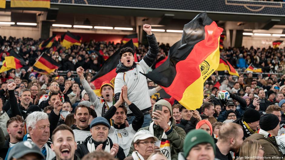
On one of the last days of March, Germany play Ghana in the final international break before World Cup preparations begin. Many fans started their journey first thing in the morning, including Dennis and Kai.
The two friends from the north of Germany put on their kits and boarded the train early, keen to support the team in person that evening in Stuttgart.
For Dennis in particular, trips like this are routine; he has been following the national team since 2015, and the 40-year-old has hardly missed a game since. Kai has been a regular since Euro 2024 on home soil.
Advertisement
“Wearing the eagle on your chest and singing the national anthem is something special,” Dennis told DW. “You always meet up with other fans, travel to tournaments — it always gives you goosebumps.”
The two are what are known as regulars, fans who accompany the team to every match — wherever the location.
The buzz before the tournament
No wonder, then, that the upcoming FIFA World Cup is firmly marked in their calendars.
“I’m really looking forward to it,” said Kai, his eyes lighting up as he speaks. “I want to soak up everything that’s going on in the cities. Dennis has always talked so much about it.”
Advertisement
The anticipation begins long before the tournament, added his mate Dennis: “The excitement starts two years in advance; you start saving up and thinking about what the trip might look like.”
Both have already bought tickets for Germany’s group games, and their itinerary is all planned out. They’re really looking forward to it, and the current political situation in the United States isn’t dampening their spirits.
“Politics should really stay out of sport. Sport is meant to build bridges and bring people together, but politics often likes to exploit tournaments like this,” said Dennis.
How big will Germany’s support be in the USA?Image: Maximilian Koch/picture alliance
Löw warns against traveling
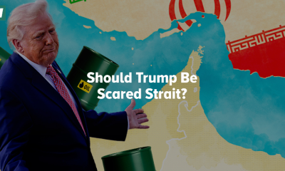
Not everyone is as relaxed, though. Most recently, former Germany head coach Joachim Löw warned against traveling to North America.
“We had debates even before the 2018 World Cup in Russia and calls for a boycott ahead of the 2022 World Cup in Qatar. But playing in a country that is currently actively at war is even more dangerous,” warned Löw at an event in Cologne.
Advertisement
Löw, who led Germany to victory at the 2014 FIFA World Cup in Brazil, was referring to the policies of US President Donald Trump, who started war with Iran at the end of February. On top of this, operations by immigration agency ICE and other geopolitical conflicts are causing unrest and uncertainty. The political situation is “completely overshadowing the tournament,” said Löw.
Green party politician worried about personal freedom
There has also been, and continues to be, strong criticism from the political sphere.
“What FIFA is organising there together with Donald Trump is not something that makes my heart beat faster,” Green Party politician and human rights activist Boris Mijatovic told DW.
Advertisement
Green party politician Boris Mijatovic has warned against traveling to the USA this summerImage: dts-Agentur/picture alliance
“The disclosure of personal data, such as email addresses, mobile phones, computers or social media accounts, should not be ignored. These are all infringements on personal freedom that I would not tolerate,” Mijatovic said. “A state that snoops into your privacy in this way should not be rewarded with a visit.”
Mijatovic also fears further “bizarre moments of vicarious embarrassment” such as FIFA President Gianni Infantino presenting the newly created FIFA Peace Prize to Trump during the World Cup draw.
“I find it utterly grotesque the way one has to pay homage to this president to win his favor. This applies just as much to Gianni Infantino as it does to [German] Chancellor Friedrich Merz,” added the politician, including DFB German FA President Bernd Neuendorf in his criticism.
Mijatovic feels there is a lack of courage to voice criticism of FIFA.
“I miss that stance,” he said. “What we once built, with respect and fair play, has gone down the drain.”
For Germany fan Bengt Kunkel this year’s World Cup will be one he watches on television at home rather than in person. Kunkel, who has worked hard to generate a great atmosphere at Germany games for several years, will not be traveling to the US.Bengt Kunkel (center) was one of many fans cheering at Germany games at Euro 2024Image: Matthias Koch/picture alliance
“I take a very critical view of the World Cup,” he said. Trump is a huge problem, he added, because he is trying to make the World Cup his own and exploit it for his political agenda.
“On top of that, there are the restrictions on press freedom and freedom of expression, plus FIFA’s political pandering in awarding the Peace Prize to Donald Trump,” said Kunkel, who is also critical of the cost to fans.
“We worked out that for the group stage alone, we would probably have had to spend between €5,000 and €8,000 ($5,800-$9,280),” explained the Germany fan. “This isn’t a fan-friendly tournament. Nothing about this World Cup appeals to me, so it was clear I wouldn’t be going.”
Advertisement
The stricter entry requirements for fans are also a cause for concern for the 27-year-old.
“When it comes to saying, ‘we’re going to check all social media activity of people wanting to enter the US and see if anyone has liked or posted anything against Donald Trump,’ then that has nothing to do with inviting the world into your home and wanting to celebrate a football festival.”
Germany fans are hopeful the country can seal their fifth star at the 2026 World CupImage: Matthias Schrader/AP Photo/dpa/picture alliance
Can the team win the World Cup together?
Kunkel knows that the 2026 World Cup is currently dividing fans.
“But I understand anyone who goes there,” said Kunkel, adding that he does not believe a boycott is the answer.
“It has to be OK to support the national team, despite everything. So let’s just make the best of it and have a brilliant World Cup summer.”
Advertisement
Even Dennis and Kai admit it’s “not a fan-friendly World Cup.” Nevertheless, they’re confident that the US will ensure everyone’s safety and that it will be a fantastic football festival.
“We want to become world champions,” Dennis said. “We have to be a team and act as a team, and if we fans stand behind the team, we can go a long way.”


")


You must be logged in to post a comment Login