
Other flood alerts have been issued across the county
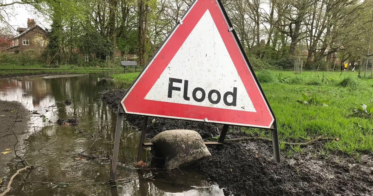
A flood warning has been issued in Peterborough, with other alerts in place across Cambridgeshire. Some places in the fllod alerts areas could experience flooding, and those within the flood warning zone are being told to “act now”, according to GOV.UK.
A flood warning has been issued today (February 7) for North Bank Road alongside the River Nene, east of Peterborough and west of Dog-in-a-Doublet Sluice. Further rainfall is forecast today and tomorrow, and river levels will remain high.
The site says that during periods of high tide, the River Nene will be unable to discharge into the sea, resulting in tide lock conditions. This is likely to lead to localised flooding of the North Bank Road, between Peterborough and Rings End.
The GOV.UK flood alert page says: “Whilst this Flood Warning is in force, the Local Authority will close North Bank Road. Diversionary routes have been put in place and further updates will be available through local media. We are closely monitoring the situation. Refer to Local Authority website for road closures.”
Less severe flood alerts will affect the following areas, according to GOV.UK.
Alconbury Brook
Areas most at risk are around Alconbury Brook at Hamerton, The Alconburys, Little Stukeley and Brampton. You are advised to move cars out of these flood risk areas.
Ellington Brook
Areas most at risk are around Ellington Brook at Spaldwick, Ellington and Brampton. Take care and avoid walking, cycling or driving through flood water.
Hundred Foot Washes
Higher river levels could lead to flooding. As of 7:30am, the causeway at Sutton Gault has around 21cm of water on the road.
Lower River Cam
Areas most at risk of flooding are around the River Cam from Stapleford to Waterbeach. Rising river levels could lead to flooding.
Lower Nene
River levels remain high following recent rainfall. Locations most affected will be low lying land and roads near rivers. Take care and avoid walking, cycling or driving through flood water.
Upper River Cam
Rising river levels today may lead to flooding. Areas most at risk are those around the River Cam from Newport to Whittlesford including the Slades.
River Great Ouse in Cambridgeshire from Brampton to Earith
Areas most at risk are around the River Great Ouse from Brampton to Earith, including Back Brook, Hall Green Brook, Parsons Drove Drain, Swavesey Drain and Wadsbys Folly. Access to properties in Berry Lane, Godmanchester may also be affected.


.jpeg?quality=75&auto=webp&width=960)


You must be logged in to post a comment Login