Pakistan’s defence minister has said the country is in an “open war” with neighbouring Afghanistan, after both nations launched strikes overnight.
Khawaja Muhammad Asif said Islamabad’s patience had run out as tensions escalated, with casualties reported on both sides.
“Our cup of patience has overflowed,” he said in a social media post. “Now it is open war between us and you [Afghanistan].”
He alleged the Taliban had turned Afghanistan “into a colony of India”, gathered militants from around the world and had started “exporting terrorism”.
Advertisement
There has been no reaction from Afghan government officials to Mr Asif’s comments.
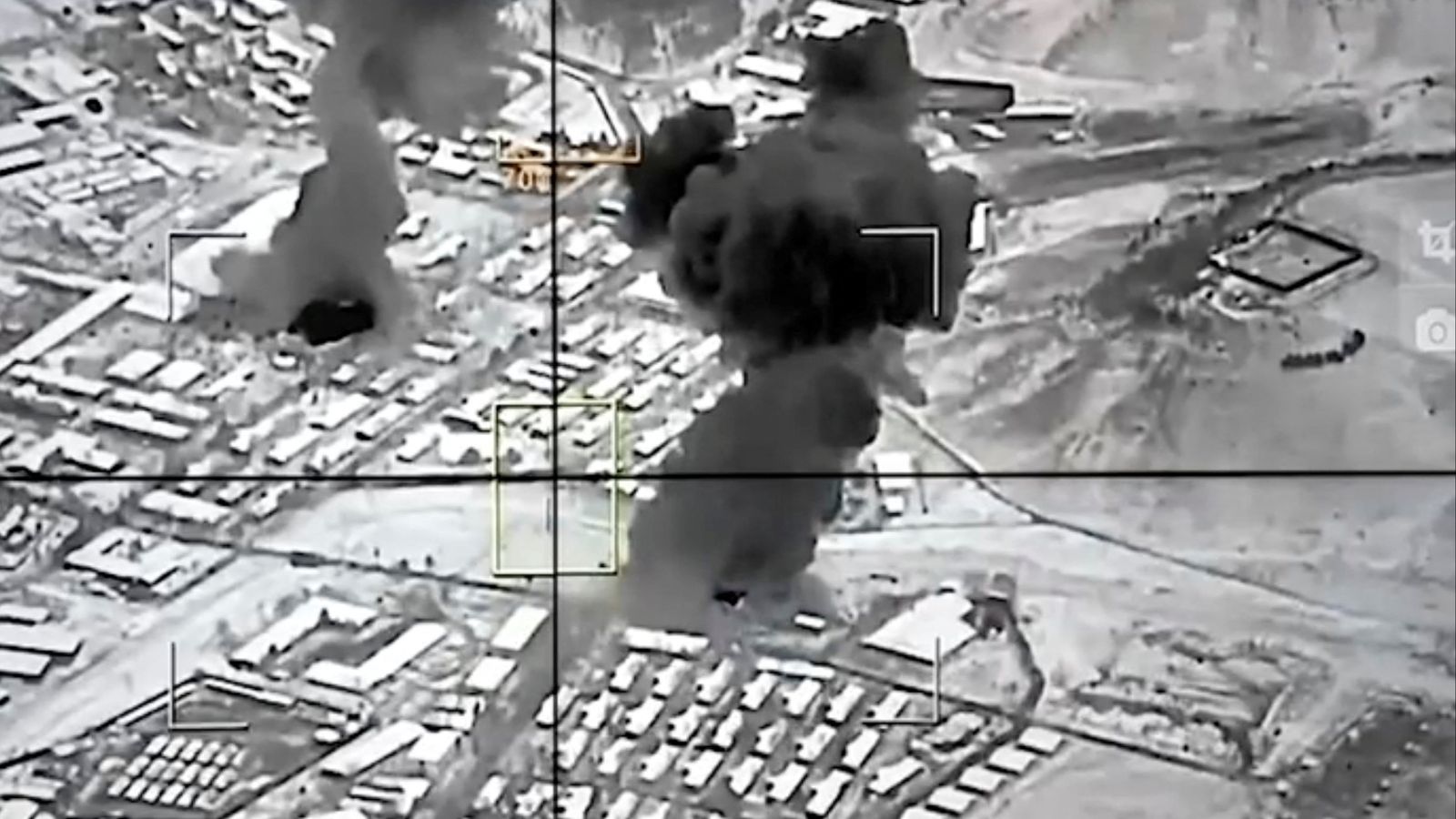
Pakistan carried out strikes on the Afghan capital Kabul and two other provinces overnight, Afghanistan government spokesman Zabihullah Mujahid said, just hours after Afghanistan launched a cross-border attack on Pakistan.
A conflicted history
The two neighbours have had a complicated relationship since Pakistan’s founding in 1947.
Advertisement
Pakistan supported the Afghan mujahideen in the Soviet–Afghan War, even taking in Afghan refugees.
Pakistan later became one of the only states to recognise the Taliban-led government in Kabul in the late 1990s and even supported their second takeover in 2021.
But warm relations began to sour after the emergence of Tehrik-e-Taliban Pakistan – otherwise known as the Pakistani Taliban.
In Pakistan, they have become known for carrying out suicide bombings against political opponents.
Advertisement
Islamabad accuses Kabul of providing a safe haven for their top figures – leading to a rise in border skirmishes over recent years as Pakistani authorities try to take them out.
Security sources in Pakistan said the strikes involved air and ground strikes against Taliban posts, headquarters and ammunition depots along the border.
Datawrapper
This content is provided by Datawrapper, which may be using cookies and other technologies.
To show you this content, we need your permission to use cookies.
You can use the buttons below to amend your preferences to enable Datawrapper cookies or to allow those cookies just once.
You can change your settings at any time via the Privacy Options.
Unfortunately we have been unable to verify if you have consented to Datawrapper cookies.
To view this content you can use the button below to allow Datawrapper cookies for this session only.
A Reuters news agency witness in Kabul said many ambulance sirens could be heard following a series of loud blasts.
Both sides reported heavy losses, issuing sharply differing figures that have not been independently verified.
How did we get here?
Advertisement
Pakistan says it’s run out of patience and it’s now open war with Afghanistan after conflict between the two escalated overnight.
It’s a big moment after months of tension between the neighbours.
So what’s happened and why are we here?
Tensions between the two have been intensifying for months with deadly border clashes killing dozens of civilians, soldiers and militants.
Advertisement
And militant violence in Pakistan has surged – last year was the deadliest in a decade. The Pakistani government blame a lot of the attacks on the Pakistani Taliban.
They say that Kabul is enabling them – Kabul denies that .
There was a ceasefire mediated by Qatar back in October but that feels pretty shaky right now and several rounds of peace talks in November didn’t lead to any kind of formal agreement.
Here we are with both sides of the border on high alert – it certainly feels like a very sensitive, very fragile point.
Advertisement
Afghanistan’s defence ministry said overnight that 55 Pakistani soldiers had been killed, including some whose bodies were taken into Afghanistan, and that “several others were captured alive”.
It said eight Afghan soldiers were killed and 11 wounded. The ministry also said it destroyed 19 Pakistani army posts and two bases and that the fighting ended around midnight, about four hours after it began on Thursday.
Ahmed Sharif Chaudhry, a spokesperson for the Pakistan military, claimed its armed forces had killed 274 members of the Taliban forces and militants.
Advertisement
He also said 22 Afghan military targets were hit, adding that at least 12 Pakistani soldiers were killed in the fighting.
None of these figures has been independently verified.
He added that military operations were ongoing on the orders of Prime Minister Shehbaz Sharif.
Is Pakistan trying to split apart Afghanistan?
Advertisement
The increase in violence between Pakistan and Afghanistan has been some time in the making since the Taliban returned to power in 2021.
Islamabad accuses Kabul of harbouring ‘Pakistan Taliban’ terrorists who operate in the border areas between the two countries, who they say are trying to destabilise Pakistan.
Advertisement
In turn, Kabul accuses Pakistan of creating a pretext for intervention in Afghanistan as part of its long-running and deep-seated enmity with India.
Both India and Pakistan have long transferred their antagonisms into interventions in Afghanistan’s tangled politics.
But there is another dimension to this event – that the Pakistani Defence Minister already calls ‘war’. The Supreme Leader of the Afghan Taliban, Hibatullah Akhundzada, is probably fighting to keep control of his government at the moment.
The Afghan Taliban movement, long committed to total obedience, seems now to be deeply split between Akhundzada, who spends most of his time in Kandahar and a somewhat anonymous group based in the capital, Kabul.
Advertisement
In this respect, the split – if such it is – mirrors the long-standing geographical, ethnic, demographic and climatic difference between north Afghanistan and south-eastern Afghanistan. If the country were to split apart politically, that would be the major fault line.
And it’s possible that Pakistan’s over-strong response to the cross-border incidents it lays at the feet of the Afghan Taliban is actually intended to make the possibility of such a split within the government of Afghanistan all the worse.
It is possible that it is intended to heap more pressure on Akhundzada.
Cross-border battles have intensified following months of tensions and skirmishes between the two nations.
The escalation threatens a fragile ceasefire along the 1,615-mile border and deepens a dispute over Islamabad’s claim that Kabul harbours Tehreek-e-Taliban Pakistan (TTP) militants – an accusation the Taliban deny.
British Foreign Secretary Yvette Cooper wrote on X: “The UK is deeply concerned by the significant escalation in tensions between Afghanistan and Pakistan.
Advertisement
“We urge both sides to take immediate steps toward de‑escalation, avoid further harm to civilians, and re‑engage in mediated dialogue.”
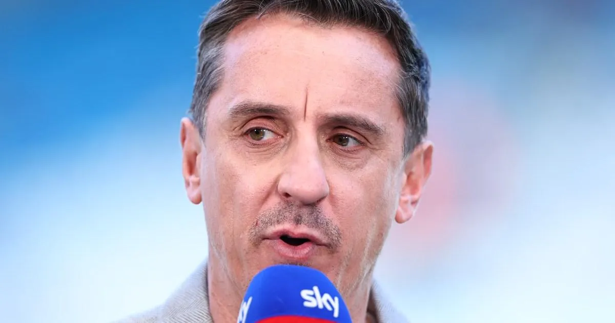
Arsenal were ‘enormously hampered’ by Piero Hincapie and Cristhian Mosquera, says Gary Neville (Picture: Getty)
Gary Neville felt Jurrien Timber was badly missed against Manchester City and Arsenal were ‘hampered enormously’ by Piero Hincapie and Cristhian Mosquera’s apparent shortcomings going forward.
Kai Havertz’s leveller – gifted to Arsenal by Gianluigi Donnarumma – had given the visitors hope of a statement victory away from home, with the forward’s effort cancelling out Rayan Cherki’s sublime opener just moment earlier.
Mikel Arteta’s men were punished for their wastefulness in front of goal in the second half, though, ensuring hosts City closed the gap at the summit to just three points.
Advertisement
Pep Guardiola’s side, who have a game in hand over Arsenal, will claim top spot should they get the better of struggling Burnley at Turf Moor on Wednesday night.
‘I believe today, I believe on Wednesday, I believed a week ago because I see them every day and I know the level that we have,’ Arteta told reporters shortly after Arsenal’s setback.
‘But today, if they need to be more convinced, I think they are now more convinced. We are talking about it in the dressing room.
Haaland scored the winner to close the gap at the top to just three points (Picture: Getty)
Arteta cut a frustrated fixture on the touchline at the Etihad (Picture: Getty)
‘It’s a new league now. We have three points of advantage, they have the game in hand.
‘Everything is still to play for. We know how much we want it and we are not going to stop!’
Advertisement
Arsenal will be eager to get their title charge back on track when they return to action at home to an out-of-form Newcastle side next weekend.
Silva went ‘above and beyond’ for City, says Neville (Picture: Getty)
Dissecting Sunday’s top-of-the-table clash on his Sky Sports podcast, ex-Manchester United and England full-back Neville made sure to single out Bernardo Silva for special praise after an ‘above-and-beyond’ display.
‘Bernardo Silva in the second half, what a performance that is just to grip a game,’ Neville said.
‘I think people sometimes become surprised when I’ve talked about Paul Scholes, in the last five or six years of his Manchester United career, gripping a football match by the scruff of the neck, controlling it and dominating the speed of it.
‘What we’ve just seen there from Bernardo Silva is absolutely above and beyond.
Advertisement
Guardiola’s men will go top with victory at Burnley on Wednesday (Picture: Getty)
‘He just beat Viktor Gyokeres on a header at the back post, he’s then pressing two minutes later, and he epitomises what Manchester City are: that experience, that know-how but also that energy, that professionalism.
‘I thought he was absolutely sensational in the second half and he just lifted it a gear.
‘In some ways, Arsenal had some good chances. Eberechi Eze hitting the post, Kai Havertz’s header at the head, what a moment that is.
‘But City just edged it with the victory but also just edged it in performance levels in the second half.’
Neville won eight league titles with Manchester United (Picture: Getty)
Neville, who backed Arsenal to win the title at the start of the season, was encouraged by the Gunners’ performance in the context of their recent performances.
But the eight-time Premier League winner is confident City have now wrestled the ‘momentum’ firmly in their favour ahead of their trip to struggling Burnley in midweek.
Advertisement
‘My takeaway for Arsenal today is that’s the best way that they could have lost,’ Neville went on.
‘I know the big talk before the match was the bottling, the freezing, the anxiety, the nervousness, the pressure… I actually think they handled the occasion very well and that’s positive.
Hincapie ‘stuck to the task’ but is limited going forward, according to Neville (Picture: Getty)
‘They didn’t come here today and not play, they didn’t come here today and have no idea. I thought they played a good game of football, one of the best performances I’ve seen here from an away team to be fair.
‘So for Arsenal, it’s as good as it can get. But you’re up against a juggernaut and that juggernaut is Pep Guardiola.
‘Manchester City have won title after title in these last seven or eight years and they’ve just stole ahead at the right time, they’ve got that momentum, and they will go in front on Wednesday. They’ll beat Burnley at Burnley.
Advertisement
‘There’s still a way to go, it’s going to be difficult now for Arsenal, but how they psychologically recover from this is going to be really important.’
Timber has been sidelined for the last month with a muscle injury (Picture: Getty)
Neville picked out Havertz for special praise, while applauding Hincapie and Mosquera for ‘sticking to the task’ and frustrating City from a defensive perspective.
But according to Neville, the full-backs’ deficiencies going forward meant Arsenal were ‘blocked off’ when it came to building attacks from the left and right flanks.
‘Arsenal were hampered enormously by their full-backs,’ he explained.
‘I thought actually they did a good job, Hincapie and Mosquera, they really stuck to their task, but they’re limited on the ball.
Advertisement
‘So if you think about Matheus Nunes and Nico O’Reilly for City, or how Jurrien Timber or Riccardo Calafiori or others are for Arsenal, they were just blocked off.
Arsenal will look to bounce back when they entertain Newcastle next weekend (Picture: Getty)
‘You haven’t got that subtlety on that ball or that ability, that safe, consistentand reliable ability, to feed the ball in, good touches and passes and getting it into your front players and midfield players because they’re centre-backs effectively, they’re not full-backs.
‘So I thought they stuck to the task really well, the two full-backs for Arsenal, but you lose a lot when you lose Timber, you lose a lot. He’s a bit of a powerhouse going forward, he links really well.
‘I’m not mentioning Bukayo Saka because every player can get an injury so Noni Madueke is there, Gabriel Martinelli is there, you can’t whinge about Saka.
‘But I think losing both of their full-backs would have cost them today in terms of on the ball and being able to get forward.’
Advertisement
Who will win the Premier League title?
Arsenal came close to equalising for a second time at the death as Havertz missed a golden chance to head home and cancel out Haaland’s earlier strike.
Neville was impressed by Havertz’s all-round performance but has no doubts the German will be ruing his missed opportunity at the death over the coming days.
‘I thought Arsenal lost the game because you can lose here. You can play well, do okay in the game and still lose here,’ he continued.
‘I’m sure Mikel Arteta will point towards chances, Eberechi Eze’s one where he hits the post, Havertz’s chance at the end… they had really good moments and they’ve not taken them.
‘The Havertz chance towards the end is a big moment.’
Simon Rose said the public had ‘unrealistic expectations’ of support and services available from local authorities
A senior Welsh council official has suggested that members of the public can have unrealistic expectations about the support and services local authorities are able to provide. Simon Rose, the housing and prevention manager at Torfaen Borough Council, used demands for social housing and the expectation of immediate GP appointments as examples of what he deemed unreasonable assumptions.
Advertisement
The council official was speaking to councillors about an early intervention and prevention strategy the authority has implemented to help manage demand, ease pressure on frontline services and improve signposting to support.
Mr Rose explained that as part of this initiative, the council – which doesn’t directly provide housing but has a statutory obligation to help those presenting as homeless – is visiting schools in an attempt to manage future demand for social housing. Always keep on top of the latest Welsh news with our newsletter.
Social housing is delivered through housing associations in Torfaen and throughout much of Gwent.
He said: “We are engaging with young people in education and very much trying to get into the mindset of young people having their own home is not easy, having a parental home with mum and dad and leaving is not easy.”
Advertisement
The council official said efforts are required around “what people can expect and what can they do for themselves.”
He explained the assumption that properties are readily available doesn’t reflect reality: “There is an expectation accommodation is available and there is a plethora of it across the borough, that’s simply not the case.
“Land is scare and affordable housing is limited.”
Mr Rose addressed the council’s adults and community scrutiny committee. He said: “In health we all expect to see a GP when we want to see one on the day, do we? Probably not. All of us probably understand that better than people in the community.
Advertisement
“I’ve sat in many doctor’s waiting rooms and seen examples of that. We’ve got to get better as public bodies to help people’s expectations and they need to be managed in a different way.”
The authority launched its Early Intervention and Prevention model in June 2025. The programme is designed to connect people with support from voluntary organisations and external services alongside the council’s own services.
It accepts referrals from the NHS, other local authority departments and schools, while the council’s customer services team can also direct individuals towards it.
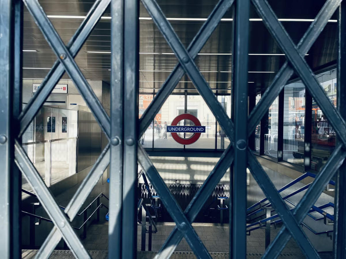
Drivers who are members of The Rail, Maritime and Transport union (RMT) will walk out for 24 hours from midday on Tuesday and Thursday.
They are the first walkouts in a series of six 24-hour strikes by drivers on the Tube.
But why are the drivers striking, when are they and how much disruption can passengers expect? Here is all you need to know.
When are the Tube strikes?
Advertisement
As it stands, members of the RMT union will strike at the following times (all BST)
21–22 April (12pm Tuesday – 11:59am Wednesday)
23–24 April (12pm Thursday – 11:59am Friday)
19–20 May (12pm Tuesday – 11:59am Wednesday)
21–22 May (12pm Thursday – 11:59am Friday)
16–17 June (12pm Tuesday – 11:59am Wednesday)
18–19 June (12pm Thursday – 11:59am Friday)
Why is the strike taking place on the Tube?
Transport for London (TfL) are offering Tube drivers the chance to work a four-day week, but the RMT has rejected the offer.
Under the plans the majority of drivers would see their working week reduced from 36 hours to 35 hours – but they would work longer shifts on days they work.
But the RMT argues the working day would be too long under the proposals, risking driver fatigue and potentially compromising safety.
Advertisement
The union instead wants to negotiate a 32-hour week over four days for drivers, meaning they would work three fewer hours each week for the same salary.
TfL is currently rejecting the RMT proposals, saying drivers do not need to take up the four day week offer and could remain on a five-day week if they want.
Members of the Aslef union have also already voted to accept TFL’s four day week offer.
How much disruption is expected?
Advertisement
All London Underground lines will be affected by the Tube strikes between April 21 and 24, TfL has said.
No service is expected at all on the Piccadilly and Circle lines during the strikes.
A reduced service will run across other lines but “significant disruption” is expected.
Any services that do run will be less frequent, very busy, and you may not be able to board the first train, TfL is warning.
Advertisement
No service is expected on the Metropolitan line between Baker Street and Aldgate
No service is expected on the Central line between White City and Liverpool Street
Outside of the specific strike times disruption is also expected.
While normal services will be expected until mid-morning on the Tuesday and Thursday, services will then begin to ramp-down before the 24-hour strikes.
Advertisement
Tube services that do run on Tuesday and Thursday will finish early – you should aim to have completed your journey by 8pm, TfL has said.
On the Wednesday and Friday, significant disruption will take place on all lines until midday.
Tube services that do run will start later than normal with no service expected before 7.30am on Wednesday and Friday.
In the afternoon on those days some disruption is expected until the evenings.
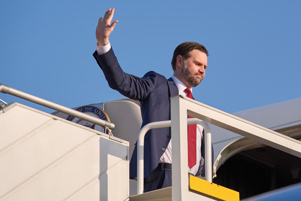
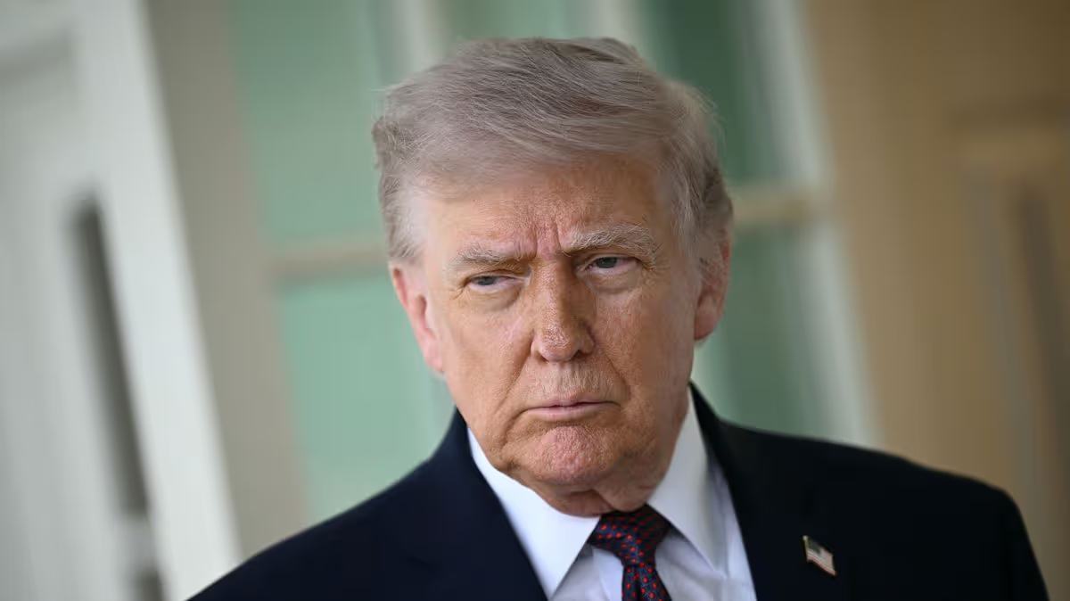
Top administration officials, including President Donald Trump himself, appeared unclear as to whether Vice President JD Vance would lead peace talks with Iranian officials in Pakistan this week, less than 24 hours before the U.S. negotiating team are supposedly due in Islamabad.
Vance’s participation in the upcoming talks has been in question for days after the last round, helmed by the vice president, failed to reach an agreement to end the war. Tuesday is the two-week deadline for the U.S.-Iran ceasefire.
Trump is closely watching Vance’s performance in the negotiations with Iran as he ponders his eventual successor for 2028. CNN reported last week, citing multiple sources familiar with the conversations, that the president was soliciting opinions of Vance’s strengths. On Sunday morning, the president took calls from reporters at a plethora of outlets, telling ABC News’ Jonathan Karl, then MS NOW’s Jacqueline Alemany that Vance would not be attending the Islamabad talks, claiming that “security issues” prohibited Vance’s participation in the second round of talks.
“It’s only because of security,” Trump told Karl. “JD’s great.”
Advertisement
Unnamed White House officials then contradicted the president and told multiple networks, including ABC and MS NOW, that Vance would indeed be traveling to Islamabad.
Vice President JD Vance led the last round of peace talks with Iran but failed to reach an agreement on the country ending its nuclear program or the opening the Strait of Hormuz (Getty Images)
On Sunday news shows, there was further confusion.Energy Secretary Chris Wright told CNN that Vance would lead the U.S. delegation to Pakistan.
U.N. Ambassador Mike Waltz, meanwhile, could not say whether Vance was leading the latest U.S. delegation, during his own interview on NBC’s Meet the Press. “My understanding from an announcement the president just made is that the team is going over. I’ll leave the delegation announcement to the White House,” he said.
Trump told two reporters who called him early Sunday morning that JD Vance would not be a part of Monday’s peace talks in Islamabad (AFP/Getty)
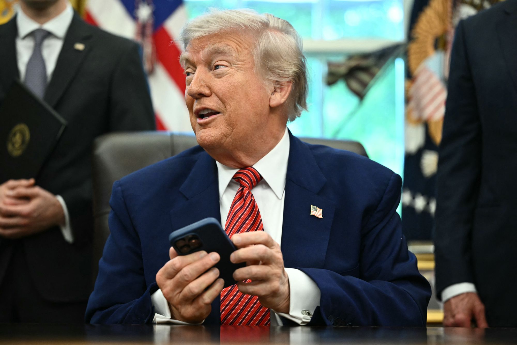
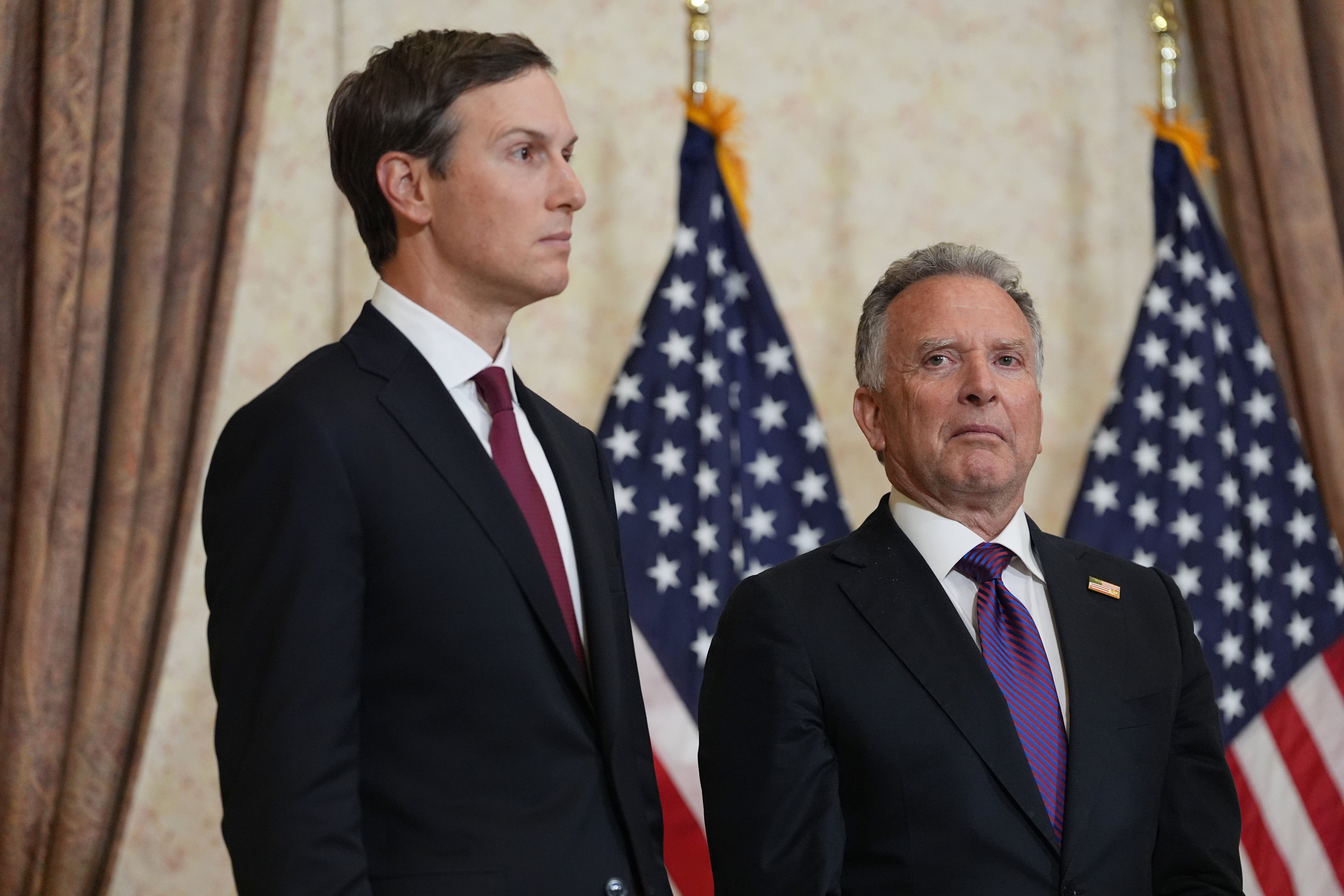
Both networks then reported Vance would be traveling to Islamabad, citing unnamed senior U.S. officials. In a call with Axios, Trump also mentioned the participation of both special envoys Steve Witkoff and Jared Kushner, but did not say if Vance would attend. Axios reported that two U.S. officials separately confirmed Vance would lead the delegation.
The Independent has asked the White House for confirmation of the vice president’s plans. When asked about the confusion around whether Vance was leading the U.S. delegation, a White House official told CNN: “Things changed.”
The White House hasn’t offered any explanation for why security risks that supposedly prohibited Vance’s attendance at the talks were no longer present, or any other reason for the sudden shift.
Advertisement
Jared Kushner and Steve Witkoff were at Vance’s side for U.S. peace talks with Iran in Pakistan last weekend (Getty)
The vice president himself has been quiet about the negotiations with Iran since last Tuesday, when he appeared at an event for conservative youth organization, Turning Point USA.
“I recognize that young voters do not love the policy we have in the Middle East, OK,” he told attendees. “Don’t get disengaged because you disagree with the administration on one topic. Get more involved, make your voice heard even more. That is how we ultimately take the country back.”
On Sunday, Tehran reportedly rejected taking part in the second round of peace talks after Trump threatened to strike civilian infrastructure in a Truth Social post earlier in the day.
“We’re offering a very fair and reasonable DEAL, and I hope they take it because, if they don’t, the United States is going to knock out every single Power Plant, and every single Bridge, in Iran,” he posted.
During his call with Axios, Trump also said: “The concept of the deal is done. I think we have a very good chance to get it completed.”
Advertisement
Iran’s official state news agency, the Islamic Republic News Agency (IRNA), reported that regime would not be taking part in the talks despite the U.S. sending a delegation to Pakistan. They cited “U.S. excessive demands and unreasonable, unrealistic requests” as preventing progress, however they did not cite a specific source.
However CNN reported from Iranian sources than an delegation from the country would be there to meet the U.S. team.
Polls indicate that a large share of Americans question whether the administration has a real plan to end the war, which the president and his allies keep insisting is already won.
Sunday began with the news that a tanker ship was fired upon by Iranian Revolutionary Guard Corps (IRGC), and a statement from the force claiming that the Strait of Hormuz would remain closed until the U.S. blockade of Iranian ports was ended. The president later wrote on Truth Social that U.S. Marines had boarded an Iranian-flagged vessel that attempted to run the blockade.
Advertisement
Days earlier, Trump had taken a short victory lap and declared the U.S.’s efforts to reopen the strait a success. Now the U.S. is staring down a deadline with Iran and the U.S. at essentially the same point the two countries were before talks began. The closure of the Strait of Hormuz by Iranian forces has caused a massive jump in oil prices that U.S. officials warn will likely last for months.
A cargo ship in the Strait of Hormuz reported that it had been fired upon early Sunday by IRGC forces (Copyright 2026 The Associated Press. All rights reserved)
Trump and his allies continue to insist that, to end the war, Iran must give up future ambitions of enriching nuclear material and commit to the full destruction of its nuclear weapons development. Iran has refused this demand.
Vance confirmed last weekend, upon leaving negotiations with Iran’s top diplomats, that the sticking point remained.
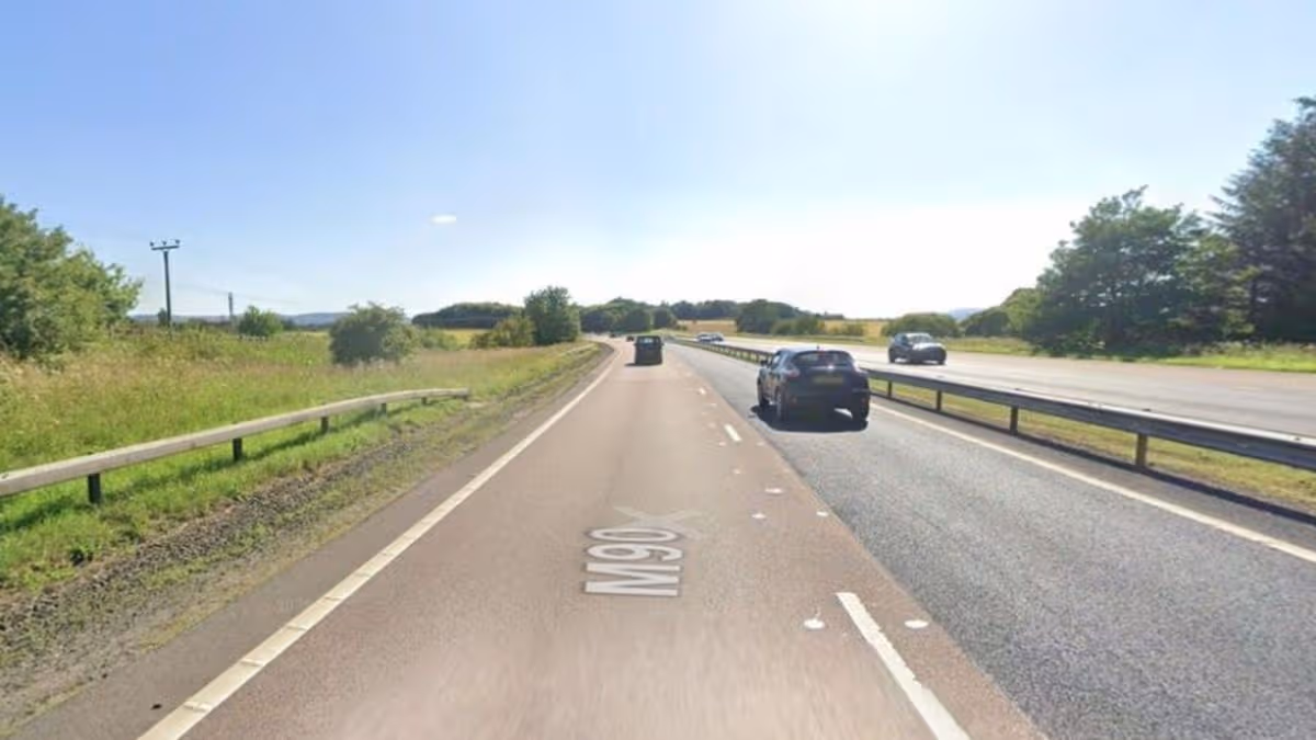
Police Scotland has revealed the circumstances surrounding the crash on the M90 near Kinross, which killed two people.
Police Scotland have revealed the circumstances of a crash that killed two men after one of them drove in the wrong direction down a motorway amid a watchdog probe.
Advertisement
Emergency crews raced to the M90 close to junction seven near Kinross at around 10.30pm on Friday after a grey Ford Kuga was seen driving northwards on the southbound carriageway. The vehicle collided with a white Vauxhall Corsa and the 44-year-old male driver of the Kuga and the 20-year-old male driver of the Corsa were both fatally injured.
Chief Inspector Lyne Williamson, Operational Support Division, has now confirmed what happened in the lead-up to the deaths amid rumours online. A statement read: “I am aware of rumours circulating on social media around the circumstances leading up to the fatal crash on the M90, near Kinross, which happened around 10.30pm on Friday, April 17, 2026.
“Whilst on routine patrol, an officer in a marked police vehicle encountered a Ford Kuga travelling towards them in the wrong direction on a roundabout, near to the entrance of junction six of the M90. Blue lights were activated but the Kuga continued onto the southbound carriageway of the motorway, travelling north in the wrong direction.
“The police vehicle then proceeded onto the northbound carriageway, travelling north in the correct direction, before coming across the collision between the Ford Kuga and the Vauxhall Corsa on the opposing carriageway. In these circumstances, it is mandatory for a referral to be made to the Police Investigation & Review Commissioner.
“I would ask the public to please avoid further speculation and respect the privacy of the families involved. Our thoughts remain with them.
Advertisement
“Extensive enquiries remain ongoing and I would again urge anyone with relevant information or dashcam footage to please contact Police Scotland via 101, quoting reference 3758 of 17 April, 2026.”
This comes after Police Scotland confirmed a referral has since been made to the Police Investigation and Review Commissioner (PIRC) to investigate..
A spokesperson said: “A referral of the circumstances of the incident has been submitted by Police Scotland’s Professional Standards Department to the Police Investigation and Review Commissioner for consideration.”
The M90 was closed southbound between junctions six and seven for around 16 hours to allow an investigation to be carried out.
Advertisement
Get more Daily Record exclusives by signing up for free to Google’s preferred sources. Click HERE
Tehran has reportedly rejected a second round of peace talks with the US
Husna Anjum, Eliana Nunes and Husna Anjum Senior Reporter
21:57, 19 Apr 2026
Donald Trump has revealed the US forcibly seized an Iranian-flagged ship near the Strait of Hormuz after “blowing a hole” in it. The dramatic event was detailed on Truth Social, Sunday evening (April 19).
The United States President wrote: “Today, an Iranian-flagged cargo ship named TOUSKA, nearly 900 feet long and weighing almost as much as an aircraft carrier, tried to get past our Naval Blockade, and it did not go well for them.”
Advertisement
Trump said US Marines intercepted and took “full custody” of the cargo ship in the Gulf of Oman. This marks the first such interception since the US blockade of Iranian ports of maritime traffic entering and leaving Iranian ports began on Monday.
The Mirror reports he added: “The Iranian crew refused to listen, so our Navy ship stopped them right in their tracks by blowing a hole in the engine room.” Iran has reportedly not commented.
Iran views the US naval blockade as a violation of the two-week ceasefire. Earlier today, Iranian state news agency IRNA reported that Tehran has rejected a second round of peace talks with the US.
Trump said the talks would take place in Islamabad on Monday night and threatened to “knock out” every power plant and bridge in Iran if Tehran does not agree to a deal with the US. Tehran’s absence is due to “Washington’s excessive demands, unrealistic expectations, constant shifts in stance, repeated contradictions, and the ongoing naval blockade”, IRNA said.
The news threw into question Trump’s announcement that US negotiators would head to the Pakistani capital for the talks, which had raised hopes of extending a fragile ceasefire set to expire by Wednesday. While Iran’s chief negotiator, parliament speaker Mohammed Bagher Qalibaf, said in an interview aired on state television late Saturday that “there will be no retreat in the field of diplomacy”, he acknowledged that a wide gap remained between the sides.
Host Pakistan also did not confirm a second round, but authorities began tightening security in Islamabad. The White House said Vice President JD Vance, who led the first round of face-to-face talks over 21 hours last weekend, would lead the US delegation to Pakistan with special envoys Steve Witkoff and Jared Kushner.
Iran said it had received new proposals from the US on Saturday. It was unclear whether either side had shifted stances on issues that derailed the last round of negotiations, including Iran’s nuclear enrichment programme, its regional proxies and control over the Strait of Hormuz.
Advertisement
Ensure our latest stories always appear at the top of your Google Search by making us a Preferred Source. Click here to activate or add us as your Preferred Source in your Google search settings.
The lawsuit follows a report by The Atlantic alleging Patel is deeply paranoid about being fired and frequently drinks to excess, raising concerns among officials.
Patel vehemently denied the allegations on Fox News, calling the report “fake news” and an “indirect attack” on the FBI.
Advertisement
The Atlantic journalist, Sarah Fitzpatrick, has stood by her reporting, stating the publication has “excellent attorneys” and that White House officials are discussing Patel’s potential replacement.
The White House, through Press Secretary Karoline Leavitt, defended Patel’s leadership, while FBI officials and Patel’s adviser also dismissed the article as ‘completely false’ and unverified.
The BBC has seemingly pulled episodes of Top of the Pops that featured Scott Mills from iPlayer after the corporation made the decision to dismiss the radio star last month
The BBC has seemingly pulled episodes of Top of the Pops that featured Scott Mills from iPlayer. In yet another scandal for the public broadcaster, Scott Mills, a BBC radio favourite for decades, was axed from his role in March.
Advertisement
The Mirror revealed that the former BBC Radio 1 and 2 DJ was questioned in 2018 over the historical allegations of serious sexual offences, but the investigation – which began in 2016 – was closed in 2019 after the CPS deemed there was insufficient evidence to bring charges.
The programme, which ended in 2006, is still repeated regularly but now the The Sun has reported that the three episodes in which Scott, 53, served as host, have now been wiped from the corporation’s streaming service.
The episodes in question originally aired in 1999 and around that time, he welcomed the likes of Billie Piper, Mariah Carey and Westlife onto the show to perform their latest singles. The Mirror has contacted the BBC for comment.
The Metropolitan Police said a man, who was in his 40s at the time of the interview in 2016, was investigated over allegations reported to have happened between 1997 and 2000. Today, BBC News reported that director general at the time, Tony Hall, was not aware of the allegations.
The investigation was dropped in 2019 after the CPS deemed there was insufficient evidence to bring charges. As first reported by the Mirror, Mills was sacked over allegations relating to his ‘personal conduct’ after the final edition of his breakfast programme aired.
Following his dismissal, Mills issued a statement via lawyers thanking his well-wishers. He said: “I wish to thank from the bottom of my heart all those who have reached out to me with kindness, my former colleagues, and my beloved listeners, who I greatly miss.”
On the police probe, he said: “The recent announcement that I am no longer contracted to the BBC has led to the publication of rumour and speculation. In response to this the Metropolitan Police has made a statement, which I confirm relates to me.
Advertisement
“An allegation was made against me in 2016 of a historic sexual offence, which was the subject of a police investigation in which I fully co-operated and responded to in 2018.”
He added: “Since the investigation related to an allegation that dates back nearly 30 years and the police investigation was closed seven years ago, I hope that the public and the media will understand and respect my wish not to make any further public comment on this matter.”
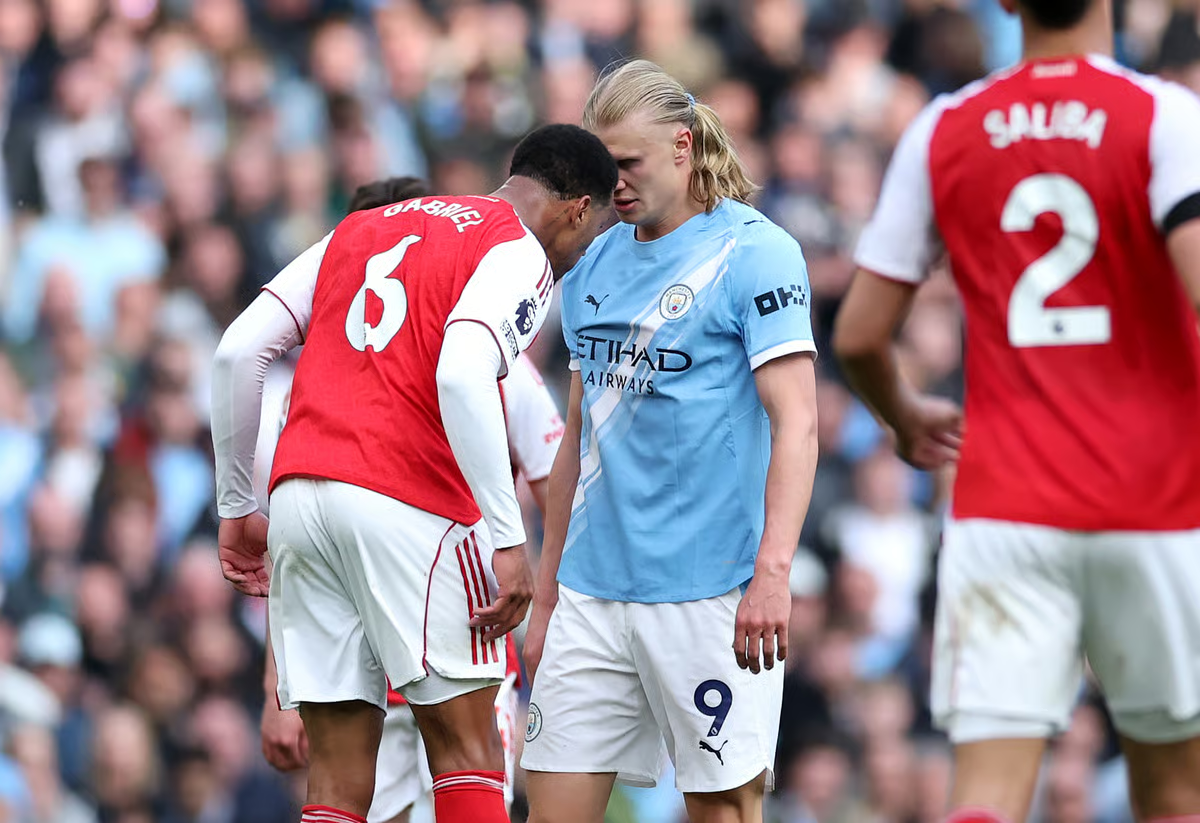
Arsenal defender Gabriel avoided a straight red card against Manchester City on Sunday in a potentially decisive referee decision in the Premier League title race.
Gabriel and Haaland have clashed previously, including when the striker bounced a football off the defender’s head when celebrating a goal, but on Sunday it turned more vicious.
Amid the melee, Gabriel had ripped Haaland’s undershirt, which required replacing after the striker had finished celebrating.
Gabriel vs Erling Haaland
PA
Advertisement
Shortly afterwards, the pair faced off again, forehead to forehead, but this time Gabriel moved to headbutt his opponent, who remained unmoved.
A headbutt is typically considered violent conduct, which results in a straight red card and an automatic three-game ban.
However, referee Anthony Taylor instead showed both players a yellow card, and VAR did not intervene to suggest upgrading to a red for Gabriel.
But is Gabriel out of the woods yet?
Advertisement
Can Gabriel be retrospectively banned for Erling Haaland headbutt?
No. The Football Association (FA) can only retrospectively punish a player if an incident was missed by all on-field officials and VAR.
Because the incident was spotted by the match official, in addition to being reviewed by VAR, the on-field decision is final.
In short, the FA cannot re-referee a match.
Advertisement
There have been examples where a ban has been extended upon review. Aleksandar Mitrovic, then of Fulham, was sent off in 2023 for pushing referee Chris Kavanagh. His ban was then extended to eight games upon review.
That was considered an exceptional circumstance, a bar Gabriel’s headbutt would not meet.
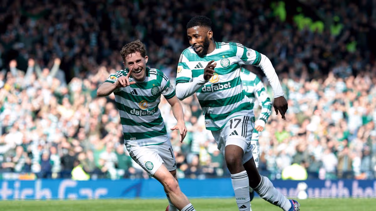
Celtic beat St Mirren 6-2 after extra-time to reach the Scottish Cup final as super sub Kelechi Iheanacho scores crucial goals
Scott Burns
22:25, 19 Apr 2026Updated 22:25, 19 Apr 2026
A dramatic extra-time thrashing of St Mirren secured Celtic’s place in the Scottish Cup final.
Martin O’Neill will take the Glasgow giants back to Hampden next month to take on Neil Lennon’s Dunfermline Athletic in the showpiece decider.
A case of master versus apprentice.
Advertisement
However, the Hoops faced a stern test, as the Premier Sports Cup champions – who defeated Wilfried Nancy’s Celtic when these sides last met at the national stadium – clawed their way back from 2-0 down and forced extra-time.
Yet, ultimately it proved to be a comprehensive victory as Celtic struck four times in the opening period of extra-time to seal a 6-2 triumph. But how did the individual players perform? Daily Record Sport assesses the ratings.
Celtic
Viljami Sinisalo 6
The goalkeeper produced an excellent stop to thwart Liam Donnelly. Appeared uncertain when dealing with back passes and was fortunate on several occasions. Powerless to prevent either goal.
Advertisement
Anthony Ralston 7
Provided stability and reliability. Struck a superb goal at the close of the opening period. The left flank became vulnerable afterwards. Restored composure in the latter stages.
Auston Trusty 7
The towering defender was another who began impressively. The US international handled the physical presence of Mandron and Ayunga effectively. Celtic’s standout defender.
Advertisement
Benjamin Arthur 6
The Brentford loanee made a confident start. He appeared commanding but began to falter when St Mirren increased the pressure. Withdrawn prior to extra-time.
Kieran Tierney 7
The left-back delivered his trademark performance down the flank. Pushed forward at every opportunity while maintaining defensive solidity. The team’s quality noticeably dipped following his substitution.
Advertisement
Arne Engels 6
The Belgian midfielder made his first start since February. A positive development for Celtic. He struck the woodwork with a powerful effort. Cautioned by the referee.
Callum McGregor 7
The skipper has faced scrutiny recently, but his knowhow proved crucial on this occasion to maintain Celtic’s rhythm. Consistently made himself available.
Advertisement
Benjamin Nygren 7
The Swedish forward often faces accusations of being one-dimensional. He displayed greater versatility in this match. Posed a significant danger and found the net.
Yang 6
Proved a constant menace down Celtic’s right flank. Gave St Mirren’s defence plenty of headaches. Delivered an excellent ball for Ralston’s strike.
Advertisement
Daizen Maeda 8
Operated centrally. The tactical switch paid dividends as he opened the scoring. His speed troubled the opposition throughout and gave St Mirren no breathing space.
Sebastien Tounekti 6
The wide player’s form can fluctuate. This ranked amongst his better displays. Fashioned several chances for teammates. Celtic require this level of output regularly.
Advertisement
Subs
James Forrest (Tounekti 61) Provided the delivery for Iheanacho’s strike 2.
Luke McCowan (Engels 74) Sealed victory with the fourth goal 3.
Alex Oxlade-Chamberlain (McGregor 74) Subdued cameo 1.
Advertisement
Kelechi Iheanacho (Yang 83) Completed the rout with a brace 5.
Marcel Saracchi (Tierney 83) Fulfilled his role 2
Dane Murray (Arthur 91) Helped close out proceedings 2.
St Mirren
Ryan Mullen 1 The goalkeeper endured a torrid quarter of an hour. A wayward clearance gifted Daizen Maeda the opening goal before he was forced off with a thigh problem.
Advertisement
Mark O’Hara 6
Operating as wing-back, the skipper put in a tireless shift. Consistently looked to receive possession and surge forwards.
Alex Gogic 6
Typically combative at the centre of the St Mirren backline. Gave absolutely everything though he and his teammates eventually ran out of steam. Tough afternoon.
Advertisement
Miguel Freckleton 6
His speed proved vital in enabling St Mirren to push higher up the pitch. Difficult to fathom how his side conceded so heavily by the final whistle.
Liam Donnelly 6
Usually deployed in midfield but stepped up amid the Buddies’ injury crisis. Didn’t disappoint his side. Advanced when his team chased an equaliser.
Advertisement
Declan John 7
Outstanding throughout. The left-back delivered the run and delivery for Mandron’s goal. Got forward consistently and posed a genuine threat for St Mirren.
Allan Campbell 6
Has experienced something of a renaissance under Craig McLeish. Certainly grafted hard and covered plenty of ground to pressure Celtic. Cautioned.
Advertisement
Jacob Devaney 6
The Manchester United loanee was eager to impress on the big occasion. Scrapped and battled for his side. Didn’t contribute much going forward.
Killian Phillips 6
Worked tirelessly and brought a physical presence for the Buddies. Thought he’d scored but saw it chalked off for handball.
Advertisement
Mikael Mandron 7
Hampered by illness in the previous final. Was determined to feature in this one. Compensated with a clinical brace. Outstanding performance.
Jonah Ayunga 6
The towering forward worked tirelessly and kept the Celtic backline busy throughout. He wasn’t really afforded opportunities to showcase his best attributes. Withdrawn in the closing stages.
Advertisement
Substitutes:
Grant Tamosevicius (Mullen 15) The youngster was exposed 3.
Roland Idowu (Phillips 74) Brought creativity 1.
Jake Young (Ayunga 74) Excellent touch for the leveller 2.
Advertisement
Jayden Richardson (Campbell 74) Provided speed down the right flank 2.
Conor McMenamin (Donnelly 82) Failed to make an impact 1.
Scott Tanser (John 106) Had limited influence 1.
Referee assessment: Matthew McDermid. While he frequently faces scrutiny, he managed proceedings effectively.
Advertisement
Star performer: Kelechi Iheanancho. Transformed the match with his brace in extra-time. The ultimate impact substitute narrowly edged Mandron for the accolade.


You must be logged in to post a comment Login