NewsBeat
More rain to hit UK this week as Met Office issues fresh weather warnings

The UK is set for more wet weather later in the week as fresh weather warnings have been issued by the Met Office.
On Thursday, a yellow weather warning will come in to force for London & South East England, South West England, Wales, and West Midlands from 5am, and will remain in place until midnight.
Heavy rain arriving overnight on Wednesday is expected to cause surface water flooding in some areas and disrupt travel. The weather agency forecasts 10 to 20mm of rain is likely to fall widely by the end of Thursday, with a few spots seeing more than 30mm.
In Central, Tayside & Fife and Grampian, a warning is in place until midday on Thursday, with spells of heavy rain and melting snow due to bring disruption.

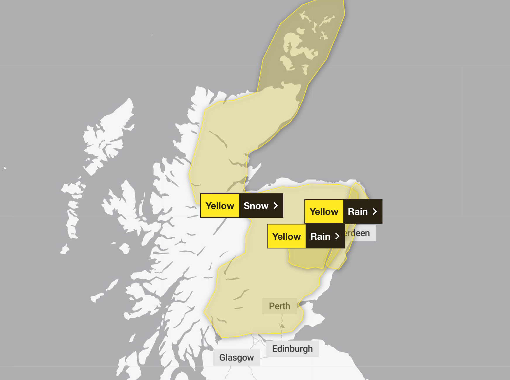
A warning for northern and eastern Scotland is in force until 3pm on Wednesday, as periods of sleet and snow and strong winds could lead to blizzard conditions.
The Met Office has warned of dangerous driving conditions, and said some roads and railways likely to be affected.
Accumulations of 1 to 3cm of snow are expected on ground above 100 metres, with up to 5cm in some areas. At low levels, precipitation will be a mix of snow, sleet, and rain, which could lead to small snow accumulations in some areas.
It comes in the aftermath of Storm Chandra, which saw record-breaking rainfall in several areas across the UK.
Met Office science manager Dr Amy Doherty said: “January has been exceptionally wet because we’ve seen a very persistent Atlantic weather pattern. A strong jet stream has repeatedly steered low-pressure systems towards the UK, bringing frequent spells of rain and wind.
“With little opportunity for drier conditions in between, the ground has become saturated, so even moderate rainfall has had a greater impact. This succession of Atlantic systems is the main reason rainfall totals this month are well above average for many areas.”
This is a breaking story, more to follow…
You must be logged in to post a comment Login