Tech
ETH Zurich Students Send a Robot (Alpine Submarine) Under Frozen Lakes

High in the Swiss Alps, frozen lakes hide risks that surface checks often miss. Snow piles up, presses the ice sheet down, and new layers form on top. Thin spots or cracks stay invisible until someone or something falls through. For more than a century people have cut holes by hand, measured with tape, and hoped the ice held for skating, racing, or simple crossings. In 1907 St. Moritz turned that hope into spectacle with skijoring, horses pulling skiers across the ice. The tradition continues, yet the dangers remain. In 2017 a crack swallowed horses during an event. Manual surveys still demand hours of chainsaw work and firefighters on standby, and they only sample a few points while ice thickness can change across short distances.


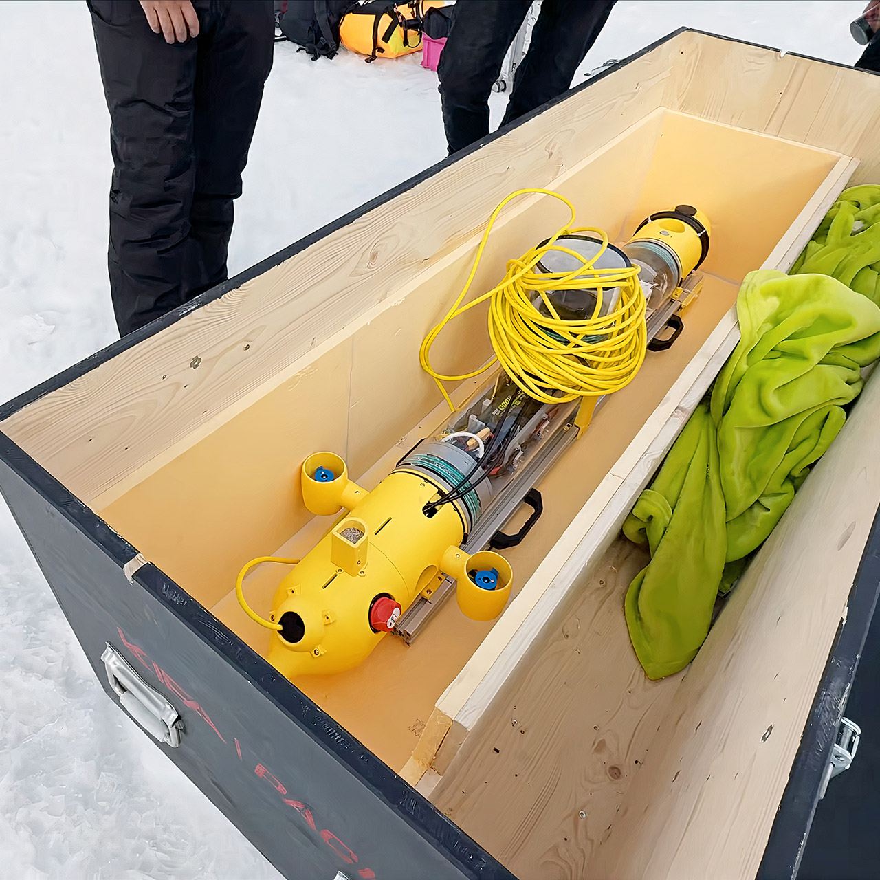
A group of 10 ETH Zurich students, including eight mechanical engineers and two electrical engineers, determined that the best view of an alpine lake is from the bottom. Their main project, Polaris, is the result of a five-month race to create a small autonomous underwater vehicle that can fit thru a single hole in the ice and survey the thickness from below. They hoped to make it safer for people to recreate on these lakes throughout the winter while also gathering additional data for climate models that try to forecast how the ice will react to warmer winter weather.


Insta360 X6, 8K 360 Camera with 1/1.1” Sensors
- DUAL 1/1.1″ SENSORS & TRIPLE AI CHIP SYSTEM: Custom-built dual 1/1.1″ square sensors deliver unprecedented 360 image quality. Combined with a triple…
- FLAGSHIP 8K50FPS 360 VIDEO: Hit record on our 360 action camera and capture your world in stunning native 8K50fps video. Every view, every highlight…
- IN-HOUSE AI MODEL FOR EFFORTLESS 360 EDITING: Insta360’s own AI model, built specifically for 360 editing. New AI Director edits your footage…
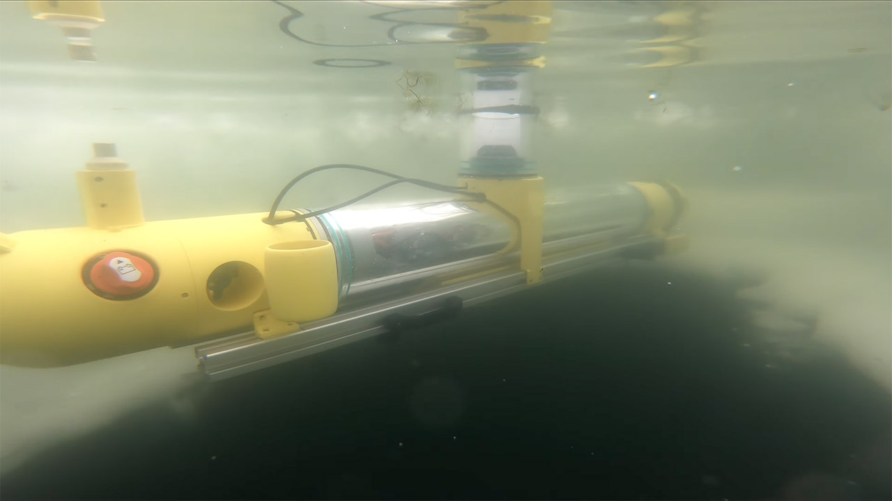
Polaris is basically a 30-kilogram torpedo robot with all electronics contained inside a watertight hull. It contains six motors that provide it complete control in all directions, forward, back, up, down, left, and right, allowing it to keep its position, climb up, or slide sideways rather than drifting aimlessly. Two huge concrete weights are placed to the bottom to keep the center of gravity stable, and Polaris is somewhat positively buoyant, so when the motors stop, it simply floats upward rather than sinking to the bottom. The autonomy software is operated by an NVIDIA Jetson computer, and the batteries are twice as powerful as usual, allowing the vehicle to travel a long distance before returning to the surface.
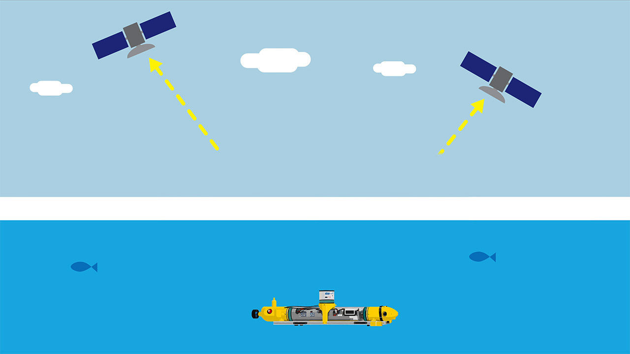
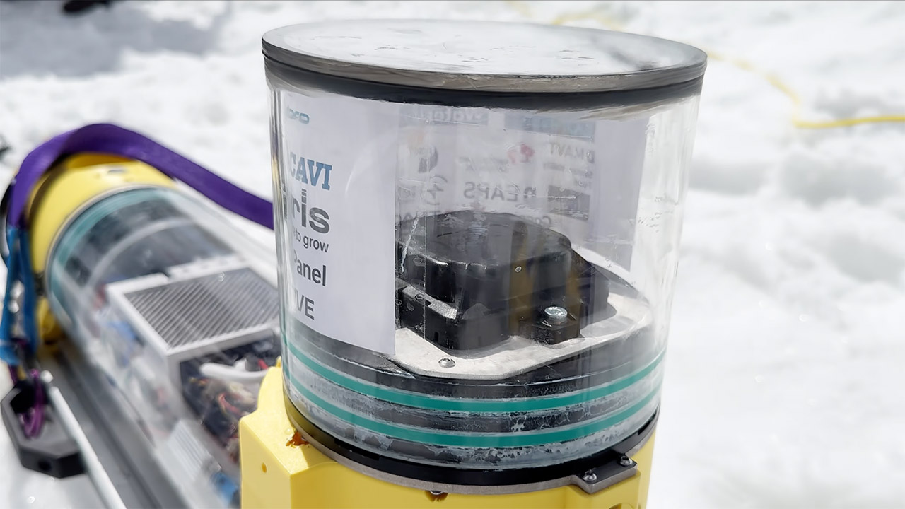
Getting a fix on the location under the ice is difficult since GPS signals simply stop working once the vehicle is fully submerged. The crew solved this problem by inserting a GPS antenna thru a clear dome on top of the hull. When Polaris is pressed against the underside of the ice, the antenna is close enough to the surface to provide a usable fix at times, but the rest of the time it relies on an acoustic system that sends sound pings down to the bottom, and three hydrophones on a surface antenna determine where it is based on the time it takes for the pings to bounce back. This enables Polaris to navigate a grid of waypoints, stopping at each one to take readings.

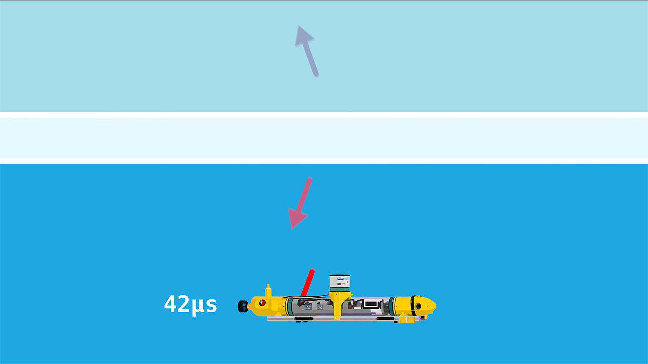
Two methods of measuring ice thickness were built-in. The first approach employs an upward-looking sonar, which shoots a sound pulse up into the ice and then determines how thick the ice must be by measuring how long the sound pulse takes to bounce back off the underside of the ice. We tested it with 50cm of ice in St. Moritz, and it appeared to be promising. Unfortunately, on the real lakes, the ice got so thick that the returns became audible and the reflections became distorted. The team devised a simpler backup plan: they simply drove the vehicle straight up until it hit the ice, then measured the water pressure to compute the depth of the water, deducting the vehicle’s length and computing the thickness of the ice at that location. Following the run, they stitch all of the dots together to form a beautiful color-coded map of the ice’s thickness.
Field tests were conducted late in the season at some stunning Swiss lakes near Zermatt. Theodul Gletschersee, located at over 3000 meters just behind the renowned Matterhorn, is a great challenge. Another spot, Schwarzsee, was slightly more accessible, but still required cutting thru a significant amount of ice. The problem was that snow had squeezed the original layer of ice, causing new ice to build on top, leaving this filthy slushy mess in the middle that took hours to cut thru with the chainsaw. Then, once they’d cut a hole, they had to get the vehicle in, configure all of the equipment, and complete the first several short swims. It basically performed a little lap between two holes that were about 10 meters apart and popped up exactly where it should. Later, it followed a large grid measuring 10 x 10 meters, touching down at all corners and halfway points. Then post-processing produced two maps: one based just on the pressure data and another that attempted to incorporate sonar information, but the sonar data is quite noisy, making it difficult to get working effectively. Nonetheless, the pressure map revealed some rather obvious variances in the area they had examined.
It’s still not perfect because the depth recorder only measures the entire thickness of all the layers piled on top of each other. In alpine lakes, the true vital safety layer is typically just the thinnest top sheet; the older ice beneath may be waterlogged or fragmented in some way. Sonar is still not really sorting out that top layer clearly. The vehicle is however not entirely autonomous for long runs because a team is still need to sort out the acoustic placement and assist with getting it back out at the finish. Of course, at high altitude, the cold air drains the batteries quickly, and the mechanics can freeze up if the seals aren’t up to par.
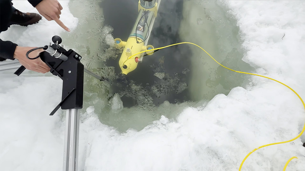
Despite this, the first few missions were a huge success, proving the concept works. Once that initial hole is bored, the Polaris can survey a very useful region in a fraction of the time it would take to collect dozens of individual hand-drilled measurements. And it can link specific thickness measures to precise places, which manual approaches cannot match. The same data also helps climate experts monitor how lake ice responds to changing winters, and students are already discussing larger grids and tighter autonomy for the following season.
[Source]
You must be logged in to post a comment Login