Tech
Google and NASA JPL release an AI model that maps methane plumes worldwide

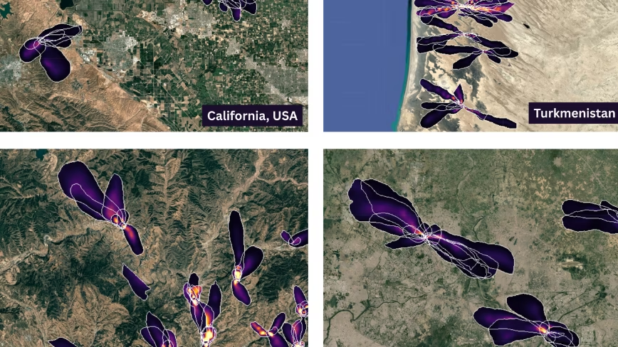

Google Research and NASA JPL have released a deep learning model that maps methane plumes globally at 60 metres, finding about 50% more than human analysts and 23,000 additional plumes, including at 24 of the 25 largest-emitting landfills. Europe’s Methane Regulation ordered a satellite monitoring tool and a super-emitter alert system, but it covers only oil, gas and coal.
Google Research and NASA’s Jet Propulsion Laboratory have released a deep learning model that maps methane plumes worldwide from space, Google Research said. It flags around 50% more plumes than human analysts, and 23,000 more than the existing product.
The model is a vision transformer trained on 3.6 million simulated plumes. It reads raw spectra from EMIT, a NASA instrument on the International Space Station, at 60 metres per pixel.
Europe already runs a version of this. The Copernicus atmosphere service switched on a methane hotspot explorer in February last year, built by Dutch researchers on Sentinel-5P data.
The two are not doing the same job. Sentinel-5P covers the planet daily at roughly 5.5 by 3.5 kilometres per pixel, a region rather than a site.
Sixty metres resolves a landfill cell. The paper reports plumes at 24 of the world’s 25 largest-emitting landfills, against 17 for the NASA product it replaces. UCLA built last year’s list of the worst sites from Carbon Mapper analysis of EMIT and Planet Labs data.
Which is where Europe’s own rules stop short.
The Methane Regulation applies to oil, gas and coal. It obliges the Commission to build a global monitoring tool on satellite data, and Article 31 alerts member states to super-emitting events.
Waste is outside it. Prognos and the ifeu Institute estimated in January that municipal waste landfilled in Europe between 2022 and 2050 will release roughly 1.5 billion tonnes of carbon dioxide equivalent as methane.
Europe’s high-resolution answer is still being built. AIRMO raised EUR 5M in March to launch its first satellite in early 2027, and the Copernicus CO2M mission is due in November of that year.
What is available now costs nothing. The plume database sits on Earth Engine under a Creative Commons licence, the model is on Kaggle and the code on GitHub.
The limit is where the instrument looks. EMIT was built to map mineral dust in arid regions, and it flies on a space station orbit inclined at 51.6 degrees. Europe was never the target.
So the sharpest methane map in existence is a by-product of an American dust mission, given away.
European Earth observation has the opposite trouble, as TNW has reported: plenty of data and too few buyers. A regulator wanting facility-level methane attribution tomorrow would download Google’s file, then find the emitters it resolves best are the ones the regulation does not reach.
You must be logged in to post a comment Login