Tech
How Do GPS Apps Like Google Maps Know When There’s Police Ahead?


Over the past few years, navigation apps, whether it’s Google Maps or Waze, have become an integral part of our lives. These apps tell you a lot more than the current traffic conditions. They give you information about road closures, optimal lanes for driving, speed cameras, flooded roads, roadwork, low visibility, and even police sightings. But you may be wondering how exactly Google Maps, or GPS apps in general, know about real-time incidents like these. As surprising as it may sound, a lot of this real-time data comes from real users, people who are actually driving on those roads.
When it comes to identifying live traffic conditions, GPS apps rely on data being sent from the smartphones of people driving on those stretches of road. Google Maps has also been using machine learning and AI to predict traffic conditions for years now. But that doesn’t help Google Maps detect police sightings. That’s where real users like you come into the picture.
As you drive and use Google Maps for navigation, the app lets you report what you see. These incident reports then appear on the maps of other users driving on the same road. Google Maps takes feedback from other drivers to confirm whether the report is still valid. So, the next time you see a prompt confirming a police sighting ahead, another user may have added it. Apart from that, there’s also the possibility that Google Maps sourced this data from another app.
How crowdsourcing helps Google Maps
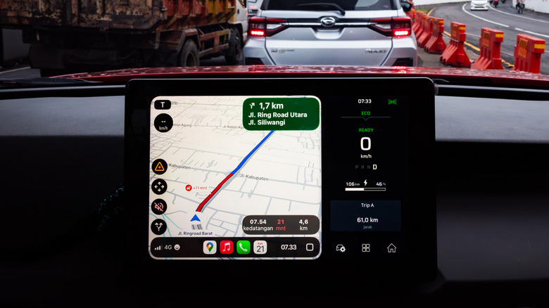
Crowdsourcing works because Google Maps has millions of users who act as its eyes on the road and, in a way, complement its efforts to gather real-time data. Google doesn’t have to independently identify and verify every police sighting. The users do that for Google Maps. When you report a police sighting, Google Maps then shows it to others driving on the same route. Other drivers can then confirm whether the police are still there, helping Google Maps keep the report up to date.
Its own users are not the only source of real-time information for Google Maps. It also sources reports from Waze, an app owned by Google. Google Maps identifies which reports come from Waze drivers. When it comes to crowdsourcing traffic-related information, Waze is one of the best navigation apps for Android. It has a built-in system to reward users with points for submitting reports. Integrating data from Waze gives Google Maps a larger dataset to work with, allowing it to provide more information to drivers.
Keep in mind that these reports aren’t permanent. They change as the situation evolves. Similarly, you shouldn’t blindly rely on these reports, because it’s essentially users who are submitting them. That’s why many GPS apps have a feedback mechanism to verify whether active reports are still up to date.
You can add reports too
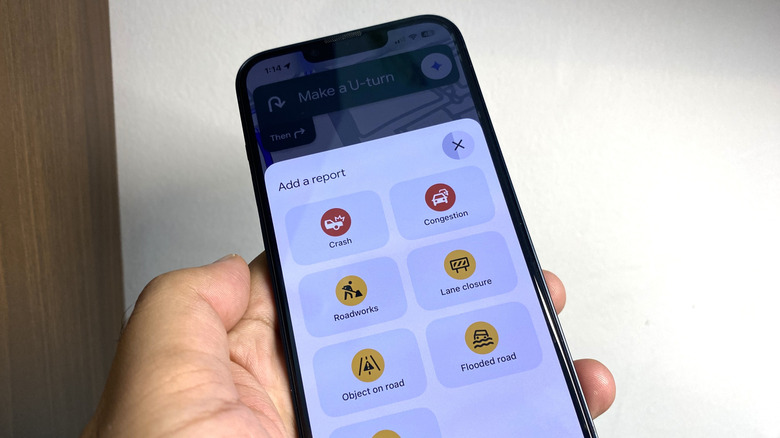
It’s not just other users who can submit reports about police sightings or similar incidents on Google Maps; you can do that too. And it’s fairly easy to do so. When using Google Maps in navigation mode, you will find a “Report” icon on your smartphone and on the Android Auto or Apple CarPlay screen. Tap on it, then select “Police,” and your report will be submitted. You should see a small police icon show up at your location. Also, you can enable or disable these alerts in Google Maps through Settings > Navigation > Alert options. Keep in mind that reporting police sightings is not supported in every region. But for users in the United States, the option should be available under the “Add a report” section.
There are concerns about features that allow drivers to find out about potential police presence. That’s because this can help drivers evade checkpoints by opting for alternate routes. For instance, someone driving under the influence could use these reports to avoid a checkpoint, putting others at risk. But for many drivers, it makes navigation much simpler, reminds them to slow down, and helps them avoid speeding tickets.
You must be logged in to post a comment Login