
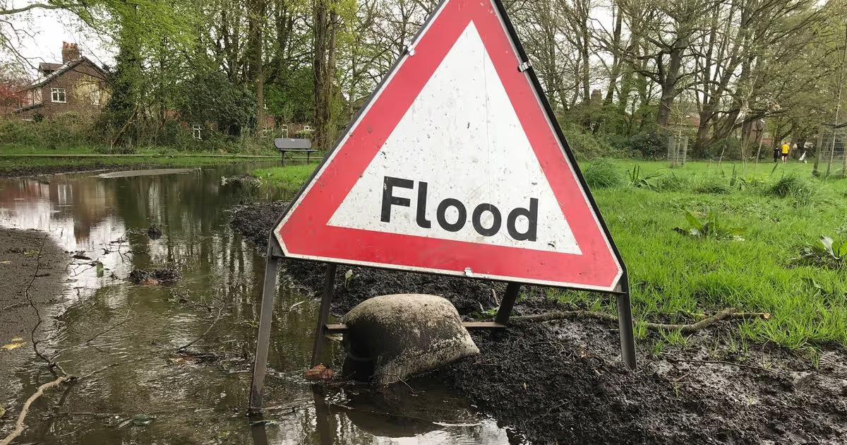
The Environment Agency has warned locals that flooding is ‘expected’ in some areas
Flood alerts and warnings have been issued for Cambridgeshire areas by the Environment Agency on Monday (February 16). Locals have been advised that flooding is ‘expected’ in some areas, and ‘possible’ in others.
Locals in areas with flood warnings have been told flooding is expected and to “act now”, according to the government agency. Flood warnings mean that homes and businesses are at risk, as are roads and railway lines.
The flood warnings issued are as follows:
- Areas close to the River Great Ouse at Wyboston, Eaton Socon, Eynesbury, Eaton Ford, and St Neots. It is advised to take care and avoid walking, cycling or driving through the flood water. This is because of the rising river levels.
- North Bank Road alongside the River Nene, east of Peterborough and west of Dog-in-a-Doublet Sluice. Whilst the warning is in force, the local authority will close North Bank Road and other routes will be put in place.
- B1040 Thorney to Whittlesey Road to the South of the River Nene. River levels are expected to remain high and the local authority may close the road for safety reasons. Diversion routes are set to be put in place.
There are also several flood alerts in place. If a flood alert is issued, it means flooding is possible and locals should ‘be prepared’ to follow a flood plan.
The flood alerts issued are as follows:
- Bury Brook. Areas most at risk are around Bury Brook, from Abbots Ripton to Ramsey.
- Alconbury Brook. Areas most at risk are around Alconbury Brook at Hamerton, The Alconburys, Little Stukeley and Brampton.
- Ellington Brook. Areas most at risk are around Ellington Brook at Spaldwick, Ellington and Brampton.
- River Kym. Areas most at risk are around the River Kym and River Til from Yelden, and Upper Dean to Hail Weston.
- River Great Ouse in Central Bedfordshire, Beds Borough and Cambridgeshire from Wyboston to Brampton. Areas most at risk are around the River Great Ouse from Wyboston to the south of Brampton, including Duloe Brook, Hen Brook and Fox Brook.
- River Rhee. Areas most at risk are those around the River Rhee from Guilden Morden to Haslingfield.
- Lower River Cam. Areas most at risk are around the River Cam from Stapleford to Waterbeach.
- River Great Ouse in Cambridgeshire from Brampton to Earith. Areas most at risk are around the River Great Ouse from Brampton to Earith, including Back Brook, Hall Green Brook, Parsons Drove Drain, Swavesey Drain and Wadsbys Folly.
- Hundred Foot Washes. The causeway at Sutton Gault has approximately 52cm of water on the road. The causeway at Welney has up to 43cm of water on the road. Floodwater is now rising onto Earith causeway. Due to the uneven surface of the roads, water may be deeper in places.


![BITCOIN IS ABOUT TO DROP !!! [Bear Flag Confirmed]](https://wordupnews.com/wp-content/uploads/2026/04/1775318607_maxresdefault-80x80.jpg)


You must be logged in to post a comment Login