

Politics
Cyprus Criticises UK Over Iran Attack Prevention Efforts
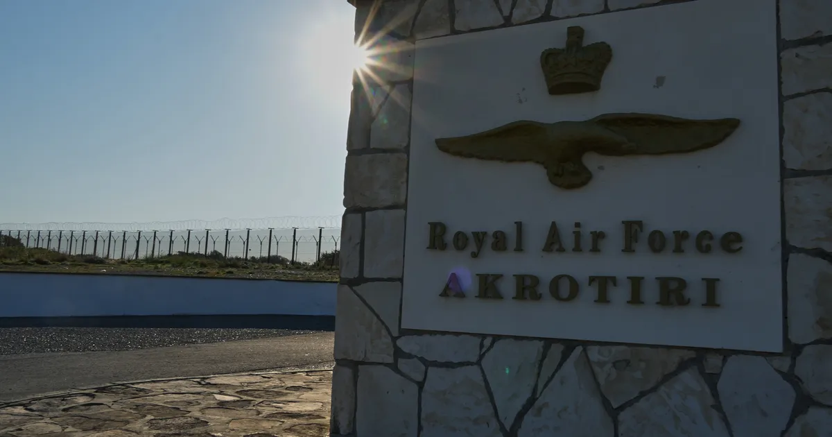
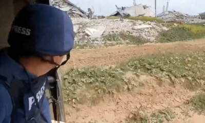
A senior Cypriot official has accused the UK of not doing enough to defend the island from Iranian attacks.
Kyriacos Kouros, the Cypriot high commissioner to the UK, said “the people are disappointed” by Britain’s efforts since the war began last weekend.
The RAF base Akrotiri, which is sovereign British territory, was struck by Iranian drones on Sunday, while further attacks were intercepted on Monday.
And while Greek forces are on the island and France has pledged support, the British warship HMS Dragon is not expected to arrive in the area until next week.
Kouros told the BBC: “The people are disappointed, people are scared, the people could expect more.
“I represent a practical people. We want to see the results.”
Speaking to Sky News, he said: “Already we have the presence of Greek forces on the island. Two frigates arrived, four aircraft arrived, all of them with abilities to combat drones.
“The French are coming. So… the least we expect is the Britons to also be present since, as I said, we are not only defending Cypriots on the island.”

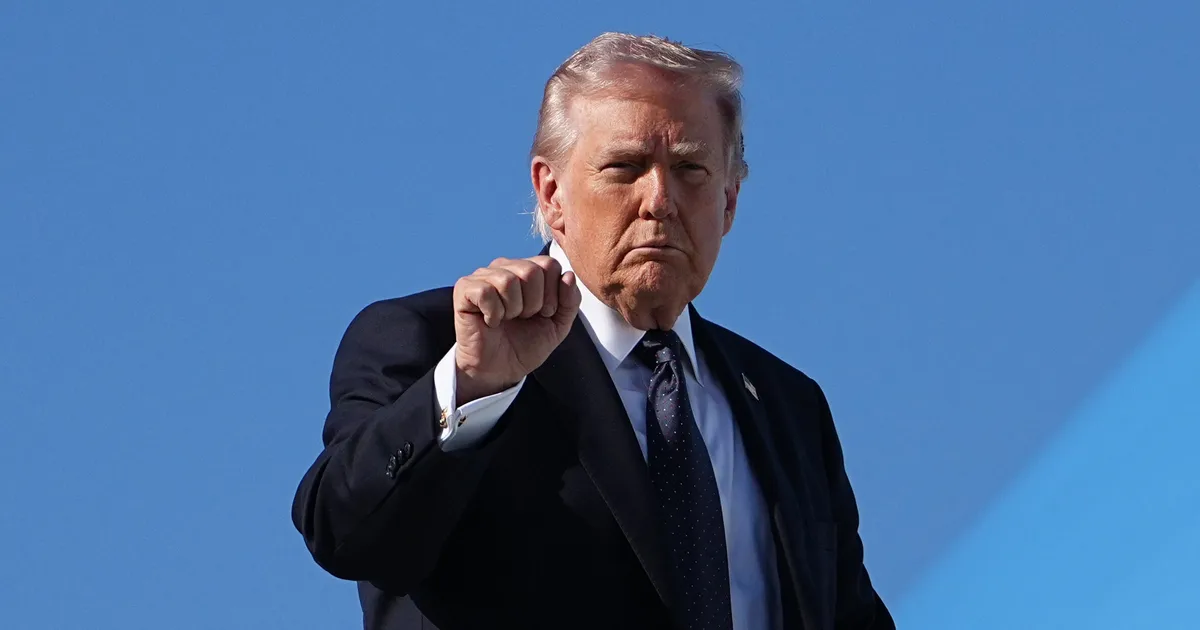
A former head of MI6 has hit out at Donald Trump’s “unnecessary war” with Iran.
Sir John Sawers, said the conflict was “not required” and could lead to the country becoming a “failed state” and even bigger danger to the world.
The US and Israel began their bombing campaign against the Tehran regime last Saturday, but since then the apparent rationale for the military action has changed on a number of occasions.
Speaking to CNN, Sawers – who was chief of the UK’s Secret Intelligence Service from 2009 until 2014 – warned of the chilling consequences which could transpire as a result.
He said: “This is an unnecessary war. It was not required because it was not as if it was to pre-empt an imminent threat against the United States or indeed against Israel.
“The rationale, to the extent that there is one, is that it secures Israel for decades to come … but this will come at a cost.
“The very best outcome you can expect from the current conflict is that a successor leadership comes in and behaves differently from its predecessors. That is what some in America are calling the Venezuela option.
“I think just as dangerous is the possibility that the regime might corrode or collapse and lose control of parts of the country, and then you could have a situation like the one we’ve faced in Syria for the last year or so, where the country fragments into several different parts.”
Sawers also said it was “unwise” for Trump to call on the Iranian people to rise up against the country’s ruling regime.
He added: “If the country dissolves into component parts, it will be basically a failed state, and we’ve known from the last 40 years what happens in failed states – it becomes a centre for terrorism, for smuggling, for gun running, for drugs, for criminality of all sorts.
“If you just dismantle the regime completely, you could end up with the sort of chaos we’ve had to deal with in Afghanistan, or indeed in Lebanon, Libya and Syria.”

Ali Ahmadi, Catherine Barnard and Fiona Costello look at the implications of the Labour governmen’s promise to close all asylum hotels.
The UK government has committed itself to closing all asylum hotels by the end of this Parliament. It aims to discontinue the use of contingency hotels and rely instead on other asylum accommodation such as Houses of Multiple Occupation (HMOs) and family houses, as well as investigating the further use of ‘large sites’ such as ‘modular buildings’ and former military bases like Wethersfield in Essex and Cameron Barracks in Inverness. This policy is intended to save taxpayer money and improve the suitability of accommodation. But what does this transition mean in practice given the housing shortage in England? And what are the implications for local authorities, support organisations, local communities, and asylum seekers themselves?
Under the Immigration and Asylum Act 1999, the Home Office is responsible for housing destitute asylum seekers. Between 2012 and 2019, this was delivered through six regional contracts known as COMPASS. In 2019, COMPASS was replaced with seven similar arrangements, the Asylum Accommodation and Support Contracts (AASCs). These contracts were awarded to three providers: Clearsprings Ready Homes, Mears Group, and Serco. Under these contracts, asylum seekers are dispersed on a ‘no-choice’ basis to areas where accommodation is cheap and available which has meant that dispersals have been concentrated in deprived (and thus low-cost) areas.
For instance, the Guardian’s analysis of Home Office data in 2016 showed that 57% of asylum seekers were housed in the poorest third of the country while the richest third housed only 10% of asylum seekers. The distribution has also been uneven across local authorities, with some accommodating none (e.g. Lincoln, Cambridge, North Norfolk, Great Yarmouth, West Suffolk) and some having more than one asylum seeker per 200 local residents (e.g. Hounslow, Halton, Belfast, Coventry), exceeding the limit set by the original dispersal policy.
In 2022, the Home Office announced the policy of ‘Full Dispersal’, distributing asylum seekers more equitably across all local authorities, requiring the providers to use an indexing tool to procure accommodation, taking into account factors beyond population size such as market availability, homelessness rate, and level of hate crimes. This has had some success. For instance, in 2014, 75% of local authorities (285 out of 375) hosted no asylum seekers while in March 2025 just 16% (59 out of 361) hosted none.
However, significant disparities remain, with asylum seekers clustered in certain deprived areas such as Glasgow in Scotland and Halton in the North-West. A Parliamentary inquiry found that providers intentionally avoid procuring dispersal housing in more expensive urban areas to maximise profit. These local authorities face significant pressure on services like schools, healthcare, and homelessness support. The Home Office provides an ‘asylum dispersal grant’ to local authorities (currently £1,200 per asylum seeker per year) but this is not sufficient to meet the full costs.
While the Home Office tried to use local housing in the dispersal areas, it was not able to provide enough such housing and so it increasingly turned to using contingency hotels, especially at the time of the pandemic and now due to asylum backlogs. At the end of March 2020, only 5% of asylum seekers were staying in contingency accommodation (mostly hotels), but by 31 March 2025, this figure rose to 35% (over 32,000 people). Asylum hotels are significantly more costly than other forms of dispersal accommodation. In 2024-25, they accounted for more than half of asylum support cost (£2.1 billion out of £4 billion). Despite the high costs, hotels are reported to be in poor condition. Asylum hotels have also been the subject of community tensions, most notably in Epping in Essex and Norwich in Norfolk. For these reasons, the government plans to end their use.
For asylum seekers, hotel closure means moving to dispersal accommodation or ‘large sites’, often in rural areas far from urban centres. This often means they lose access to support services. For example, third sector organisations that provide legal assistance, mental health and integration support are primarily based in urban areas. They may not have the resources to reach asylum seekers who are located in rural areas. One refugee support organisation in the East of England talked of the difficulty of reaching asylum seekers in rural dispersal accommodation: “[From] Lowestoft to Haverhill, opposite corners of the county, is about 75 miles apart, which with a small team is quite a challenge.”
They also said that availability of services, support, and public transport (in rural dispersal areas) is not a factor in the Home Office’s dispersal index/formula: “….if you’re lucky, the village will have one bus a day that goes to a nearby town…. Some may not have that. So, no, Serco don’t take any of that into account. You know, local school places… don’t take into account if it’s families. Provision of service and culturally appropriate services, not at all.” This affects the lives of the individuals: there are multiple reports of serious mental health crises at Weathersfield. In the first three months of 2024, there were 30 recorded occurrences of men self-harming, attempting suicide, or at serious risk of doing so, and over 160 safeguarding referrals made regarding suicide and self-harm.
It is also not clear whether the government will make any cost saving. Evidence suggests that the use of large sites may, in fact, be more expensive than hotels. The Home Office estimates that Wethersfield costs around £132 per person per night compared to hotels at £144.98. However, these estimates exclude the £105 million in acquisition, lease, and setup costs. A Parliamentary inquiry found that ‘large sites’ attract considerably more public attention, complaints, and media coverage than smaller sites. There are also added policing costs.
To conclude, closing asylum hotels may redistribute costs and pressures rather than reducing them, let alone eliminating them. Local authorities, voluntary organisations, and asylum seekers themselves are likely to bear much of the burden. Dispersal accommodation and ‘large sites’ can work only if they are accompanied by sustained investment in local services, support, and community engagement. There is currently little evidence of this.
By Ali Ahmadi, Research Associate, University of Cambridge and PhD student at Anglia Ruskin University, Catherine Barnard, Senior Fellow, UK in a Changing Europe & Professor of EU Law and Employment Law, University of Cambridge and Fiona Costello, Assistant Professor, University of Birmingham.

Described by one critic as “Fleabag for 50-somethings”, Netflix’s steamy new comedy-drama, Vladimir, looks set to become your new binge-watch obsession.
Starring Rachel Weisz and Leo Woodall, Vladimir follows a fourth wall-breaking narrator as she becomes obsessed with her young, attractive colleague while also trying to manage her husband’s sexual misconduct allegations in the workplace.
Set in the world of academia, Vladimir’s unpicking of cancel culture and middle-aged desire is already sparking debate, with some critics loving the depiction of the complexities of the situation and others struggling with the show’s “unlikeable protagonist” and apparently shallow exploration of a serious subject.
If you’re looking for something spicy and addictive to stream this week, here’s everything the critics have been saying about Vladimir and why it deserves a spot on your Netflix watchlist…
“Vladimir is that rare visitor to the screen – proper television for proper grownups. The eight-part adaptation of Julia May Jonas’s provocative 2022 debut novel of the same name has not shied away from the properties that made the book great – black comedy, bleak insight, evisceration of accepted pieties – and fitted them perfectly to the new form.
“The screenwriter, Jeanie Bergen, who has obviously absorbed the book into her very bones, retains all of Jonas’s wit, confidence and, crucially, her willingness to dwell in grey areas and luxuriate in the complexities that govern life in middle age.”
“It’s not flattering and it’s certainly not nice, but it feels honest and maybe even – oh, let’s just admit it – relatable.
“Dig into the heart of your deepest desire, Vladimir argues, and you’ll find nothing more or less than your own face staring right back at you.”

“Weisz is tremendously funny as she navigates this crush while her life unravels. The style of the series takes a bit of getting used to – it’s fourth-wall breaking, with Weisz addressing the camera throughout and speaking in sometimes quite stilted, stagey language. But before long you fall into the rhythm of it. Think of it as Fleabag for 50-somethings.”
“Why shouldn’t we see a story through the eyes of a chaotic and flawed woman? It’s still quite rare, even in 2026, for female anti-heroes to be afforded the same treatment as their male counterparts, decidedly doing away with any need to make them palatable, or to give you a driving reason to root for them. She’s fun to watch, and that should be enough.”
“Weisz meanwhile, is a terrific actor (even if her American accent occasionally hits those Rs like a back wheel bumping the curb when parking) and the chemistry with Vladimir feels, rightly, elliptical.
“But she is an unlikeable protagonist – her decision-making at times even sociopathic – and the tone of the show, its frequent collapse of the fourth wall, can be grating. Your tolerance for that device might correlate with your judgment of the show’s rather unhinged ending.”
“Vladimir takes on a host of knotty issues, from changing sexual mores to aging to infidelity to – imagine the loudest sigh ever sighed – cancel culture. Given that self-assigned degree of difficulty, Vladimir is far from the catastrophe it could easily be in clumsier hands.
“But while Weisz is reliably magnetic and the eight episodes often amusing as farce, Vladimir is an imperfect translation of the novel’s hothouse subjectivity to TV’s three-dimensional space, where canvases for projection and conduits for desire take the form of flesh-and-blood human beings.

“Come for the steamy obsession and stay for everything else. Rachel Weisz shows her onscreen mastery in this completely unexpected Netflix show that doesn’t quite know what it wants to be.”
“Almost all of the eight episodes feature a hot and heavy sex scene, and showrunner (and original author) Julia May Jonas has spectacularly nailed the spice. Nothing is gratuitous or unnecessary, and desires are explicitly explored with nothing off-limits.”
“As far as darkness goes, Vladimir is little more than a run-of-the-mill narcissist, not asking for the protagonist’s book when she requests to read his. However, most narcissists are significantly more charming, whereas Vlad’s cool guy personality is more ‘meh’.”
“Like the film After the Hunt with Julia Roberts, Vladimir looks at campus misconduct in the later #MeToo era. But it plays the goings-on as dark comedy rather than psychological drama.
“Consider its tongue firmly in its cheek, which works sometimes but on other occasions can be confusing. “
“Vladimir raises interesting, timely questions about power, feminism, and the #MeToo movement, but it stops short of engaging with them in a meaningful way. Because it doesn’t seem to know quite what it wants to say about the topics, it ends up not saying much at all, the commentary staying close to the surface rather than diving deep into the intricacies. It revels in its main character being messy and subversive, but after all is said and done, it’s more thematically clean and conventional than it wants to be.”
“Ms. Weisz never seems quite comfortable as the so-called M. And only if she were would the story about inappropriate lust between students and faculty – and faculty and faculty – be as amusing as she has to pretend it is.”
“Vladimir offers viewers a front-row seat to its protagonist’s frantic inner monologue by having her deliver her thoughts straight to camera. Look, Phoebe Waller-Bridge’s Fleabag doesn’t own the art of fourth-wall breaking, but it’s impossible not to see its influence in the professor’s asides. If you’re going to use a technique that’s almost synonymous with another TV show about a spiraling, complicated, unnamed woman, you’d better bring something new to it.
“To its credit, Vladimir tries, but doesn’t quite pull it off.”
All eight episodes of Vladimir are now streaming on Netflix.
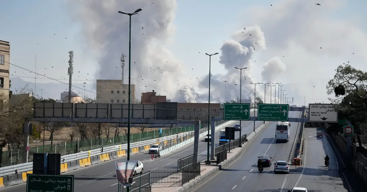
Donald Trump sent the Middle East into chaos when he decided to launch strikes against Iran along with his Israeli allies on Saturday.
Tensions were already rising between Tehran and Washington over Iran’s nuclear capabilities after talks on a settlement failed last week, but the US and Israel launched the first blow.
Now, as Iran hits American military bases across the region – after targeting a UK RAF base in Cyprus – the aggression continues to escalate.
The US president has since warned the war could last “far longer” than four or five weeks.
While his vice president JD Vance has insisted that Trump would not allow the US to fall into a multi-year war with “no clear objective”, the reasons behind the White House’s aggression remain unclear.
Here are the varying reasons both the president and his top officials have come up with in recent days.
1. Eliminating Threats From The Iranian Regime
Immediately after bombing Iran, Trump said his goal was to eliminate threats from the Iranian regime – though he had no evidence to back it up.
He also sent a message to the protesters in Iran, saying when the US was “finished”, the country was “yours to take”.
That call for an Iranian revolution has faded significantly since the attacks started at the weekend.
2. Stopping Iran’s Nuclear Capabilities
Two days after the attack, US secretary of war Pete Hegseth said it was not a “regime change” war.
Instead he said the operation was meant to “destroy Iranian missiles, destroy Iranian missile production, destroy their navy and security infrastructure” – all to prevent Iran from developing its own nuclear weapons.
But Trump and Israel already launched a 12-day offensive on Iran last summer, and claimed to have obliterated its nuclear capabilities at the time.
It’s worth remembering Trump actually pulled the US out of an international agreement with Iran to limit its nuclear abilities back in 2018.
Tehran subsequently terminated the entire agreement in October 2025, following the US-Israel strikes.
US intelligence has previously indicated Iran was not building a nuclear weapon any time soon, though Trump has said that information was “wrong”.
3. A Response To An Israeli Plan
Secretary of State Marco Rubio offered up a different theory, telling reporters that it was all down to planned actions from Israel.
He said: “We knew there was going to be an Israeli action, we knew that was going to precipitate an attack against American forces.”
“We knew that if we didn’t pre-emptively go after them [Iran] if they were to launch those attacks, we would suffer higher casualties,” he claimed.
Bizarrely, Trump then contradicted his top diplomat, saying, “I might have forced Israel’s hand” to attack Iran.
Rubio then U-turned, insisting he had never said the “imminent threat” pushing the US to attack Iran was a pre-planned strike from Israel.
He said: “The president made a decision, and the decision he made was that Iran was not going to be allowed to hide behind its ballistic missile program, that Iran was not going to be allowed to hide behind its ability to conduct these attacks.”
He insisted that is what he said the day before too, accusing the press of flipping his statement “to reach a narrative that you want”.
Rubio also told the press that the US attacked because Iran is “run by lunatics”.
4. A Particular Feeling
Trump’s press secretary Karoline Leavitt had yet another reason to explain the violence.
She told reporters on Wednesday: “This decision to launch this operation was based on a cumulative effect of various direct threats that Iran posed to the United States of America, and the president’s feeling, based on fact, that Iran does pose an imminent and direct threat to the United States of America.”
She added: “The president had a feeling, again, based on fact, that Iran was going to strike the United States, was going to strike our assets in the region, and he made a determination to launch Operation Epic Fury based on all of those reasons.”
5. A Personal Vendetta
The president also suggested that this may have all come down to his own desire to hit out at a particular individual.
“I got him before he got me. They tried twice. Well I got him first,” Trump told ABC, alluding to Iranian supreme leader Ali Khamenei.
US intelligence believes there was a plot to kill Trump in 2024 during his presidential campaign though Iran has denied that it plotted to kill the president.
Hegsethalso told reporters on Wednesday: “Yesterday, the leader of the unit who attempted to assassinate President Trump has been hunted down and killed.
“Iran tried to kill President Trump, and President Trump got the last laugh.”
He did not name any individuals.
Then he said this was not the goal of the attack.
Hegseth claimed: “While that was not the focus of the effort by any stretch of the imagination, in fact, never raised by the president or anybody else, I ensured, and others ensured, that those who were responsible for that were eventually part of the target list.”

Nicola Coughlan has laid out why she’s definitely not here for the discussions about her body that have arisen since she shot to international fame in Bridgerton.
During a new interview with Elle UK, the outspoken former Derry Girls star explained: “The thing I say sometimes that pisses people off is I have no interest in body positivity.
“When I was a kid growing up, I never thought about that. I didn’t look at actors and think about their bodies. So, I actually don’t care.”
Nicola pointed out that there are “a lot of things I’m passionate about”, but discussions about body positivity are not one of them, insisting that this is something that’s been projected onto her by “someone else”.
She went on to explain that ahead of Bridgerton’s third season – in which she took the lead alongside co-star Luke Newton – she’d been exercising “a lot” and had lost “a bunch of weight”.

“I was probably a size 10 and one of the corsets was a size eight,” she said. “And then people talked about how I was ‘plus size’ and I was like, ‘How fucked are we that I am the biggest woman you want to see on screen?’.”
Nicola went on to recall one incident in which she was cornered in a public bathroom and told by a “really drunk girl” about how much she loved Bridgerton “because of your body”.
As the person in question began talking more about her body, Nicola admitted she became deeply uncomfortable (“I was like, ‘I want to die. I hate this so much’,” she commented).
“It’s really hard when you work on something for months and months of your life, you don’t see your family, you really dedicate yourself and then it comes down to what you look like,” she concluded. “It’s so fucking boring.”
Back in 2024, around the release of Bridgerton’s third season, Nicola shared that she’d grown tired of people suggesting her nude scenes in the Netflix period drama were “brave”.
“Don’t call me brave. I have a cracking pair of boobs,” she said at the time. “There’s nothing brave about that, that’s actually just me showing them off.”
She noted: “I’m a few sizes below the average size of a woman in the UK and I’m seen as a ‘plus-size heroine’.”
“Making it about how I look is reductive and boring,” she added. “What if I was suddenly going to play a ballerina and lose a shit ton of weight, are you not going to like me anymore? That’s insane and so insulting.”
Before that, Nicola claimed that she’d “specifically asked for certain lines and moments to be included” in the latest season of Bridgerton as a direct response to body-shaming she’s experienced in her career.
“There’s one scene where I’m very naked on camera, and that was my idea, my choice. It just felt like the biggest ‘fuck you’ to all the conversation surrounding my body,” she said, describing the sequence as “amazingly empowering”.
Read Nicola Coughlan’s full interview with Elle UK here.

Victoria Beckham has joined her husband Sir David in wishing their son Brooklyn a happy birthday, despite their eldest child no longer being on speaking terms with them.
Across several social media posts, he accused them of “performative” and “controlling” behaviour over the course of his “entire life”, as well as claiming that they had tried “endlessly” to “ruin” his relationship with his wife Nicola Peltz Beckham.
Neither Sir David nor Victoria has commented publicly on Brooklyn’s claims, but on Wednesday, the football legend shared an old family photo to commemorate his son’s 27th birthday.
After reposting her husband’s message, the former Spice Girls star then shared one of her own, writing alongside an old photo of herself and her son: “Happy 27th birthday Brooklyn, I love you so much.”

Victoria Beckham/Instagram
The morning after Brooklyn’s social media post confirming the fall-out, Sir David made an appearance at the World Economic Forum in Davos, Switzerland, where he dodged numerous questions about the family drama.
During a subsequent interview, he made a timely comment about social media use among young people, explaining: “I’ve tried [with] my children to educate them. They make mistakes. Children are allowed to make mistakes. That’s how they learn.
“That’s what I try to teach my kids. But you know, you have to sometimes let them make those mistakes as well.”
In the weeks before Brooklyn’s posts, it had been reported in the press that Sir David and Victoria had unfollowed him on Instagram, to which his brother Cruz Beckham made a public statement in retaliation.
“My mum and dad would never unfollow their son,” he insisted, before alleging: “They woke up blocked… as did I.”
A representative for Victoria also told People magazine around this time that it was “not true” that she had unfollowed Brooklyn.
Politics
The House | We are closer than ever to allergy-safe schools. Now Parliament must finish the job


Benedict Blythe

3 min read
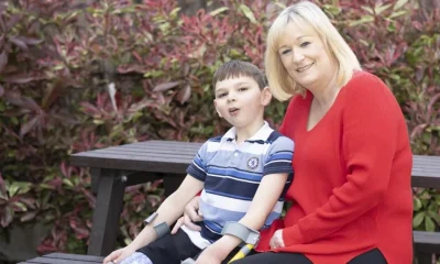
For more than a decade, families, clinicians and coroners have warned that allergy safety in our schools is too often left to chance. During that time, children have died. My son Benedict was one of them.
In the years since his death, we have campaigned for what has become known as Benedict’s Law, a straightforward set of protections: spare adrenaline auto-injectors in every school, proper allergy training for staff, and clear whole-school policies so that everyone knows how to respond in an emergency. These are basic safeguards that most parents assume already exist.
This week, the Government launches a consultation on new statutory guidance for supporting pupils with medical conditions and allergies. That is a significant moment. After years in which allergy safety struggled to gain political attention, Ministers have listened. The commitment to strengthen guidance shows that this issue is finally being taken seriously.
From September, schools in England will be expected to have clearer allergy policies, ensure staff are trained to recognise anaphylaxis, and strengthen arrangements around emergency medication. That will make children safer, it will provide clarity for schools and it marks real progress.
But guidance is not the same as law.
In Benedict’s case, his school did not have spare allergy pens available and the signs of anaphylaxis were not recognised quickly enough. Adrenaline was administered too late to save his life. These systemic gaps were the result of inconsistent standards and unclear expectations, not the failings of individual teachers.
The new guidance addresses much of that ambiguity, and is to be welcomed. But there remains a crucial difference between statutory guidance and legislation.
While statutory guidance sets expectations, they do not create a legal duty and are not legally enforceable. Guidance does not guarantee funding and it does not ensure consistent implementation in every school. Legislation does.
If the core elements of Benedict’s Law are written into statute, schools would be held to a clear, consistent standard. Crucially, funding would accompany that duty. That matters because schools are not operating in equal financial circumstances. Headteachers today are managing SEND pressures, attendance challenges, safeguarding responsibilities and rising costs within increasingly tight budgets. Schools in more deprived communities or carrying existing deficits are under particular strain. Asking them to implement additional medical safeguards without funded support risks creating uneven provision. In those circumstances, even strong statutory guidance can leave gaps.
Some schools will be able to go further and faster. Others may struggle to meet expectations. The result could be a postcode lottery of protection, where children with allergies in more affluent areas are better safeguarded than those in communities already facing disadvantage. We know from Dr Paul Turner’s published research that altering the distribution model of allergy pens -by providing them directly to schools rather than an oversupply of extras to young pupils – can release enough funding to pay for spare adrenaline devices, meaning no extra cost burden on the treasury. Delivering safer spaces at no extra cost has to be something universally supported.
The recent vote in the House of Lords recognised the need for government to go further. Peers supported an amendment to the Children’s Wellbeing and Schools Bill that would write the protections of Benedict’s Law into legislation and provide the funding mechanism to support delivery. When that amendment returns to the House of Commons it offers MPs an opportunity to build on this constructive step forward.
We are closer than ever to allergy-safe schools. Progress has been made. The government has showed it takes the protection of children with allergies seriously, the question now is whether we can secure that progress in a way that guarantees equal protection for every child in every classroom, for children like our son.
Benedict’s life mattered. His death must matter too.
Labour MP’s husband in China spy investigation
“Labour was plunged into a fresh China spying crisis on Wednesday after an MP’s husband was arrested. Lobbyist David Taylor, who is married to Labour MP Joani Reid, was held by Scotland Yard on suspicion of assisting a foreign intelligence service. Police also picked up two other men, believed to have been advisers during the Tony Blair government, during a series of raids. All three suspects were being questioned on suspicion of helping Chinese intelligence amid claims of ‘foreign interference targeting UK democracy’. The shock development threatened to reignite the row over Labour’s relationship with Beijing after the collapse of an unrelated prosecution of a parliamentary researcher and his English teacher friend who were accused of passing on Whitehall secrets.” – Daily Mail
- MP not seen anything to suspect husband has ‘broken any law’ – BBC
- Tories redouble demands on Labour to axe approval for Beijing mega-embassy in London in wake of latest shock spying allegations – Daily Mail
Iran 1) Allies dismay at “weak” UK response
“Britain’s allies in the Gulf and Cyprus have accused Sir Keir Starmer of failing to do enough to protect the region and UK citizens from Iranian missile strikes. The Times has been told that Bahrain and the United Arab Emirates have concerns about the UK’s response to the Middle East conflict. At the same time Cyprus’s high commissioner to the UK said the “least” his country expected was for the government to provide a robust defence of the island that is home to two British bases.” – The Times
- US did not share details with the UK before attacking Iran, sources say – The Guardian
- Stock markets and oil prices still volatile over fears Iran war may drag on – BBC
- How attacking Iran may help Netanyahu’s election chances – The Times
>Today: Bob Seely on Comment: Starmer’s standing by his principles and defending them, but he’s confused and not defending us
Iran 2) Badenoch calls for stronger action
“Sir Keir Starmer has defended the government’s approach to the conflict in Iran, saying protecting British nationals is his “number one priority”. It comes after President Trump criticised the prime minister for refusing to allow the use of UK bases in the initial US-Israel strikes on Saturday, saying he is “no Winston Churchill”. During Prime Minister’s Questions Conservative leader Kemi Badenoch accused Sir Keir of “asking our allies to do what we should be doing ourselves” by not taking “offensive action” after British bases in Bahrain and Cyprus were attacked. But the PM said he was not prepared for the UK to join a war without “a lawful basis and a viable, thought-through plan.” – BBC
- First UK government flight for Britons stuck in Middle East yet to take off – BBC
- Starmer’s slow start in the war against Iran could leave UK playing catch-up – The Guardian
- Iran war has exposed the depths to which our once all-conquering Royal Navy has been allowed to sink – Leader, The Sun
- Britain’s shrunken armed forces are an embarrassment – Leader, The Times
>Today: ToryDiary: Shadow Cabinet League Table: Badenoch may not be popular with Starmer but she’s dominant with Conservatives
>Yesterday: Video: PMQs: Badenoch “The PM is catching arrows not dealing with the archers”
Iran 3) Miliband led Cabinet revolt against war
“Ed Miliband led Cabinet opposition to US military action in Iran and the use of Britain’s bases. In a meeting on Friday ahead of the strikes, Mr Miliband, Rachel Reeves and Yvette Cooper are understood to have strongly opposed British support for pre-emptive military action, which they believed would be illegal. Sir Keir Starmer backed them, and resisted pressure from Donald Trump to allow the US to fly bombing runs to Iran from RAF bases in Gloucestershire and the Chagos Islands. The Prime Minister changed his position less than 48 hours later and American B-2 stealth bombers are due to arrive at Diego Garcia, the military base in the Chagos Islands, in the next few days to fly “limited, defensive” missions.” – Daily Telegraph
Iran 4) US submarine sinks Iranian warship off Sri Lanka
“A torpedo fired by a US submarine sank an Iranian warship off the south coast of Sri Lanka as the Trump administration followed through on its threats to destroy Tehran’s military and political leadership. At least 87 Iranian sailors were killed in the attack on the Iris Dena on Wednesday. The frigate was sailing in international waters as it returned from a naval exercise organised by India in the Bay of Bengal. The torpedo strike prompted questions from former US officials about whether Washington’s aim of eliminating all of Iran’s military breached international law.” – The Guardian
- Ground invasion launched against Iran as thousands of US-backed Kurdish fighters storm border – Daily Mail
Iran 5) Neil: Starmer has made a grave error
“International law may be an opaque, malleable, even mysterious construct with controversial rulings involving judges sometimes appointed by dictators. But when it comes to a choice between international law and the national interest, Starmer chooses international law every time. Request denied, the Americans were told. Cue the biggest crisis in Anglo-American relations of modern times. Donald Trump lashed out at Starmer from the Oval Office on Tuesday. He lumped Britain with the viscerally anti-American socialist government of Spain. He painted us as far worse even than the usually US-sceptic French. Nowhere near as good as the Germans, whose Chancellor was sitting beside him, offering no words in Starmer’s defence. So much for all that cosying up to Europe. Now you don’t have to agree with everything Trump said – far from it – to recognise Starmer had made a grave error.” – Andrew Neil, Daily Mail
Other comment
- What does victory in Iran look like? Here are three possible answers – Tobias Ellwood, Daily Telegraph
- By betraying our allies, Starmer is demonstrating he is our Neville Chamberlain – Dan Hodges, Daily Mail
- As the liberal order dies, Starmer’s Britain is doubling down on its stupidity – Allister Heath, Daily Telegraph
- The Iran war may be lawful, but not for the reasons Trump gives – Geoffrey Robertson, Daily Telegraph
- The cynical opportunities of ‘Epic Fury’ – Martin Wolf, Financial Times
- The terrifying gap in Britain’s defences that means Iran could launch drones at our towns and cities – Jake Wallis Simons, Daily Mail
- The PM must publish the Iran legal advice – Leader, Daily Telegraph
- Women’s celebration of tyrant Khamenei’s death was joy to behold – Janice Turner, The Times
- I am sick of the US bossing us about – Peter Hitchens, Daily Mail
- Trump is pushing Britain closer to Europe – Leader, The Guardian
Ex-Labour mayor and councillor join Reform UK
“Former Labour mayor of Newham Sir Robin Wales and ex-councillor Clive Furness have joined Reform UK. Furness has been selected as the Reform’s candidate for mayor of Newham, while Sir Robin will act as the party’s London director of local government. Announcing the move at a press conference alongside Reform leader Nigel Farage, Sir Robin, who was the UK’s longest serving mayor when he was deselected by Labour in 2018, said the party had “a lot of rough edges” but represented a chance to “transform our society”. Furness said the “balkanisation of Britain”, with people voting along religious and racial lines, was among the reasons he was joining Reform.” – BBC
- Reform pledges to give Wales lowest income tax in UK – Daily Telegraph
- Reform would prioritise Welsh people for social housing, party says – BBC
Mahmood warns Labour MPs to back laws to stop illegal migration or lose trust
“Failing to stop illegal migration will demolish trust in the state, the home secretary will warn on Thursday as new legislation to scale back asylum support is introduced in parliament. In a call on Labour MPs to back her, Shabana Mahmood says that without changes there would be a rise of “ethno-nationalism” on the “far right”. Despite calls from some backbenchers for a tack to the left after last week’s by-election loss to the Greens, she rejects pandering to “student politics”. Mahmood is expected to acknowledge voters’ frustration with levels of illegal migration after last year became the second-highest on record for small-boat arrivals, at 41,472.” – The Times
- Foreign criminals will be thrown out of taxpayer-funded hotels – Daily Telegraph
- Restoring order at the border speaks to Labour values. Without that, we won’t be able to do anything else at all – Shabana Mahmood, The Guardian
OBR warns Government will struggle to cushion energy price surge
“The UK government is poorly positioned to cushion the blow to households from surging energy prices given the mountain of public debt it is trying to manage, a top economist has warned. David Miles, a senior official at the Office for Budget Responsibility, said this week’s jump in oil and gas prices driven by the war in Iran was “unambiguously bad” for a major energy importer such as the UK and that it would be “understandable” if there was public pressure for the government to intervene if energy costs continued to spiral upwards. But he added that it came at a “particularly difficult time” given that the government had been attempting to bring borrowing down and stop the debt-to-GDP ratio from continuing to rise.” – Financial Times
- Another gas shock and Europe’s still not ready – Juliet Samuel, The Times
Labour waters down ‘Islamophobia’ definition to head off a free speech backlash
“Labour has watered down its controversial “Islamophobia” definition to head off a free speech backlash. Ministers have struck out references to the “racialisation” of Muslims amid concern it is a vacuous term that could be weaponised to silence critics of the religion. The phrase was included in the original definition drafted by a working group but is not expected to make the final version when it is published as soon as next week. Despite pressure from community leaders, Labour has also refused to use the word “Islamophobia”, opting instead to define “anti-Muslim hatred”. Wrangling over the wording has dragged on for more than a year, despite Labour pledging an Islamophobia definition in its election manifesto.” – The Sun
Other political news
- Phillipson launches review into surging anti-Semitism in schools – Daily Telegraph
- Burnham drops new leadership hint – Daily Express
- Lobbyists send legal threats to councils over anti-wood burner campaigns – The Guardian
- Describing workplaces as ‘competitive’ is too masculine, says Labour – Daily Telegraph
- Green Party faces gender-critical group lawsuit over trans ‘witch-hunt’ – The Times
- BBC to call for permanent charter and end of political appointments to board – The Guardian
- Reeves’s claim of £1,000-a-year boost ‘may be as little as £40’ – The Times
- Councillors scrap 2050 carbon neutral target – BBC
- Police Federation boss is arrested for corruption – Daily Mail
- Asylum seekers waiting over a year for claim in UK may be allowed to work under new measures – The Guardian
- Migrants will have to speak English to A-level standard before they can settle permanently in Britain – The Sun
- 60% of Welsh voters unaware of how new system will work in May elections – The Guardian
- Minister fails to say if Labour will bring down benefits bill – The Times
- Revealed: the student loan reforms backed by Labour MPs – Daily Telegraph
News in brief
- ‘Whose side are you on?’: How Keir Starmer alienated Britain’s allies over Iran – Tim Shipman, The Spectator
- Free trade among free nations – Pierre Poilievre, CapX
- Who is Keir Starmer without Morgan McSweeney? – Ailbhe Rea, New Statesman
- Reform is making a mistake on Iran – Ben Sixsmith, The Critic
- Is this the end of Hezbollah? – Michal Kranz, Unherd


As we stand on the threshold of rebirth, will the government listen to the thousands of people who demand change, writes Emma Slawinski, CEO of the League Against Cruel Sports
This month the Secretary of State for the Environment, Emma Reynolds, is due to launch Defra’s long-teased consultation on banning trail hunting, in a bid to tighten up existing hunting laws in England and Wales.
But we’ve been here before.
On April 1 last year, animal welfare organisations were promised that there would be a consultation on strengthening hunting laws “later this year”.
We were April fooled.
Then, when the government’s Animal Welfare Strategy landed just before Christmas, the minister for animal welfare, Baroness Sue Hayman, said: “We are working out the best approach to take the ban forward and will run a consultation to seek views in the new year.”
Apparently that New Year’s resolution held as firmly as a Christmas trifle.
Now, as we stand at the threshold of the season of nature’s rejuvenation, we are renewing our calls for proper hunting laws to protect our wild mammals and to see a rebirth of this government’s commitment to doing so.
Make no mistake, every time this consultation is delayed, and the legislation that must surely follow, more innocent animals are condemned to death. Hunts will continue to persecute not just foxes, but deer, otter, mink, and hares. Animals will suffer, and they will die. It is unacceptable, but it seems we are expected to wait patiently while the government and Defra dithers and delays yet again.
Since the government came to power the League Against Cruel Sports has compiled 648 individual reports of foxes being chased. That’s 648 times a wild mammal has been pursued by a pack of hounds since a government that has specifically pledged to stop illegal hunting has been in power.
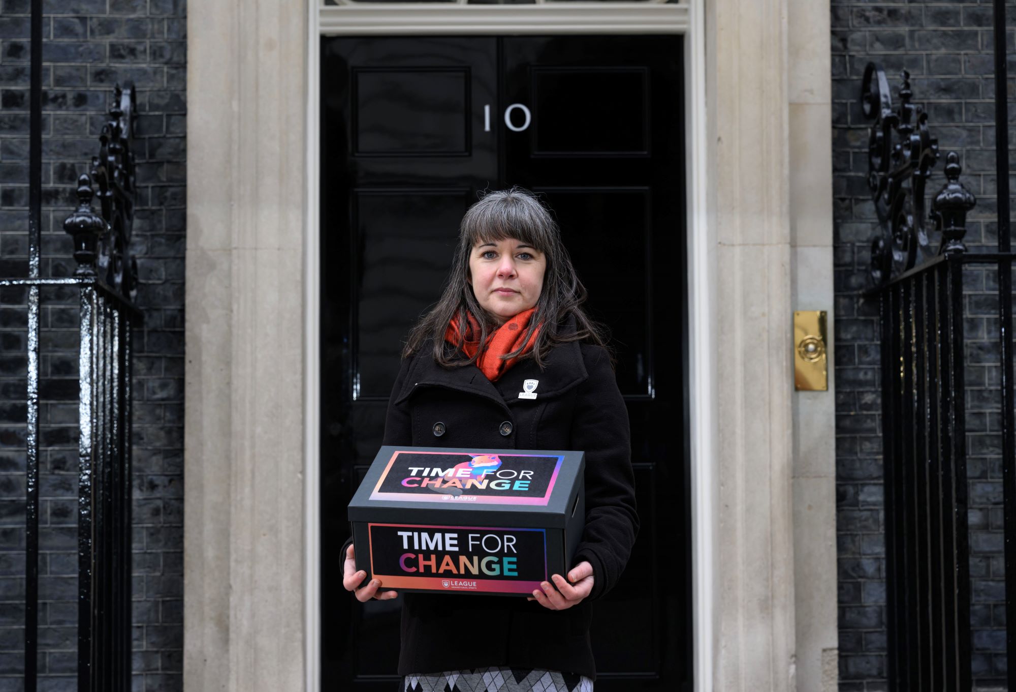 On February 18, 2025, on the twentieth anniversary of the Hunting Act coming into force, we delivered a petition signed by 104,000 people urging the government to close the law’s myriad loopholes and properly ban hunting.
In January this year, with still no movement from Whitehall we wrote an open letter to Sir Keir Starmer and Emma Reynolds with a view to handing it in at Number 10 this February.
In just four short weeks more than 36,000 people, including other animal welfare and environmental organisations, signed it.
When it comes to strengthening hunting laws and banning so-called ‘trail’ hunting, most people think a stronger law is a better law. Polling carried out by FindOutNow and Electoral Calculus in 2024 showed 76 per cent support stronger hunting laws.
And they expect action, not further delays.
Those who defend hunting wild mammals with dogs will use any argument to prevent the law being strengthened, including trying to obfuscate the overwhelming evidence that time is up for trail hunting: The public are on our side. The police are on our side. Most MPs are on our side.
This government was elected with a manifesto pledge to end hunting. It could not be clearer that the time for change is now. Further delays are no longer acceptable. It is time to end hunting.
Find out more about the consultation at league.org.uk/hunting_consultation

Private Eye put not one, not two, not three — but FOUR — mocking spins on the image of Donald Trump, Secretary of State Marco Rubio and CIA Director John Ratcliffe in a makeshift situation room at the president’s luxury Mar-a-Lago resort during the start of U.S.-Israel military operations against Iran this weekend.
The satirical magazine reproduced the image below, with speech bubbles coming out of the trio, four times, under the headline “Trump Attacks Iran: How Operation Epic Fury Unfolded.”
See the cover on Instagram.

In one picture, Ratcliffe is depicted asking “Is the Supreme Leader dead?” And Rubio replies: “No, Trump always looks like this.”
In another, Ratcliffe boasts “Mission accomplished,” to which Trump, wearing a white “USA” cap, replies “Yes, I’ve killed the Epstein story.”
A third picture shows Ratcliffe asking, “What happens next?” Trump says, “Popular revolt and regime change,” and Rubio replies, “In America.”
The final image shows Ratcliffe asking Trump: “Why have you started this war?”
Trump replies: “So that I can stop it.” Rubio responds, “I’ll ring the Nobel committee.”
The cover was hailed by commenters on Instagram as “Absolutely spot on,” “brilliant” and “so bloody true.”
Private Eye has ripped Trump on countless occasions before, previously poking him over his failure to broker an end to Russia’s invasion of Ukraine (despite vowing to do so in his 2024 campaign) and trolling him with a sarcastic message on his return to the White House.
Rigetti Computing (RGTI) Stock: Revenue Miss Doesn’t Shake Analyst’s 142% Upside Forecast

MI6 Veteran Condemns Trumps Unnecessary Iran War
Tony Bellew sums up Conor Benn fighting Regis Prograis on his Zuffa debut

Smart energy pays enters the US market, targeting scalable financial infrastructure

Why Israel is blocking foreign journalists from entering

Bitcoin: We’re Entering The Most Dangerous Phase

Bitcoin pumpt auf 72.000$. Warum ich trotzdem NICHT einsteige

5 Financial Mistakes Keeping You Poor #finance #moneytips #wealthmindset #success #Budgeting

ASX down in global sell-off as South Korea’s Kospi crashes | Finance Report | ABC NEWS
-
 Politics6 days ago
ITV enters Gaza with IDF amid ongoing genocide
-

 Politics2 days ago
Alan Cumming Brands Baftas Ceremony A ‘Triggering S**tshow’
-

 Fashion6 days ago
Weekend Open Thread: Iris Top
-

 Tech4 days ago
Unihertz’s Titan 2 Elite Arrives Just as Physical Keyboards Refuse to Fade Away
-
Sports5 days ago
The Vikings Need a Duck
-
 NewsBeat5 days ago
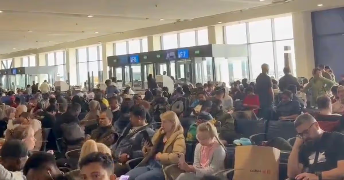
Dubai flights cancelled as Brit told airspace closed ’10 minutes after boarding’
-

 NewsBeat4 days ago
‘Significant’ damage to boarded-up Horden house after fire
-
 NewsBeat5 days ago
The empty pub on busy Cambridge road that has been boarded up for years
-
 NewsBeat5 days ago
Abusive parents will now be treated like sex offenders and placed on a ‘child cruelty register’ | News UK
-

 Tech4 hours ago
Bitwarden adds support for passkey login on Windows 11
-

 Entertainment3 days ago
Baby Gear Guide: Strollers, Car Seats
-
 Tech6 days ago
NASA Reveals Identity of Astronaut Who Suffered Medical Incident Aboard ISS
-

 Business7 days ago
Only 4% of women globally reside in countries that offer almost complete legal equality
-
Politics4 days ago
FIFA hypocrisy after Israel murder over 400 Palestinian footballers
-
 NewsBeat4 days ago
Emirates confirms when flights will resume amid Dubai airport chaos
-

 NewsBeat3 days ago
Is it acceptable to comment on the appearance of strangers in public? Readers discuss
-

 Crypto World6 days ago
From Crypto Treasury to RWA: ETHZilla Retreats and Relaunches as Forum Markets on Nasdaq
-

 Tech4 days ago
Viral ad shows aged Musk, Altman, and Bezos using jobless humans to power AI
-
 Business7 days ago
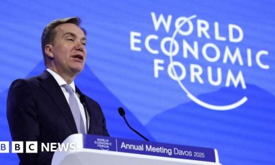
World Economic Forum boss Borge Brende quits after review of Jeffrey Epstein links
-

 Video3 days ago
How to Build Finance Dashboards With AI in Minutes