
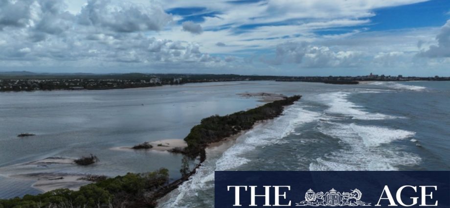
“It’s only when you’re standing on this fragile 15-metre wide barrier that’s between us and the ocean that you really get what’s going on.”
Local historian John Groves – who, like Kettleton-Butler, is a member of the Pumicestone Passage Catchment Management Body – has researched changes going back to 1890.
“I’ve got over 60,000 photos of the Sunshine Coast, so I had enough photos to put the book together,” Groves said.
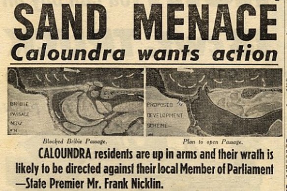
A Sunday Telegraph clipping from 1964 details community backlash after the northern end of Pumicestone Passage was filling with sand.Credit: John Groves
“It’s all it’s from the locals who were here at the time – a lot of them have passed away now, but they gave me the photos and the stories.
“The public here have been trying since 1969 to get something done about it.”
Associate Professor Javier Leon, a physical geographer at the University of the Sunshine Coast, said the 2022 breakthrough on Bribie Island was “obvious” in hindsight, but erosion was difficult to predict.
Loading
“Bribie has been moving and changing for thousands of years now – 5000 years or more – and then you have short-term events acting on top of that,” he said.
Leon said cyclones were likely behind most large-scale changes to the island, but that localised erosion had chipped away low-lying areas to form the two breakthroughs.
“It’s a very dynamic environment, it just keeps changing all the time,” he said.
Locals have raised issues with the lack of intervention to prevent sand movement around the entrance, as well as water quality in the northern end of the passage.
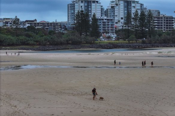
People walking across the old Caloundra Bar, off the Bulcock and Happy Valley beaches, during low tide, in March this year.Credit: Bluey’s Photography
Two petitions were handed to the Department of Environment, Tourism, Science and Innovation earlier this year asking for reviews into the water quality behind the now-blocked old Caloundra bar.
Locals said runoff from Caloundra had introduced bacteria to the system, and a reduced water flow through the area could cause it to build up.
Environment Minister Andrew Powell responded to the petition in a letter released on Thursday, stating tests had shifted to a monthly schedule, and testing had “not shown any substantial decline in environmental water quality”.
The northern tip had almost silted over in the 1960s, prompting the University of Queensland to create a scaled model for mapping future changes.
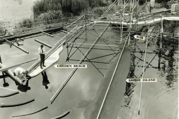
Scientific modelling of the Caloundra bar, in Pumicestone Passage, by the University of Queensland.Credit: John Groves
Kettleton-Butler said the PPCMB was worried the waterway could fill with sand again, undermining its natural beauty, which was also a drawcard for tourists.
The northern end of Bribie Island is popular with campers, off-road drivers and day-trippers.
While the review has yet to officially open, Bleijie said the community would be involved from the beginning.
Loading
“Terms of reference will be drafted in consultation with the local government and also the community associations representing this beautiful part of the Sunshine Coast,” he said.
“I want the terms of reference to be as broad as possible, so [the] community can have a say.”
The PPCMB was due to host an information evening on Monday night.
