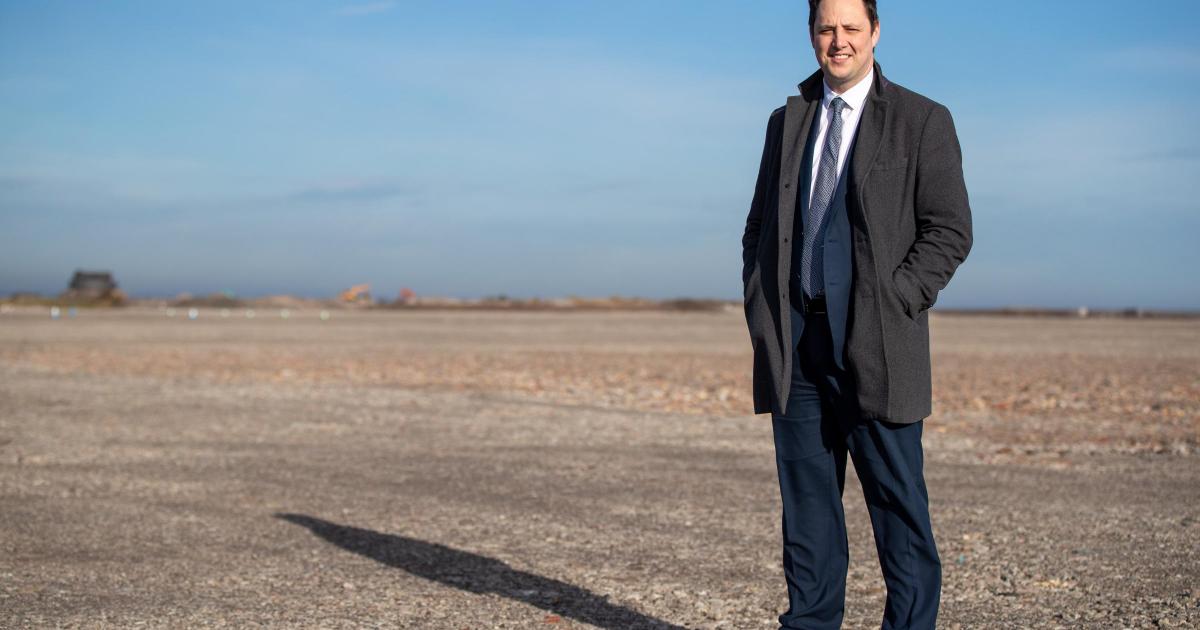
The draft budget proposals for 2026/27, which are currently out for consultation, include a major rise in Conservative Mayor Ben Houchen’s office budget, most of which is set aside for paying employees.
TVCA has attributed the increase to “a previous period of understaffing”.
The total mayoral office budget will rise from £272,000 in the current financial year (2025/26) to £486,000 in the upcoming financial year, from April 1.
Advertisement
The sum is broken down into different categories, with the big change coming in expenditure on employees, which is set to see funding increase from £263,000 to £452,000, providing that the budget is approved later this month, following the current period of consultation.
The total mayoral office budget figure then rises by £12,000 to £13,0000 each year within the medium term financial plan, which can be put down almost entirely to expected pay awards for employees in Mayor Houchen’s office.
The other changes from this current financial year to 2026/27, within the mayoral office budget, include an increase from £9,000 to £13,000 in the transport budget, while new features for the upcoming year see £1,000 assigned for “supplies and services” and £20,000 for “support services charge”.
TVCA was contacted about the large increase in the mayoral office budget.
Advertisement
A spokesperson said: “This change in budget reflects a previous period of understaffing and an expected move towards more standard staffing levels in future years.
“As the draft budget makes clear these costs are funded directly from central government grants and not from local taxpayers.
“The mayor has repeatedly made clear he will never impose a mayoral tax, unlike in other regions where taxpayers are forced to pay millions of pounds to their combined authority.”
Professor Ramani Moonesinghe, national clinical director for critical and perioperative care at NHS England, said: “Staff across the NHS will be doing everything they can this week to keep patients safe and ensure people can continue to get the care they need,” said Prof Moonesinghe.
We have picked out two well-fancied horses we like, as well as an outsider that could go close at a big price
15:11, 05 Apr 2026
Advertisement
The BoyleSports Irish Grand National is the richest race in the Irish jump racing calendar and has a roll of honour that includes Desert Orchid, Bobbyjo and a number of subsequent Aintree Grand National winners.
Picking the winner is not always easy, though. In 2021 and 2022, Dermot McLoughlin trained 150/1 and 40/1 winners of the race, much to the delight of bookmakers.
The last two winners have gone off at 13/2, though, so choosing the best betting strategy is difficult.
With this in mind, we have picked out two well-fancied horses for the race, as well as an outsider that could go close at a big price.
Advertisement
Solider In Milan 8/1
It would have been hard to imagine that Solider In Milan, less than a year after winning a bumper at Punchestown, would be lining up in the Irish Grand National.
This Emmet Mullins-trained horse was well backed to beat none other than King Rasko Grey, winner of the Turners’ Novices’ Hurdle at Cheltenham, in the aforementioned bumper, before connections took the bold step of going straight over fences.
He has been brought along steadily this season, and the feeling is that this race was the plan all along. The seven-year-old’s lack of experience is a concern, but he certainly has the class to be involved.
Advertisement
Goraibhmaithagat 14/1
Colm Murphy has been in the game for a long time and has trained some brilliant horses, not least the likes of Brave Inca and Big Zeb.
But after many quiet years, he has quality stock in his yard again, and many of them are running this weekend.
Zanoosh looks to hold very strong claims in the Honeysuckle Mares’ Novice Hurdle, and Goraibhmaithagat could win the big one.
Advertisement
Goraibhmaithagat showed plenty of ability over hurdles but was not highly tried, and has been brought along steadily over fences ever since.
Always looking like a step up in trip would suit, the money came for the JP McManus horse in the Leinster National last time, only for the gelding to be caught on the line.
You get the sense, though, that this horse is improving with every run over fences and could still be well ahead of his mark.
Weveallbeencaught 40/1
Advertisement
There have been plenty of surprise winners of this race in recent years, and Weveallbeencaught might be the next.
Compared to some of the unexposed novices in this line-up, Weveallbeencaught has shown his hand many times to the handicapper, but he looks an ideal type for this sort of marathon challenge.
Formerly trained by Nigel Twiston-Davies, this nine-year-old gelding has been reinvigorated by a switch to Eric McNamara’s Limerick yard this season.
After finishing second in the Munster National in October, he was disappointing at Leopardstown over Christmas but showed plenty of spirit when running a gallant race to finish seventh in the Kim Muir Handicap Chase at Cheltenham.
Advertisement
The Irish handicapper has given him a chance, and while many might crumble under the demands of this race, Weveallbeencaught looks tailor-made for the challenge.
Yang Haiming didn’t stop working when he retired from the coal mines at age 60. Instead, he jumped into a new industry.
Yang is part of a generation of workers that powered China’s growth by digging coal from underground mines in Datong, a city known as China’s coal capital in the northern province of Shanxi. Now, as China prioritizes renewable energy over coal, Yang is ahead of the change his fellow workers are being forced to confront.
He now runs a restaurant that sells lamb skewers to tourists visiting the Yungang Grottoes, a historically significant 6th century site featuring Buddhist carvings in caves that draws millions of visitors a year.
Shanxi province would be the world’s larger producer of coal if it were its own country. Its roughly 800,000 miners dug 1.3 billion tons in 2025, or nearly one-third of China’s coal. A few million more people work in jobs that rely indirectly on coal, ranging from logistics to restaurants. The province will see crucial change as China adds renewable energy so fast it covered almost all of the nation’s growth in power demand last year, and growing tourism is a major goal.
Advertisement
Experts say it’s vital to make sure coal workers don’t get left behind — a worry for many.
“It doesn’t feel like money’s coming into this industry,” said Zhou Hongfei, a coal miner.
Coal town’s evolution
As is typical for China’s state-owned enterprises, the coal company built Yang’s village right next to the mine — called No. 9 — that its residents would work. The place once hummed with thousands of workers and their families, with a school, a day care and a sports center. An elevated rail line passes through to carry coal to the rest of the country.
Advertisement
These days, the No. 9 mine is mostly a museum, though a section is still being worked. The school is empty, its gates locked. Many of the low-rise apartment blocks are only partially filled, often not by miners but by people attracted to cheap housing.
Yang recalls prosperous years before surrounding villages were dismantled.
“There were so many people, especially during the new year days,” he said. “It was crowded everywhere. Now the bustling scenes have gone, and so has the feeling.”
Those who stayed behind, like Yang, have tried to capitalize on visitors to the Yungang Grottoes. On a day when Associated Press reporters visited, one retired coal miner walked the street striking up conversations in hopes of bringing customers to his noodle shop. Mostly elderly people walked in the street, soaking up the sun.
Advertisement
Transitioning to tourism is difficult
Yang is in the minority of workers who’ve managed to make a transition.
There are many “who don’t know what to do, who say they don’t have the right skill sets for anyone else. All they know is to be a coal miner, or the easiest fallback option is for them to go back to farming,” said Tom Wang, a Shanxi native, environmental activist and founder of People of Asia for Climate Solutions.
Zhou, 36, said he thought about switching to tourism but didn’t know how. And he worries about supporting his wife and 8-year-old daughter.
Advertisement
“To really be able to make contact with and then switch into a new industry is very hard, and the truth is, I don’t dare,” he said. “If you leave this industry, you don’t know if it’ll work out. Can I adapt? And what if this ends up being a burden for my family?”
Mining wages rise and fall with demand. Before Yang retired eight years ago, he earned up to 10,000 renminbi (about $1,450) in a good month. He said he earns more now from his restaurant.
The province is trying to develop several alternative industries, from investing in coal-to-hydrogen projects to promoting its native “youmai,” a type of oat used by locals to make a special type of noodles.
But Shanxi’s major focus and biggest success for life after coal has been tourism. Hang Kan, who directs the Yungang Research Institute that oversees the grottoes and is a representative in the National People’s Congress, last year called for accelerating development of the culture and tourism industry into “a strategic pillar” that “promotes people’s welfare” in Shanxi.
Advertisement
His remarks came after the blockbuster video game Black Myth: Wukong, in which the lead character visits the grottoes and many nearby sites, caused a spike in visitors. The number jumped to 4.5 million in 2024, up from 3 million the year before, according to state media.
Yan Jiali, a tour guide in the region, said that boom has caused rising interest in jobs like hers, which requires a government test to become licensed.
“Even my mom’s friends would come ask me about taking this test,” she said.
Wang, the activist, is hoping that the high-tech industries that are now the nation’s priority will help Shanxi’s transition by providing jobs. After all, he said, the province’s coal powered China’s transformation into an economic powerhouse.
Advertisement
“What if DeepSeek comes over to Shanxi and says, OK, we will start a data center here? What if Baidu comes over to Shanxi?” he said, referring to China’s homegrown tech companies.
Coal remains important
Few think Shanxi can leave coal mines behind completely. Experts see coal as a critical safety net for China’s security needs, and the Iran war has once again highlighted just how vulnerable energy supply chains are to disruptions.
The government recently declined to cap how much coal can be used, walking back its commitment to gradually reduce coal consumption, according to analysts at the Centre for Research on Energy and Clean Air.
Advertisement
“The confidence hasn’t grown to the point where they can entirely depend on renewable energy,” said Qi Qin, an analyst at CREA.
In fact, China has continued to build out coal power plants at a massive scale, bringing online 78 gigawatts in 2025, more than India did in a whole decade. One gigawatt can power about 320,000 Chinese households for a year.
Even if demand doesn’t fall, workers also have to worry that their mines will play out. Some of the older mines in Datong are near the end of their lives. When that happens, workers can be reassigned to other mines that may be far away and pay less.
Another coal mine worker, Xu, has taken a second job as a ride-share driver, spending about 5 hours a day behind the wheel after his day job ends. Xu — who declined to give his full name for fear of repercussions from the state-owned mine — said he doubted that the benefits of the industries replacing coal will be spread evenly, whether it’s tourism or renewable energy.
Advertisement
“This tourism industry, how do I get in there?” he asked. “For Datong, those who can enjoy the benefits of this tourism boom, it’s mostly the big hotels and maybe some restaurants, noodle shops, but what do you think regular people can get?”
___ The Associated Press’ climate and environmental coverage receives financial support from multiple private foundations. AP is solely responsible for all content. Find AP’s standards for working with philanthropies, a list of supporters and funded coverage areas at AP.org.
Ministers claim the reforms will address what they call “perverse incentives” that, in their view, have encouraged people to remain on benefits without getting proper help to move into employment.
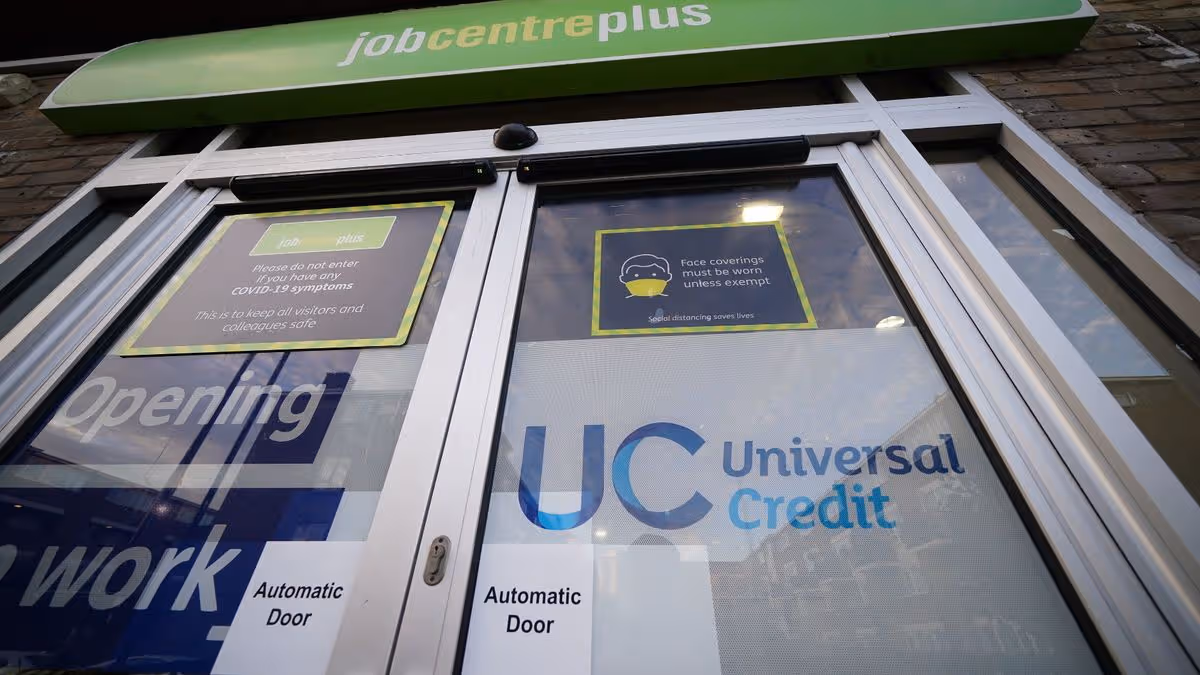
From Monday, new applicants for the health component of universal credit (UC) will receive a lower rate of £217.26 a month.
Universal credit is a benefit to help with living costs, available both to people in low-paid work and to those who are unemployed or unable to work.
Advertisement
People with the most severe, lifelong conditions, people nearing the end of life, and all existing UC health claimants will continue to receive the higher monthly rate of £429.80.
The change will save taxpayers around £1 billion, the Government has said.
Statistics published last month showed there were 2.7 million people on UC assessed as having limited capability for work and work-related activity (LCWRA) across England, Scotland and Wales.
People in this category are not required to undertake any interviews or work-related activity.
Advertisement
The Government has pledged that its investment in tailored employment support can offer people opportunities, supporting them to move into and stay in work “rather than leave people stuck on benefits”.
Also this week, the standard rate of UC will be boosted, in what ministers have said is an effort to “bear down on the cost of living”.
It said this will result in almost four million households on the standard rate of UC getting around £295 extra this year in cash terms.
Social security and disability minister Sir Stephen Timms said: “The welfare system we inherited has for too long locked disabled people and people with long-term conditions out of work.
Advertisement
“Laws coming into force today will change that, reducing projected expenditure on universal credit by almost £1 billion.
“Simultaneously boosting the standard allowance and investing £3.5 billion in employment support means we’re creating a welfare system that backs people to work and helps them build a better future.”
Last year, ministers were forced to climb down on plans to also reform disability benefits, including for those with mental health conditions, in the face of backbench Labour opposition.
Advertisement
Instead of immediate reform, the Timms review is seeking views on personal independence payment (PIP) and how it works.
Ministers have promised that any changes to the benefit, which helps with extra living costs for people who have a long-term physical or mental health condition or disability and difficulty doing certain daily tasks or with mobility because of their condition, have been postponed until after that takes place.
The review is expected to report to Work and Pensions Secretary Pat McFadden by autumn, with the Government stating that an interim update will come ahead of that.
With household bills and petrol and diesel prices set to rise further, budgets are stretched. But there is some help on the way.
With household bills, petrol and diesel prices rising, we’re all feeling the pinch. Broadband payments, TV licences, council tax and water all look set to go up.
Advertisement
And with the ongoing war in the Middle East affecting petrol and diesel prices, budgets could be stretched even further. The ongoing conflict could lead to food inflation reaching at least 9 per cent by the end of the year, up from the 3.2pc that economists for the Food and Drink Federation forecast in September last year.
Get MEN Premium now for just £1 HERE – or get involved in our WhatsApp group by clicking HERE. And don’t miss out on our brilliant selection of newsletters HERE.
Prime Minister Sir Keir Starmer last week said he knew people were worried about how the war will impact them and their families. He said: “I want to reassure them that they have a Government on their side, working with allies on de-escalation and bearing down on the cost of living.
Advertisement
“Today, millions of people up and down the country will see energy bills go down by £117, wages go up for the lowest paid, and more support will be available for people who need it most – because of the decisions this Government has taken.
“But we must go further to bear down on costs, and that means pushing for de-escalation in the Middle East and a re-opening of the Strait of Hormuz. That is the best way we can bring down the cost of living for families and that is my focus.”
Here are all the financial, money and benefits changes from this month.
Advertisement
HMRC Child Benefit to increase
Every year rates go up in line with the rate of inflation from the previous September. In September 2025 this was confirmed as being 3.8%, according to the consumer price index. Child benefit payments are made to parents or anyone looking after a child. They are intended to help you withthe costs of your children.
They are usually paid every four weeks on a Monday or Tuesday, but there are different payment dates if it’s due on a bank holiday. You can getChild Benefit paid weekly if you’re a single parent or if you or your partner are getting certain benefits, such as Income Support.
You can get Child Benefit if you’re responsible for bringing up a child who is under 16 years old or under 20 years old and still in approved education or training. Only one person can receive Child Benefit for a child. Here is how much it is going up by from April 6.
Advertisement
Payments for the first or eldest child: increasing from £26.05 a week to £27.05 a week
Payments for any additional child: increasing from £17.25 a week to £17.90 a week
State Pension payments to go up
State Pension payments are set to rise by up to £44 a month from April as the new financial year begins. Pensions will increase in line with the average earnings growth figure for May to July 2025.
They will be uprated by 4.8% from April 6. State Pensionsincrease each April and the amount they go up by is worked out by the triple lock – a mechanism used to ensure the payment rates rise each year in line with whichever is higher out of inflation, earnings or 2.5%. This is to prevent the value of pensions being reduced by cost of living pressures.
The planned rises for pensions for the 2026/27 financial year (from April 2026) are as follows:
Full New State Pension
Weekly payment: £241.30 (from £230.25)
Four-weekly payment: £965.20 (from £921)
Full Basic State Pension
Weekly payment: £184.90 (from £176.45)
Four-weekly payment: £739.60 (from £705.80)
Rise in DWP Universal Credit payments
Rates of Universal Credit payments are set to go up along with many other DWP benefits. Every year rates go up in line with the rate of inflation from the previous September.
Advertisement
In September 2025 this was confirmed as being 3.8%, according to the consumer price index.Universal Credit is a means-testedbenefit that was first introduced in the UK to replace the old benefits in 2013. By 2018, all new customers were required to apply for UC, while existing legacy benefit customers continued receiving their awards.
Below are the confirmed new monthly rates for Universal Credit due to come into place from April 2026.
Single
Single under 25 from £316.98 to £338.58
Single 25 or over from £400.14 to £424.90
Couple
Joint claimants both under 25 from £497.55 to £528.34
Joint claimants, one or both 25 or over from £628.10 to £666.97
Child amounts
First child (born prior to April 6, 2017) from £339.00 to £351.88
First child (born on or after April 6, 2017) or subsequent children from £292.81 to £303.94
Disabled child additions
Lower rate addition from £158.76 to £164.79
Higher rate addition from £495.87 to £514.71
Limited Capability for Work
Limited Capability for Work amount from £158.76 to £158.76
Limited Capability for Work and Work-Related Activity amount from £423.27 to £217.26
Limited Capability for Work and Work-Related Activity amount (Pre-2026 claimant, severe conditions criteria claimant or claimant who is terminally ill) from £423.27 to £429.80
Carer amount
Carer amount from £201.68 to £209.34
Childcare costs amount
Maximum for one child from £1031.88 to £1071.09
Maximum for two or more children from £1768.94 to £1836.16
Housing cost contributions
Non-dependants’ housing cost contributions from £93.02 to £96.55
Work allowances
Higher work allowance (no housing amount) – One or more dependent children or limited capability for work from £684.00 to £710.00
Lower work allowance
One or more dependent children or limited capability for work from £411.00 to £427.00
New DWP Personal Independence Payment rates
Like Universal Credit payments, Personal Independence Payment (PIP), rates will increase by 3.8% in April. Below are the confirmed new monthly rates for Personal Independence Payment due to come into place from April 2026.
Advertisement
Personal Independence Payment (PIP) & DLA Care Component
Enhanced/Highest Rate: Rising from £110.40 to £114.60 per week
Standard/Middle Rate: Rising from £73.90 to £76.70 per week
The lowest rate of DLA care will rise from £29.20 to £30.30 per week
PIP & DLA Mobility Component
Enhanced/Higher Rate: Rising from £77.05 to £80.00 per week
The standard/lower rate of mobility will rise from £29.20 to £30.30 per week
Pension Credit
Pension Credit is paid to people over theState Pension age who are on a low income and need extra money to help with living costs. The means-tested benefit can also help with housing costs, such as ground rent or service charges. Like other DWP benefits, this will rise by 3.8% in April.
Recipients might also get extra help if they’re a carer, severely disabled, or responsible for a child or young person. Pension Credit is separate from your State Pension, and you can get Pension Credit even if you have other income, savings or own your own home.
Pension Credit recipients can also access other things, such as council tax discounts and free TV licences for over-75s. There are also additional elements available if you’re a carer, you’re disabled, you look after children, or if you have savings and reached State Pension age before April 2016.
Standard minimum guarantee
Advertisement
Single: increasing from £227.10 to £238.00
Couple: increasing from £346.60 to £363.25
Additional amount for severe disability
Single: increasing from £82.90 to £86.05
Couple (one qualifies): increasing from £82.90 to £86.05
Couple (both qualify): increasing from £165.80 to £172.10
Additional amount for carers
Increasing from £46.40 to £48.15
Savings credit
Threshold – single: increasing from £198.27 to £208.07
Threshold – couple: increasing from £314.34 to £329.75
Maximum – single: increasing from £17.30 to £17.96
Maximum – couple: increasing from £19.36 to £20.10
Children
First child born before 6 April 2017: increasing from £78.10 to £81.07
Subsequent children: increasing from £67.42 to £69.98
Disabled child
Lower rate: increasing from £36.54 to £37.93
Higher rate: increasing from £114.12 to £118.46
Polygamous marriage
Amount for claimant and first spouse: increasing from £346.60 to £363.25
Additional amount for each additional spouse: increasing from £119.50 to £125.25
Non-State Pensions (for Pension Credit purposes)
Statutory minimum increase to Non-State Pensions: increasing from 1.70% to 3.80%
DWP Attendance Allowance rates to rise
Like other DWP benefits, Attendance Allowance rates will increase by 3.8% in April 2026. More than 1.7 million people across the UK were receiving additional financial support through Attendance Allowance at the end of February this year.
Attendance Allowance is a benefit paid to people over the state pension age who need help or supervision with personal care due to illness or disability. Rates of Attendance Allowance payments depend on the level of help you need, broken down into a lower rate of payment and a higher rate of payment, both paid weekly.
Attendance Allowance rates from April 2026:
Higher Rate: £114.60 per week (up from £110.40).
Lower Rate: £76.70 per week (up from £73.90).
Minimum wage to rise
Minimum wage will rise again in April. The National Living Wage, the minimum wage rate for all workers aged 21 and over, will rise by 4.1 per cent to £12.71 per hour. The minimum wage for people aged between 18 and 20 will increase to £10.85 and the rate for 16 and 17 year olds will increase to £8.00.
The government said the rate rise will ensure “a real-terms pay rise for low-paid workers” and marks progress towards aligning the rate for 18 to 20 year olds with the National Living Wage.
Advertisement
The new rates from April 2026 will be:
National Living Wage (21 and over): £12.71 per hour – up 50p
Rate for age 18-20: £10.85 per hour – up 85p
Rate for age 16-17: £8.00 per hour – up 45p
Apprentice Rate: £8.00 per hour – up 45p
Millions to pay more in Council Tax
Across England, the average Band D council tax in 2026/27 will be £2,392 – an increase of £111 or 4.9% on 2025-26, according to the Ministry of Housing, Communities & Local Government.
The figures include all additional charges, including adult social care, parish precepts and costs levied by police, fire and regional authorities where appropriate.
It is the fourth year in a row that the England-wide increase has averaged around 5%.
Advertisement
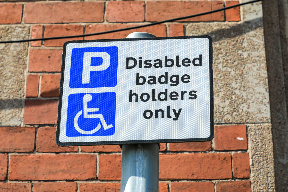
Single-person households qualify for a 25% discount, full-time students can be fully exempt, and those on low incomes can apply for a reduction of up to 100%. Carers and people with disabilities may also qualify. Discounts are not applied automatically, so households need to contact their council to claim.
Households can also contact their local authority to review their bill or spread payments over more months to help manage costs.
Household water bills to increase
Household water bills across England and Wales are to rise by an average of 5.4%, equating to £33 a year for the average household.
There is significant regional variation in bill increases, with Severn Trent customers seeing a 10% increase, Sutton and East Surrey imposing an 11% increase, Bristol Water a 12% rise and Affinity Water (central region) customers warned they have a 13% jump coming.
Advertisement
Around 2.5 million households are eligible for social tariffs, with savings of around 40%.
Monthly broadband and mobile phone prices to rise
BT, EE, Plusnet and Virgin Media are all hiking broadband prices by £4 a month, Sky by £3, and Vodafone by £3.50 – adding nearly £50 more per year to bills.
Additionally, one in four broadband customers are out of contract, paying up to £9 per month more than those in contract.
Household energy prices will fall
The price most households pay for energy will fall by 7% from April 1. Ofgem’s price cap will drop from the current £1,758 to £1,641 – a reduction of £117 or around £10 a month for the average household using both electricity and gas.
Advertisement
However, the reduction is lower than the average £150 cut to bills pledged by the Chancellor in November, when she moved 75% of the cost of the renewables obligation from household bills onto general taxation and scrapped the energy company obligation (Eco) scheme.
There is also increasing concern that energy bills will rise by from July as a result of the Middle East conflict – with latest predictions suggesting this could be by £288 a year.
Car tax has increased
Vehicle Excise Duty (VED) is changing for motorists from this month. The new changes primarily focus on aligning electric vehicles (EVs) with the existing tax system and adjusting rates for inflation. The most notable shift is the end of the “tax-free” era for electric cars, alongside a higher “luxury tax” threshold specifically for zero-emission vehicles.
For most cars registered on or after 1 April 2017, the annual flat rate is also increasing. This rate applies to petrol, diesel, hybrid, and now fully electric vehicles.
Advertisement
The petrol and diesel rate has increased from £195 to £200, while the rate for hybrid vehicles has risen from £185 to £190. Fully electric vehicles have gone from an annual flat rate of £195 to £200.
Cars with a high “list price” (the price before discounts) will pay an additional supplement for 5 years (from years 2 to 6). For petrol, diesel and hybrid cars, the threshold remains at £40,000.
For EVs, the threshold increases to from £40,000 to £50,000. The supplement itself rises to £440 (up from £425).
If your car exceeds these price thresholds, you will pay the £200 standard rate, along with the £440 supplement. If you buy a brand-new car registered after 1 April 2026, the first year of tax is based on CO2 emissions.
Millions of patients face higher NHS dental costs from April 1. From Wednesday NHS dental charges in England have risen by around 1.7 per cent, with the cost of a routine check-up (Band 1) increasing from £27.40 to £27.90.
Band 2 treatments like fillings, root canal treatments and tooth extractions will now cost £76.60, while Band 3 treatments like dentures or crowns will cost £332.10.
Advertisement
From 1 April 2026 the dental charges are:
Band 1 course of treatment and urgent treatments will rise by £0.50, from £27.40 to £27.90.
Band 2 course of treatment, there will be an increase of £1.30 from £75.30 to £76.60
Band 3 course of treatment will increase by £5.40 from £326.70 to £332.10
BBC TV licence costs more
The price of a TV licence went up on April 1. The annual cost of a TV licence is now £180 from £174.50. This will mean a monthly bill of £15, up from £14.54. The cost of an annual colour TV licence will rise by £5.50, or the equivalent of an extra 46p a month.
Every household which watches live TV programming or anything on BBC iPlayer must have a TV licence, but for those who don’t watch these – or don’t have a TV at all – you can declare to the TV licencing company that you do not require a licence.
The odds of winning will reduce from 22,000 to one to 23,000 to one from the April draw, and the interest rate will drop from 3.6% to 3.3%. It comes after several reductions were made to the interest rate in 2025, which was 4% at the start of last year. It was reduced to 3.8% in April 2025, and slashed even further to 3.6% in August 2025.
Advertisement
Stamps going up in price again
Royal Mail said the price of a second-class stamp would go up by 4p to 91p and first-class stamps would increase by 10p to £1.80 from April 7
It means thecost of a first-class stamp has now more than doubled – up 137% – in the past six years after eight rises, while thecost of a second-class stamp has been hiked six times.
The price of a passport is rising
The cost of a British passport is to pass the £100 mark for the first time. From April 8, the cost of a standard adult online renewal set to rise to £102 – an 8% increase.
Advertisement
The adult online application will rise from £94.50 to £102, while the child online application will rise from £61.50 to £66.50.
The adult postal application is increasing from £107 to £115.50, while the one-day premium will go from £222 to £239.50
Overseas applications will also rise, with the adult online service rising from £108 to £116.50 and the adult postal going from £120.50 to £130.
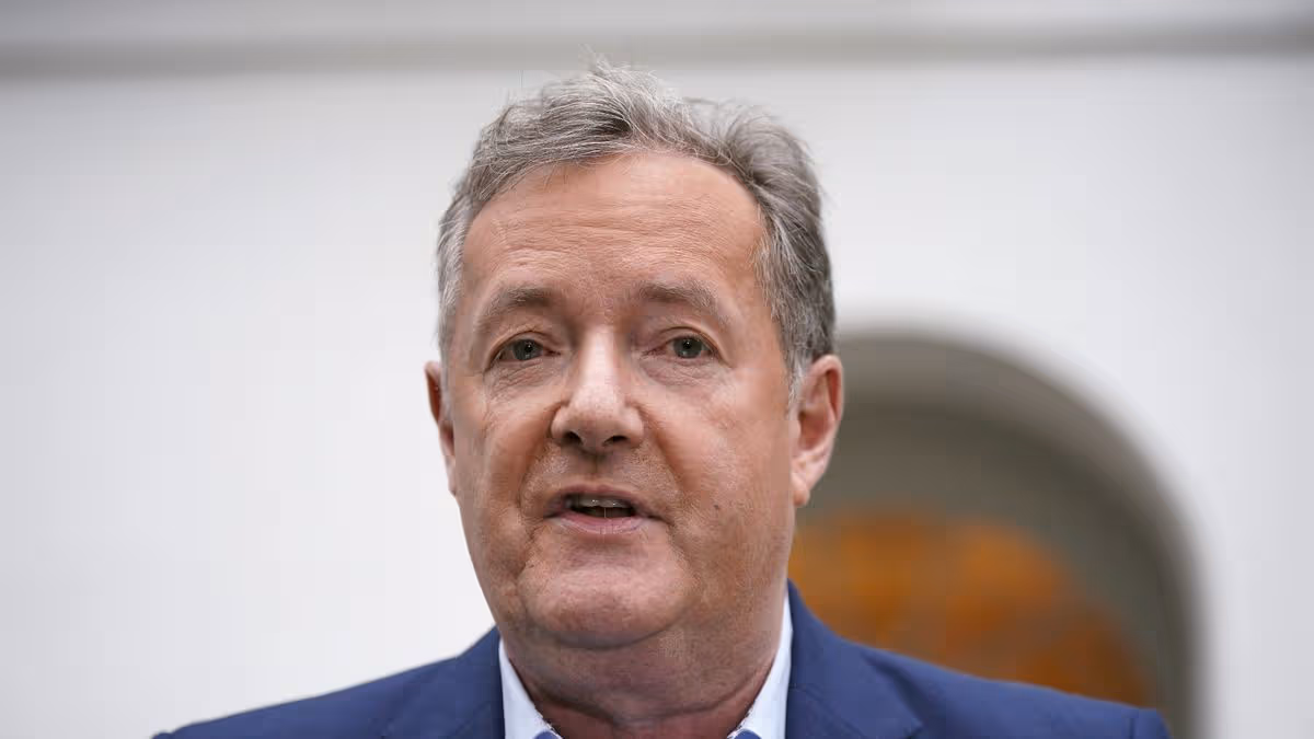
After Donlad Trump sent a barrage of menacing threats towards Iran on Sunday morning Piers Morgan hit out at the President’s “embarrassing” post on Truth Social
Pers Morgan has blasted Donald Trump after his latest barrage of menacing threats towards Iran.
Advertisement
President Donald Trump spent Sunday afternoon at his Virginia Golf Course after bypassing traditional Easter events amid speculation about his wellbeing. Trump was captured by Reuters arriving at the facility on Sunday morning dressed in golf shoes. He paused to take photographs with supporters, while social media posts revealed various Easter-themed events taking place at the venue.
Just hours earlier the president sent a barrage of menacing threats towards Iran. He posted on Truth Social: “Tuesday will be Power Plant Day, and Bridge Day, all wrapped up in one, in Iran. There will be nothing like it!!!” Trump, 79, started. “Open the F***ing’ Strait, you crazy b*****ds, or you’ll be living in Hell – JUST WATCH!” he fumed. “Praise be to Allah. President DONALD J. TRUMP”
His message has triggered fierce criticism, with many challenging the President’s state of mind. Outspoken broadcaster Piers Morgan reacted: “This is embarrassing. Delete it, President – unless you want everyone to think you’ve lost your marbles.”
But it isn’t all negative from Piers as two hours later he took to X to address the US mission to rescue their second downed airman in Iran. He said: “The more I read about the US mission to rescue their 2nd downed airman in Iran, the more astounding it is. Kudos to the CIA, SEAL Team 6, and all the others involved in finding their man & getting him out. And to him, for incredible guts & tenacity.”
It comes after Social media erupted on Saturday afternoon with unverified claims that Trump had been transported to Walter Reed Hospital – with some users on X even suggesting the president had passed away.
The speculation intensified when the White House announced a lid on Trump’s schedule for the remainder of the day at 11 a.m., prompting widespread questions about the Commander-In-Chief’s whereabouts. The White House subsequently refuted any health concerns, stating the President was continuing to work throughout the Easter weekend.
Advertisement
For the latest Middle East conflict updates click here.
The Government claim the Universal Credit reforms will tackle ‘perverse incentives’
Welfare changes kicking in today will see new claimants of the health element of DWP Universal Credit get paid almost 50 per cent less than those already on the benefit. The Government says the change will reform a system that has ‘for too long locked disabled people and people with long-term conditions out of work’.
Advertisement
Number 10 claims the reforms will tackle what ministers have branded ‘perverse incentives’ which they argued encouraged people to stay on benefits without support to move into work. From today (Monday), new claimants for the health element of universal credit (UC) will get a lower rate of £217.26 a month.
Universal Credit is a payment to help with living costs and is available for people in work who are on low incomes, and those who are out of work or cannot work. People with the most severe, lifelong conditions, people nearing the end of life, and all existing UC health claimants will continue to receive the higher monthly rate of £429.80.
Get MEN Premium now for just £1 HERE – or get involved in our WhatsApp group by clicking HERE. And don’t miss out on our brilliant selection of newsletters HERE.
The change will save taxpayers around £1 billion, the Government has said. Statistics published last month showed there were 2.7 million people on UC assessed as having limited capability for work and work-related activity (LCWRA) across England, Scotland and Wales. People in this category are not required to undertake any interviews or work-related activity.
Advertisement
The Government has pledged that its investment in tailored employment support can offer people opportunities, supporting them to move into and stay in work “rather than leave people stuck on benefits”. Also this week, the standard rate of UC will be boosted, in what ministers have said is an effort to “bear down on the cost of living”.
It said this will result in almost four million households on the standard rate of UC getting around £295 extra this year in cash terms.
Social security and disability minister Sir Stephen Timms said: “The welfare system we inherited has for too long locked disabled people and people with long-term conditions out of work. Laws coming into force today will change that, reducing projected expenditure on universal credit by almost £1 billion.
“Simultaneously boosting the standard allowance and investing £3.5 billion in employment support means we’re creating a welfare system that backs people to work and helps them build a better future.”
Advertisement
Last year, ministers were forced to climb down on plans to also reform disability benefits, including for those with mental health conditions, in the face of backbench Labour opposition. Instead of immediate reform, the Timms review is seeking views on personal independence payment (Pip) and how it works.
Minsters have promised any changes to the benefit – which helps with extra living costs for people who have a long-term physical or mental health condition or disability and difficulty doing certain daily tasks or with mobility because of their condition – have been postponed until after that takes place.
The review is expected to report to Work and Pensions Secretary Pat McFadden by autumn, with the Government stating that an interim update will come ahead of that.
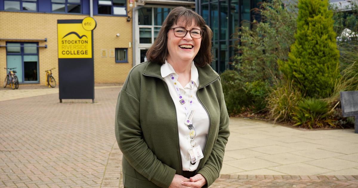
Carol Race has spent the past 22 years supporting students at Stockton Riverside College, with a further 22 years spent guiding pupils in schools before that.
Now, after a career spent helping thousands achieve their ambitions, she is stepping into retirement with a sense of pride and nostalgia.
Ms Race said: “It all feels very surreal at the moment.
Carol Race is retiring after a 44-year career in careers guidance (Image: Supplied)
“To leave is a wrench because, like everyone who works in a college, this is a role where you make a real difference to students.
Advertisement
“You always want to do your best for the students and help them find the opportunities they are looking for.”
Known for her practical advice, interview coaching, and assistance with university applications, she has left a lasting impression on countless students over the years.
The careers advisor said: “You get to meet so many different people and hear about their lives.”
She also supported adult learners, often guiding those returning to education through the application process and helping them regain confidence.
Advertisement
Her journey into careers guidance began unexpectedly after the company where she worked in a secretarial role went into liquidation.
Applying for a position as an employment assistant, she was later seconded for training at Edinburgh Napier University and qualified as a careers advisor in 1985.
She spent the next 20 years working in schools as part of the Cleveland County Careers Service before joining Stockton Riverside College in January 2004.
Over the past 22 years, she has worked with hundreds of students every year and is now senior careers co-ordinator.
Advertisement
Ms Race said: “I don’t think I had any particular expectations when I joined the college, I just got my head down and cracked on.”
Her commitment to students never wavered.
She continued to take appointments even on her final day, ensuring every person received her full support.
She said the most rewarding part of her job was seeing people achieve their goals, whether that meant starting a career, securing university offers, or simply finding meaningful employment.
Advertisement
For adult learners, especially, the transformation could be remarkable.
Ms Race said: “When access to higher education students arrive in September, I say to them that this will be the fastest year of their lives.
“I see them again at the end of the course, with their university offers and they can’t believe how fast it has gone.”
Her genuine care extended beyond career advice.
Advertisement
She remembered the ambitions and journeys of her students, even if names sometimes escaped her.
A mother and grandmother, Ms Race now looks forward to spending more time with family and enjoying time in the garden, though she admits retirement will be bittersweet.
She said: “It’s a cycle in education but I like helping people with their university applications, getting to know the students and just being able to help them gives you a lot of satisfaction.
” It’s the people I work with that I’ll miss most, you spend a lot of time at work and they support you.”
A Local Government Association spokesperson said: “Although the vast majority of badges are used correctly, there is a small minority who fraudulently use other people’s, either to save money by parking in disabled bays or through laziness, depriving someone with a genuine need.
The alerts were also considered for severe weather events across the UK, including when widespread flooding occurred in Cumbria, Lancashire and Greater Manchester in 2025, and when Storm Babet brought exceptional rainfall and winds to Scotland and the North East of England in 2023.


You must be logged in to post a comment Login