Politics
“Operation Exporter” 1941: South Lebanon in the Calculations of Global Military Geography

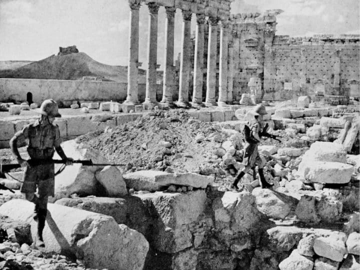

Scarcely had a temporary calm returned to settle over the Palestinian-Lebanese border following the suppression of the Arab Revolt in 1939, when violent political and military storms swept in from the European continent.
These events overturned the strategic equations of the Middle East, bringing an abrupt end to the harmonious relations and mutual agreements that had long prevailed between the mandatory regimes in Beirut and Jerusalem.
Vichy Lines and the Fracture of the Shared Mandate
In April 1940, French defences collapsed, and the capital, Paris, fell beneath the onslaught of the Nazi German army. This led to the installation of a collaborationist French government in the city of Vichy.
This strategic shift meant that Lebanon and Syria were now ruled by a French military and political administration that pledged absolute loyalty to the Vichy regime. Consequently, this placed the French Levant states in a state of overt hostility and turned them into a direct battlefront against British-mandated Palestine, which was leading the war effort against the Axis powers.
The British military command in London and the Middle East viewed the presence of Axis-aligned Vichy forces in Syria and Lebanon as a highly dangerous strategic vulnerability. They feared Nazi Germany could exploit the territory as an air and land staging base to strike the Suez Canal and seize vital oil reserves in Iraq and Palestine.
Driven by these existential anxieties, the British General Staff moved rapidly to draft precise military plans to invade Lebanon and Syria, thereby uprooting them from Vichy control. These plans, however, were entangled in complex political calculations.
The “Free French” forces, led by General Charles de Gaulle, were informed of the operational details to alleviate the deep apprehensions of the French. They suspected that Great Britain’s ultimate, long-term objective was to exploit the war to expel the French imperial presence from Beirut and Damascus and replace it with exclusive British imperial influence. The joint invasion blueprint was finalized under the codename “Operation Exporter”, historically remembered as the Syria-Lebanon Campaign.
On 30 June 1940, British authorities in Jerusalem partially closed the Palestinian-Lebanese border as a precautionary measure, sealing it completely and tightly by 25 May 1941. While the immediate impact of these rigorous administrative and military measures on the daily lives of the Upper Galilee farmers remains entirely undocumented, it is certain that the official and solitary border crossing at Ras al-Naqoura bore the direct brunt, as the vital arteries of commercial and social interaction were severed.
Iron and Fire in the Passes of Jabal Amel
On 8 June 1941, the military signal was given. “Operation Exporter” launched with immense ground, air, and naval momentum.
Although the broader campaign included a parallel offensive in the east to capture Damascus and overrun Deir ez-Zor on the Euphrates River, the primary tactical focus and most critical military lessons were concentrated on the main axis: the invasion of Lebanese territory from northern Palestine.
The Lebanese capital, Beirut, was the primary strategic and political objective for the British command in this sector. To secure it, a massive assault force was assembled, consisting of two infantry brigades from the 7th Australian Division – renowned for its combat resilience – supplemented by a distinguished battalion of Zionist commandos and youth trained in guerrilla warfare and reconnaissance (the Palmach).
Conversely, they faced a French force of roughly equal numbers and conventional equipment on the other side of the border. This force was loyal to the Vichy government and entrenched in excellent mountainous defensive positions. Nonetheless, the military balance shifted clearly in favour of the Australians due to their overwhelming advantages – specifically, absolute air superiority and the support of the British Royal Navy, which controlled territorial waters.
Here, the unforgiving military geography of the region imposed strict conditions on the movement of troops. The rugged, mountainous terrain of Jabal Amel and Marj’ayoun confined the advance of the Australian division toward the Lebanese interior to two sole, irreplaceable geographical axes: the narrow coastal road leading directly to Beirut, and the winding inland route cutting toward the Beirut-Damascus highway via the Beqaa Valley.
These two axes forced the advancing Allied forces to move through exceptionally narrow and exposed corridors, granting an extraordinary topographical and defensive advantage to the Vichy forces holding the high ground and overlooking the deep ravines. Yet, the Australian soldiers had no tactical alternative but to engage in direct, bloody combat with the twisting, rocky terrain of Jabal Amel as they launched their thrust across the border extending between the coast and Metula.
At the same time, the coastal axis offered the Australians their only opportunity to exploit their most lethal asset: a monopoly on heavy naval gunfire from the British fleet, which battered Vichy fortifications along the coastal ridges.
Battles on the border
On the opening day of the invasion, 8 June, Australian forces advanced and successfully captured the fortified Lebanese border post at Ras al-Naqoura, beginning a cautious northward push under a blanket of bombardment.
The inland supporting assault achieved a rapid breakthrough, capturing the strategic town of Marj’ayoun on 11 June. However, the Australian celebration of this advance was short-lived, as complex military crises rapidly developed on the ground.
On 10 June, a unit of Zionist commandos was tasked with launching a swift, specialized raid to seize the vital Qasimiya bridge on the coast to secure the flow of armor and prevent the French from demolishing it. The attack failed catastrophically and bloodily in the face of resolute Vichy defence. During this fierce engagement, a young Zionist Jewish soldier named Moshe Dayan lost his left eye when a sniper’s bullet struck his binoculars.
Following this failure, and fearing that the primary coastal offensive would grind to a complete halt at the Litani River, the Australian command made a perilous tactical decision to suspend the supporting advance in the Beqaa sector. They ordered the bulk of those forces to wheel sharply westward toward the coast via the rugged roads of Marj’ayoun and Jezzine to rescue the coastal front.
As a consequence of this sudden redeployment, the command left a nominal, small military force to secure Marj’ayoun – a fatal strategic error that Vichy forces immediately exploited. The French launched a swift counter-offensive, recapturing the vital town on 16 June, while the main body of the supporting Australian brigade found itself isolated and trapped in the rugged mountains of South Lebanon. Their supply lines severed, this unit was completely cut off and virtually decimated in the mountains.
Military Calculations
The victorious Vichy forces in Marj’ayoun lacked the numerical strength and logistical depth required to exploit their success into a conventional counter-offensive to invade Palestinian territory through the Metula gateway. This allowed the Australians to regroup and recapture the town in late June, following intense artillery bombardment.
Meanwhile, the main Allied coastal assault, heavily sustained by absolute air and naval supremacy, slowly and bloodily forced its way through French strongholds until it reached the outskirts of Beirut. Confronted with this military impasse and the fall of Damascus in the east, the Vichy command recognized the futility of continued resistance. An armistice agreement was formally signed on 14 July 1941, officially terminating Vichy rule in the Levant and handing control of the territories over to the Free French and British forces.
The legacy of “Operation Exporter”
Although “Operation Exporter” is considered a minor and marginal chapter in the massive volumes of Second World War military history, it served as the military academy and field laboratory that taught the newly formed Zionist Jewish military leadership in Palestine, who gained invaluable lessons regarding strategy and operations in the complex geography of South Lebanon. This military force later became the core of the “Israel Defense Forces”.
The campaign provided a decisive, practical demonstration of the vulnerabilities Palestine faced due to the military geography of the border region. It became clear that, while Palestine’s flat terrain was inherently open and exposed to irregular infiltration from Lebanon at any time and without obstacles, the axes for conventional, organized military advance from Palestine into Lebanon were few, narrow, and structurally suffocating.
In fact, assuming a relative parity in air support and indirect firepower between the two sides, it was militarily certain that French Vichy forces could have halted both Australian thrusts and permanently blocked their advance. However, looking at the geographical reality – which dictated that there were only two viable main highways for invading Lebanon from the South (the coastal maritime route and the inland Metula-Marj’ayoun-Beqaa route) – and considering the abundance of secondary roads and valleys running from east to west rather than the natural north-south progression, Zionist military planners arrived at a definitive strategic conclusion.
They deduced that, in the event of a clash between forces of roughly equal competence and number, the tactical defensive advantage always favors the force facing south – namely, the army entrenched within Jabal Amel. Furthermore, the rapid and dangerous threat of an invasion into northern Palestine that loomed when Vichy forces seized Marj’ayoun left a deep, enduring imprint of chronic anxiety in the minds of Zionist commanders regarding a potential offensive threat from the north.
This conventional “threat” would inevitably have to contend with the exact same harsh topographical difficulties and barriers that impeded any offensive operations directed northward.
Strategic Contradiction and the Riddle of Northern Sovereignty
The successive military experiences – tied first to the construction of “Tegart’s Wall“, and second to the battles of “Operation Exporter” – left conflicting and perplexing strategic concepts in the minds of Zionist planners.
Zionist strategic thought found itself confronting a security dilemma and a riddle requiring a radical solution. From a security standpoint, would it be more beneficial for Israel in the future if South Lebanon were heavily fortified and strong? Garrisoned by large numbers of official Lebanese security personnel and a regular army capable of, and authorized to, secure the border and prevent irregular operations and cross-border infiltrations against targets inside Palestine? This was the self-evident lesson derived from the uprisings and revolts of 1925 and 1936–1939.
Or was it better, from the perspective of Zionist military planners, for South Lebanon to remain militarily weak, poorly guarded, and devoid of organized forces? Such a scenario would guarantee and facilitate the success of rapid offensive operations or swift retaliatory strikes launched from Palestine into the Lebanese interior, while simultaneously ensuring that any conventional attack from Lebanon could be easily repelled due to topographical superiority. This second conclusion appeared far more pragmatic and operational from the perspective of the 1941 “Operation Exporter” experience.
Yet, there loomed a third, terrifying possibility that alarmed Zionist military commanders – a scenario that combined both dangers: intensive irregular commando raids inside Palestine that enjoyed the full political backing of the Lebanese authorities, while being simultaneously protected by a strong conventional and regular military force stationed in the South.
The aversion of this frightening scenario was precisely what was realized and codified in the strict military clauses of the 1949 Armistice Agreement between Israel and Lebanon. Israel succeeded in imposing conditions that restricted the strength and capabilities of the Lebanese Army to just 1,500 soldiers, depriving it of heavy weaponry and armor throughout the entire region south of the Qasimiya (Litani) River. Consequently, South Lebanon was left exposed and weak, entirely subject to Israeli military superiority.
Featured image via About History
You must be logged in to post a comment Login