


Britain faces its fourth heatwave of the year next week as a heat health alert is issued and the extremely dry weather continues with no rain for 36 consecutive days.
The Met Office expects temperatures to reach at least 28C in south-east England between next Tuesday and Thursday – meeting the criteria for another heatwave.
The third heatwave of the year ended last weekend in London after a fortnight, but has continued for 19 days so far at Exeter in Devon and Usk in Monmouthshire.
Temperatures could reach 30C in some areas today and tomorrow, prompting the UK Health Security Agency (UKHSA) to issue six 48-hour yellow heat health alerts.
These will cover regions across the South and the Midlands from 9am today until 9am on Sunday and warn of ‘increased use of healthcare services by vulnerable people’.
Officials said there is a ‘greater risk to life of vulnerable people’ while ‘water‑related incidents may increase, including risks from cold‑water shock and drowning’.
The Met Office defines an official heatwave as three days in a row of temperatures above a certain threshold, which varies by UK region but is 28C in London.
The heatwave temperature threshold will be met for only two days today and tomorrow, before conditions turn much fresher across the country by Sunday.
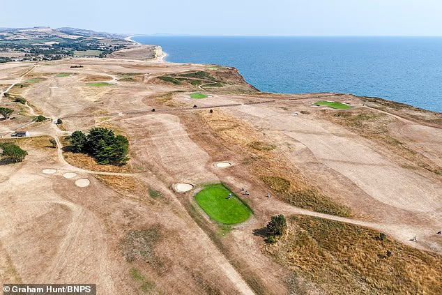
An aerial view of the drought sun-scorched fairways and rough which surround the watered 15th green at the Bridport and West Dorset Golf Club at West Bay in Dorset yesterday

Scorched grass at Blackheath in south-east London yesterday as the dry weather continues

Dried grass at Peckham Common in south London yesterday after a prolonged lack of rainfall

Holiday traffic at the Port of Dover in Kent today as drivers make their way across the Channel

The Met Office forecast for London shows the heatwave criteria of temperatures at least 28C for three consecutive days could be met between Tuesday and Thursday next week


Rain is also possible in very dry areas – with Wisley in Surrey now having had 36 consecutive days with no rain. London has had no rain for 27 days since June 27.
But while heavy rain could fall in the North of England, the areas most in need of it in the South and Wales are set to see just a few millimetres at most and possibly none.
Temperatures will get to 27C on Monday, but the fourth heatwave is then set to start from Tuesday with 28C highs in London before 30C on Wednesday and Thursday.
An official drought has now been declared in North Wales and the Upper Severn, after record dry conditions, heatwaves, wildfires and dwindling rivers. This is the first part of the UK to declare drought status amid a summer of record-breaking heatwaves.
Many parts of England are in prolonged dry weather status as the country has received just 3 per cent of its average July rainfall, with hosepipe bans in place for 23 million customers and suppliers warning they may stay in place all summer.
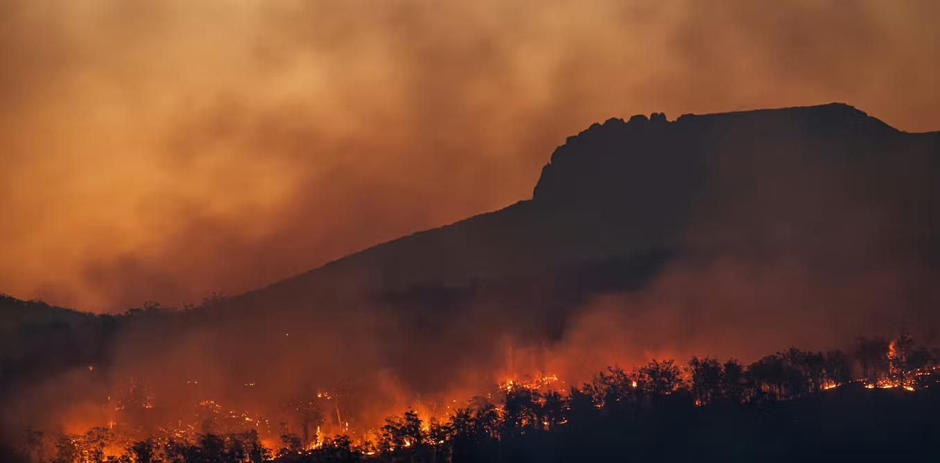
Wildfires have been raging in several places in England, while Scotland has also been hit by a major wildfire in the Cairngorms, and in the Republic of Ireland, a nationwide hosepipe ban is in place in response to the dry conditions.
The South-East has seen the longest no-rainfall spell for more than 30 years. Three heatwaves have brought the UK’s hottest ever days in May and June, while the latest one earlier this month saw 12 consecutive days of temperatures above 30C.
Met Office forecaster Craig Snell said rain will move southwards tomorrow, spreading from Scotland and Northern Ireland into northern England and parts of Wales.

The UK Health Security Agency (UKHSA) has issued yellow heat health alerts from 9am today

Heavy rain could fall in the North on Sunday but the South could see a few millimetres at most
By Sunday, temperatures are expected to turn ‘fresher’ across much of the UK, with rain possible in ‘areas that haven’t seen much’ over the past few weeks, he added.
BBC lead weather presenter Ben Rich wrote: ‘Weather fronts are expected to bring spells of rain in the north and west, with parts of Scotland, Northern Ireland and north-west England likely to see their most significant rainfall in a number of weeks.
‘However, high pressure may build to the south-east which would cause those weather fronts to stall.
‘That could allow dry and hot weather to rebuild across many parts of England and Wales, with temperatures potentially climbing back into the 30Cs in places. There is the chance that heatwave conditions could return.’
The heat alerts are in place at the beginning of a stretch in which millions of motorists are expected to take to the roads for summer getaways.
The AA said around 6.3 million drivers are planning a road trip of more than 100 miles between today and Thursday.
Schools have broken up for the summer holidays and the Met Office said areas in England and Wales will see ‘plenty of sunshine’ in the coming days.
Lee Morley, AA expert patrol, said: ‘The roads may not have the same first-day rush as they did when schools first broke up, but holiday traffic is far from over.
‘Families are continuing to head away throughout the summer rather than all leaving on the same weekend, so we expect plenty of busy routes over the coming days.’
RAC breakdown spokesman Simon Williams said: ‘Drivers should be ready for some very busy roads this weekend and expect delays.
‘The best advice is to plan journeys and think about setting off earlier or later in the day to avoid traffic jams.’

This Environment Agency graphic shows how little rainfall there has been since mid-June

River flows are also low in many areas of England and Wales – especially those marked in red

The heatwave threshold is defined as three consecutive days at or above a set temperature
The Port of Dover is expecting another busy weekend but has worked to smooth any delays caused by new EU border checks.
This morning, the port posted on X that there was a 40-minute processing time in the Buffer Zone – the area where traffic may be held in multiple lanes while waiting to pass through French border and security checks.
Ferry company DFDS also said its wait times at Dover were up to 60 minutes at border controls and ‘free flowing’ at check-in.
The Entry Exit System (EES), rolled out fully in April, involves people from third-party countries such as the UK having their fingerprints registered and photograph taken to enter the Schengen Area, which consists of 29 European countries, mainly in the EU.
For most UK travellers, the process happens at foreign airports, but it is also carried out at the port, as well as Eurotunnel’s Folkestone terminal and London St Pancras railway station.
The Port of Dover declared a ‘critical incident’ during the May half-term period after waiting times reached four and a half hours on a day with about 8,500 outbound tourist vehicles.
However, after last weekend, it said in a statement that French border police had ‘performed extremely well’ by ‘maximising their resourcing as required throughout’.
The statement added: ‘We will be preparing in earnest once again with all of our partners for the upcoming weekend, which will be our busiest of the whole summer.
‘Let’s all continue working together to ensure local communities remain clear of disruption, trade continues to flow and everyone can start their holidays well.’



















































You must be logged in to post a comment Login